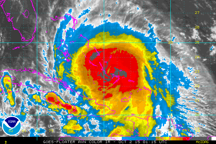
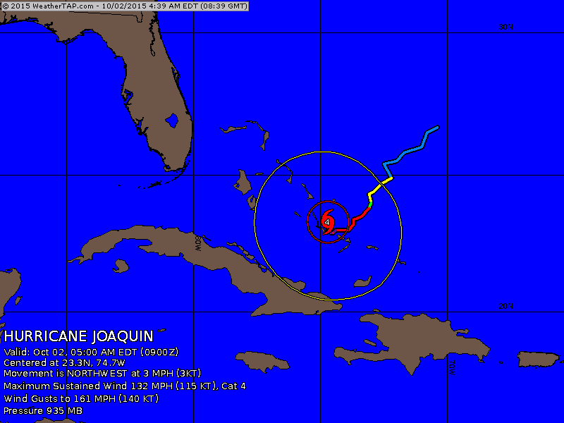
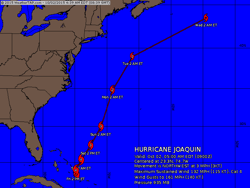
Morning satellite picture shows a healthy storm still killing the Bahamas. 130 mph winds and only moving 3-5 mph. He should pick up forward speed today and weaken slowly and stay offshore but could affect Bermuda. Below...early morning position...followed by the track of the Hurricane Center.
Map is valid for Friday evening and shows stalled front offshore.
Moist warm air is overrunning the cool maritime air on surface thus the reason for damp wet weather on the east coast. Rest of the nation...not bad for early October.
Moist warm air is overrunning the cool maritime air on surface thus the reason for damp wet weather on the east coast. Rest of the nation...not bad for early October.


Radar - satellite overlay shows the wet weather along the east coast....showers over the Plains and Intermountain region. Rest of the nation...fair...including Florida. Below...a wide shot of The Atlantic showing the hurricane ....
| The light orange you see in the Atlantic is dry air...and the storm is likely to follow the channel between it and the moisture along the east coast. | 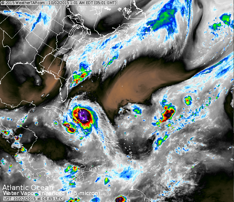 |
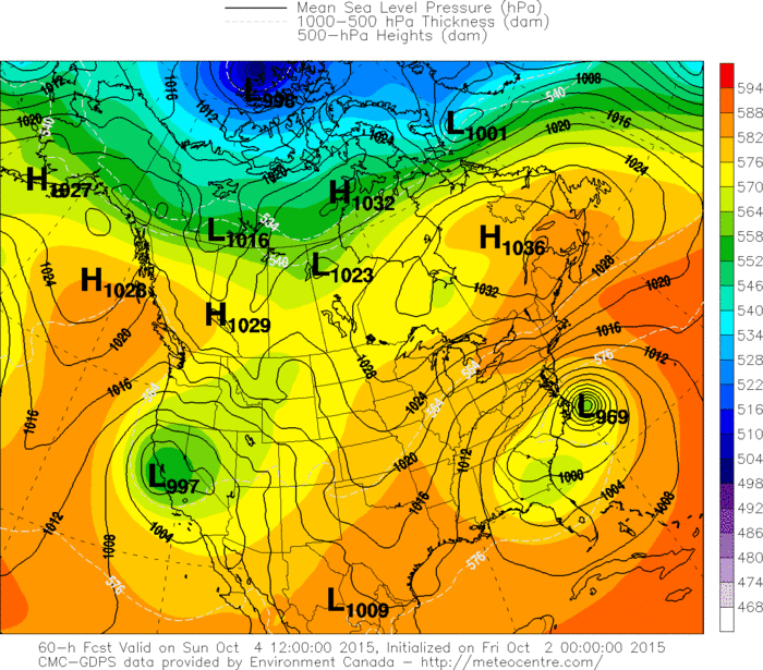
The below map is the Canadian model valid for Sunday. One of the only models to continue to bring the hurricane into the Carolinas. I doubt it is going to be close to correct. Be safe...will continue to update through the day.

 RSS Feed
