Metro Weather Inc. Services
Like us, follow us, link to us, contact us!
  • Home
    • Daily Weather Discussion
  • Weather Prepared for You
    • Film and TV Production
    • Radio & Television
    • Government and Industry
    • Forensic Services >
      • Weather Record Request Form
    • Metro Morning Monitor
  • About Metro Weather
    • Senior Staff
  • Your Weather Images
  • Contact Us

January Closes Colder...

1/29/2018

0 Comments

 
Picture
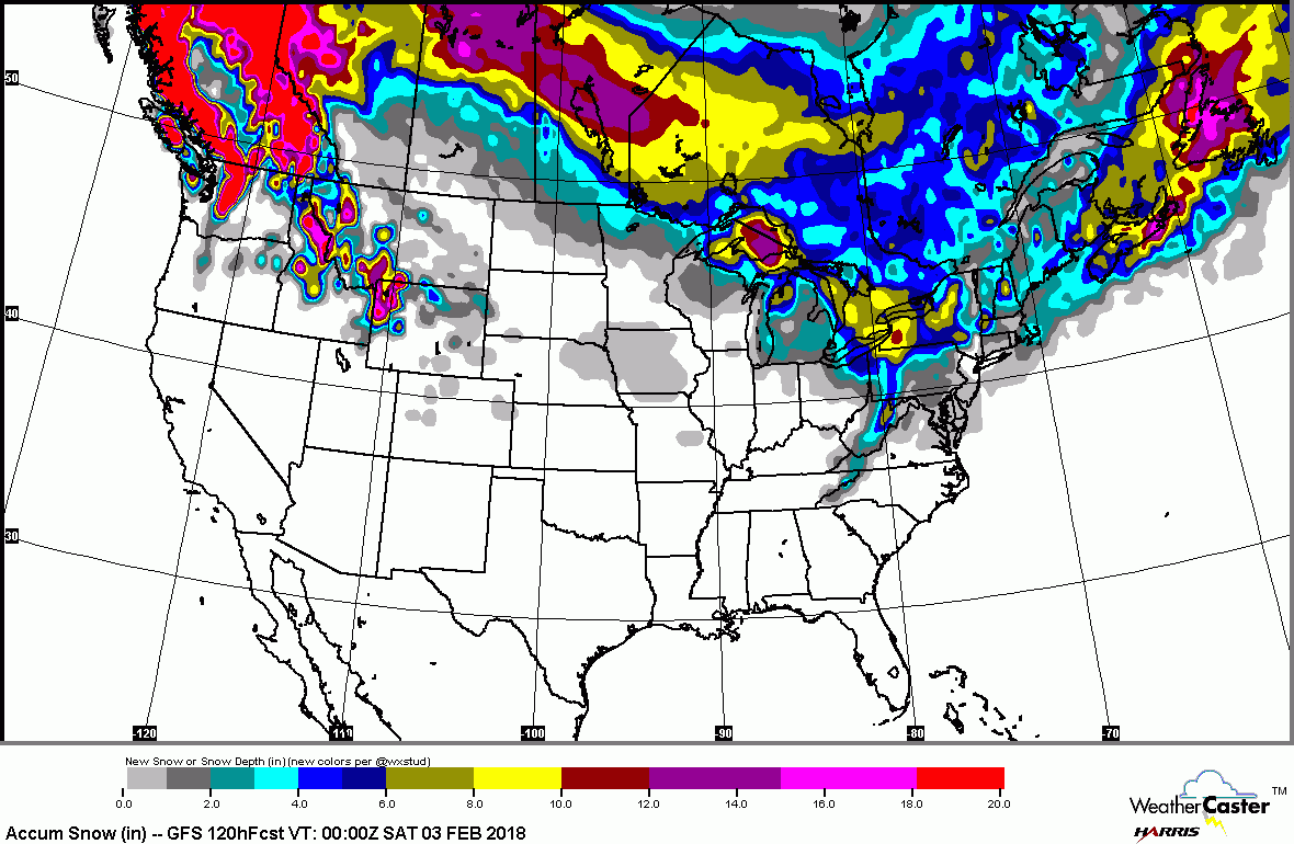
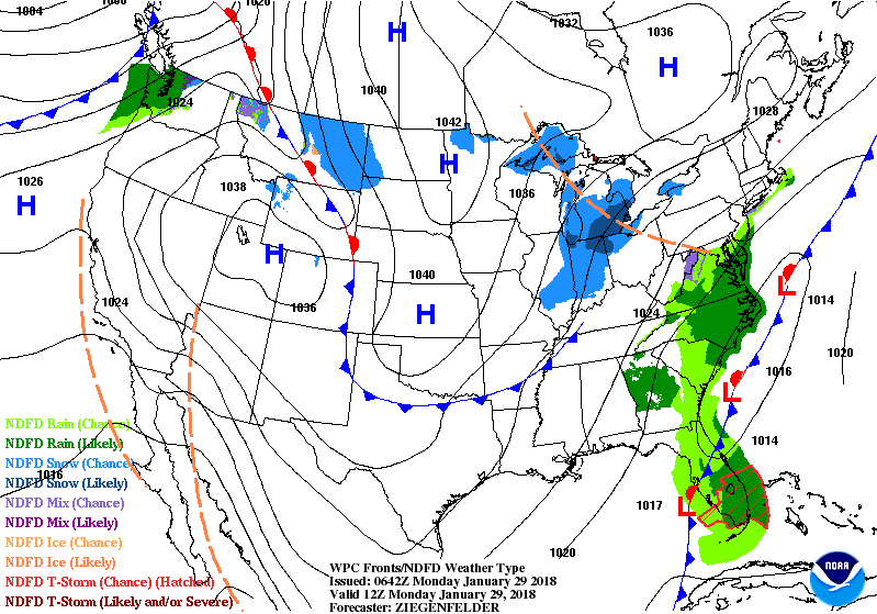
A front stalled off East Coast will produce rain with a chance of wet snow on the northern edge from Mid Atlantic to New England into Tuesday...but amounts..if any - will be quite light. Snowshowers in Lakes and Ohio Valley ...new system in the Pacific Northwest. That one could be a troublemaker in the East by late week...more on that later this week. Below...amount of snow forecast over the next 5 days....followed by the animated maps for the next 2 days.
Picture
Picture
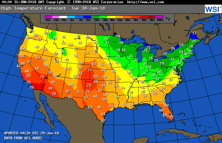
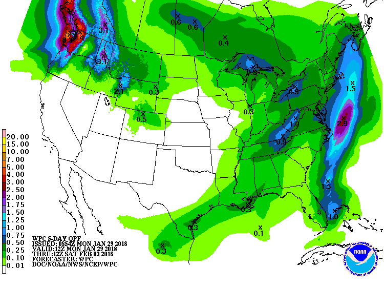
​Below - high temperatures expected for Tuesday followed by amounts of rainfall over the next 7 days.  Be safe.
Picture
Picture
0 Comments


Leave a Reply.

    Genesis of a Tornado
    We'll have daily weather discussions, talking about major systems on the horizon along with anything noteworthy that pops up on our radar.

    Pat Pagano,
    Mike Merin

    Follow us on Twitter and like us on Facebook to get updates whenever we post a new entry!

    RSS Feed

Powered by Create your own unique website with customizable templates.