
You can see the remains of Bill on satellite in Oklahoma. It will merge with another band of moisture working across the Northern Plains. This will make things very wet from Southern Plains into Ohio Valley...and then to the Mid Atlantic and Northeast by Father's Day.
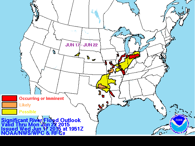
River Flood Potential through Monday.
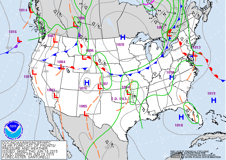
Map for Thursday evening: "Bill" northeast Oklahoma....will be steered by cold front over Great Lakes.
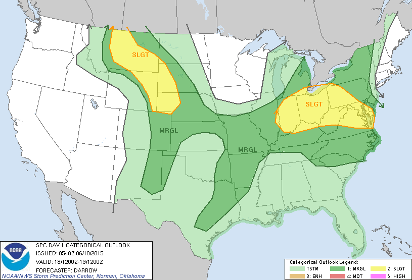
Best chance of severe weather today - yellow areas.
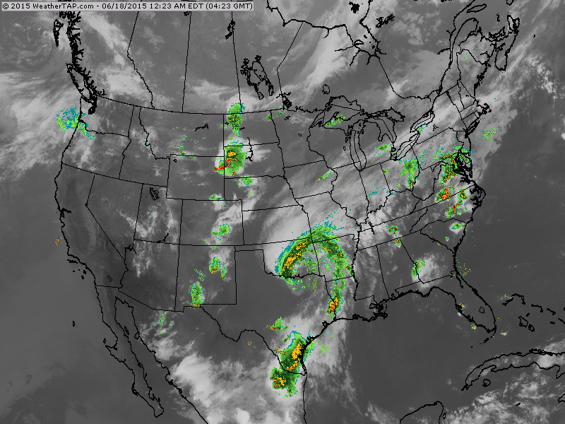
This satellite/radar shows how moisture from Bill will be taken across the Ohio Valley and east this weekend. Amazingly...Bill still has a very defined circulation for a tropical system that has been on land for a long time.
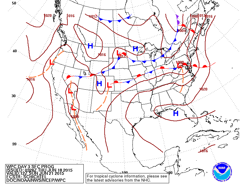
This map is for Sunday. "Bill" over Pennsylvania....cold front moving down through Great Lakes....all spells trouble for East.
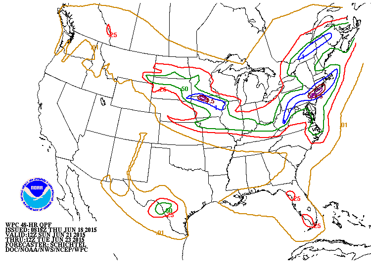
Projected rainfall - Sunday into Monday. Heaviest rain...southern New England...including NYC & Long ISland...and parts of Iowa. These places could see 1"- 3".
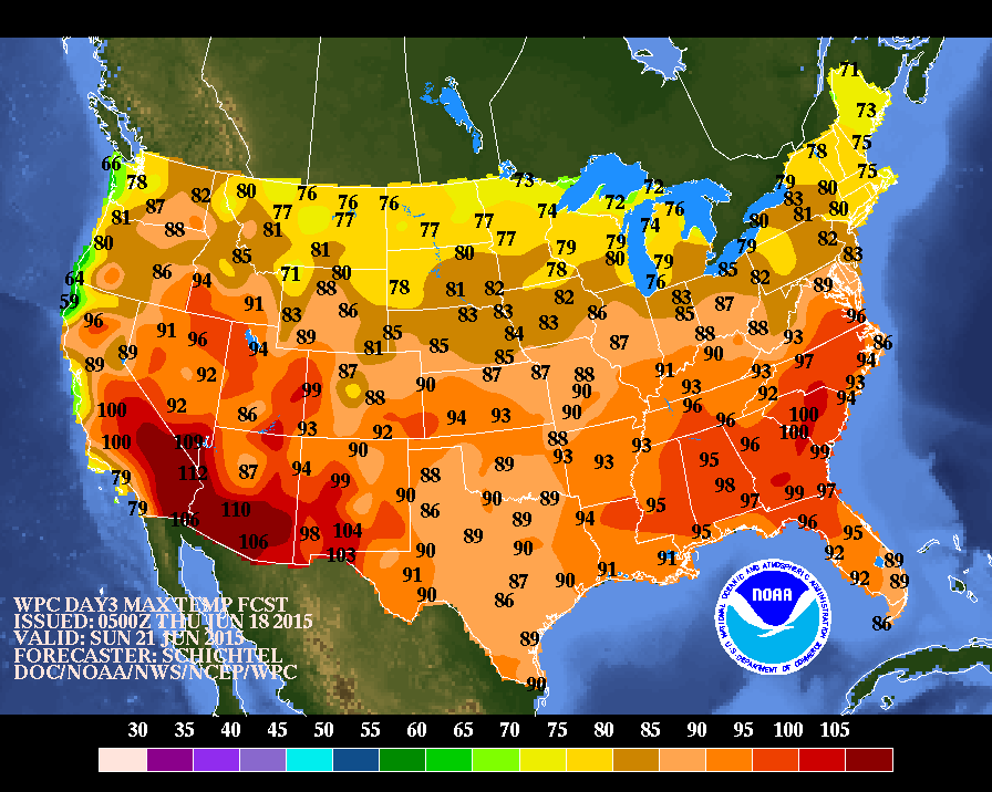
These are projected highs for Sunday. Be safe.

 RSS Feed
