
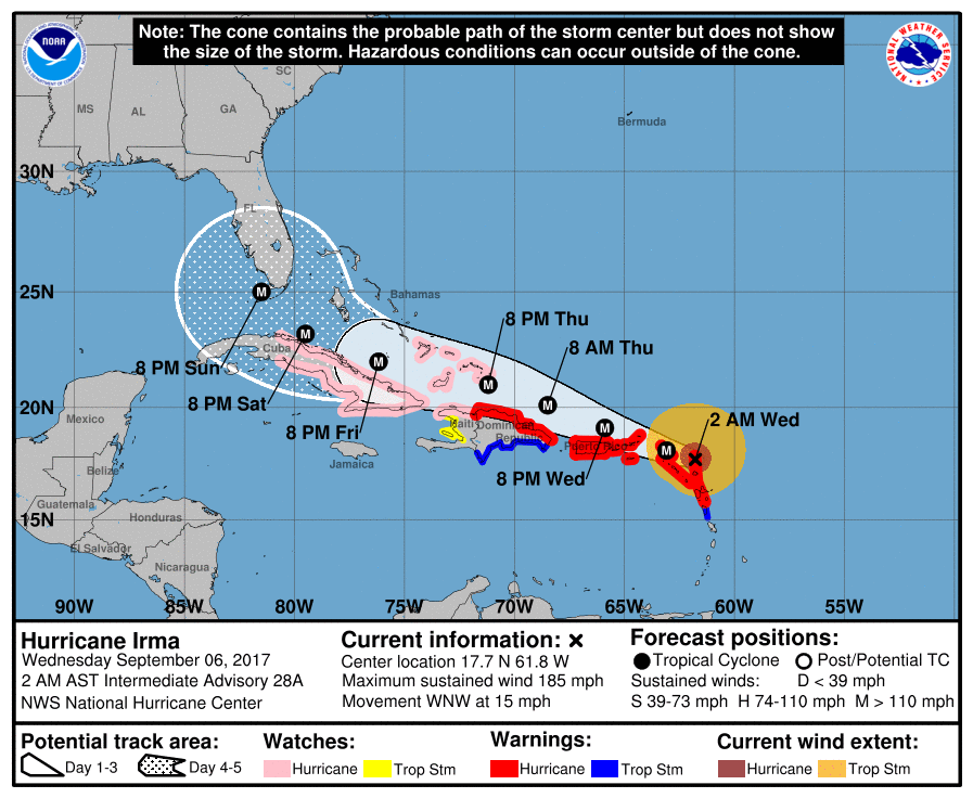
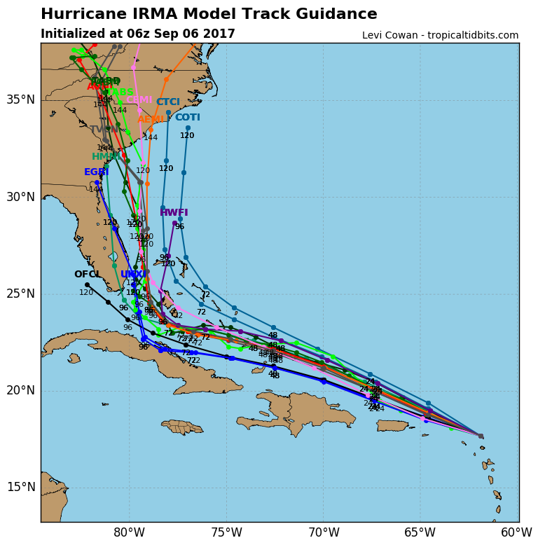
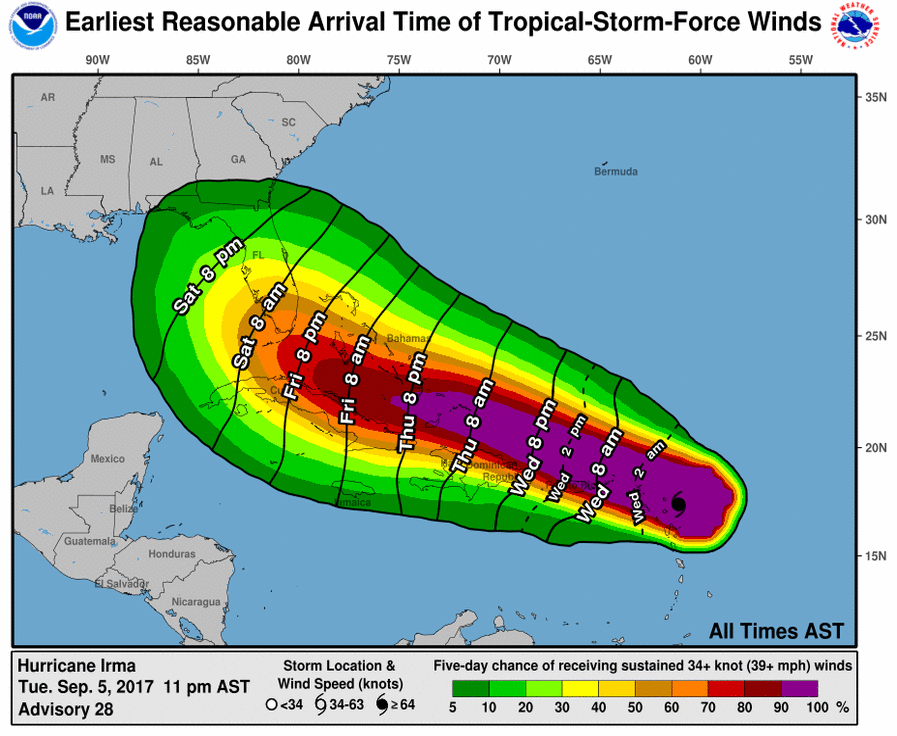
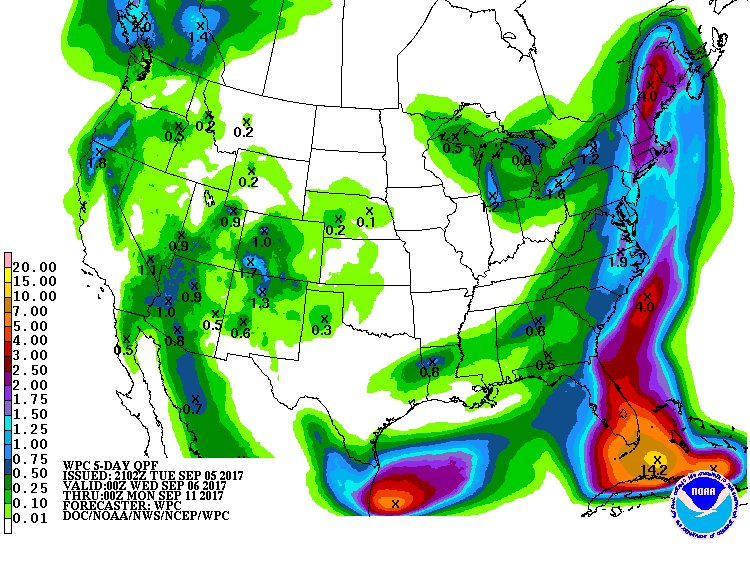
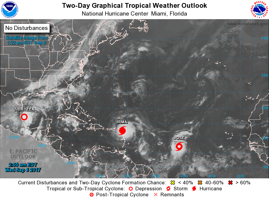
You don't need to be a meteorologist to look at this picture and know this is Dangerous! Cat 5 Irma - 185 to 200 mph winds moved across Barbuda and now the Northern Virgin Islands then Puerto Rico. There is still some question as to what she will do when nearing Florida. Most models place the emphasis on Florida's east coast...but staying just offshore and then making landfall over So. Carolina coast. We think Thursday's models will be able to nail the track better...but meanwhile...preparations have started. Below....track of Irma....wind projections.....rainfall projections.
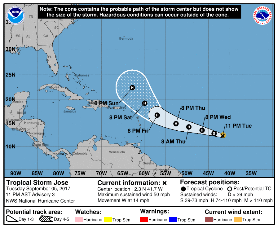
Not to forget - Tropical Storm Jose....in back of Irma...55 mph winds. Below..his track...but again....watch this guy....I do not buy the guidance and I think this may become a player in our weather...although not major.
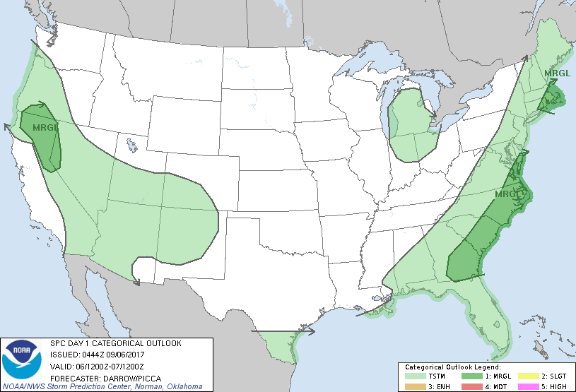
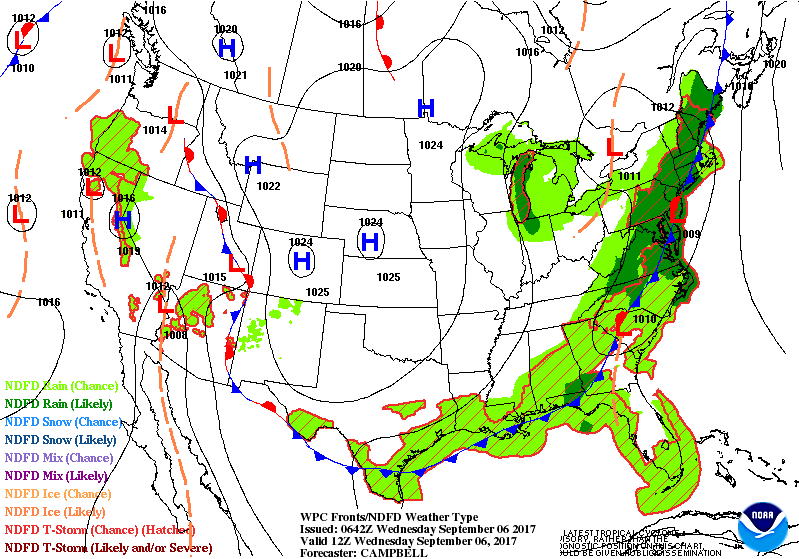
Finally - today's threat of severe weather in dark green....followed by animation of maps for next two days. Be safe.

 RSS Feed
