
A wet windy front will lift into New England this morning...paving the way of a record breaking warm day for much of the Eastern Seaboard. Energy diving down the Rockies will spark a storm in Gulf ...and that's trouble for The East.

A windy front moves through The East late today. Lake effect snow for Great Lakes. Fair and colder much of the Nation.
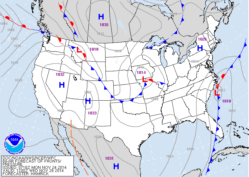
This map is for Wednesday. Two players...one in Midwest..other along the Carolinas. The Carolina low will become the major storm and the system in Midwest will feed it..allowing it to move up the coast with a cold rain and wind going to snow. Many places west of the major cities
from DCA to BOS will get 4"-6". The Big cities may also
result in some accumulation. All moving out by Thanksgiving morning.
from DCA to BOS will get 4"-6". The Big cities may also
result in some accumulation. All moving out by Thanksgiving morning.
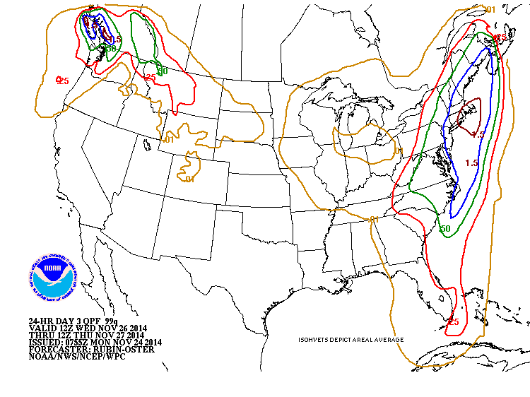
Amounts of precipitation that will fall Wed- Wed nite.
If all the precip were to be snow...the Northeast could
easily get 6"- 10".....but that will not be the case and since it will be wet snow...much less is expected.
If all the precip were to be snow...the Northeast could
easily get 6"- 10".....but that will not be the case and since it will be wet snow...much less is expected.
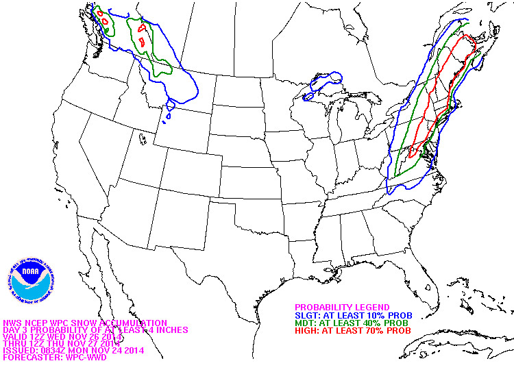
Probability of snow with Wednesday's storm. The red indicates the best possibility of 4" or more...green is
a moderate chance....blue is a slight chance. Good luck.
Be safe. Later.
a moderate chance....blue is a slight chance. Good luck.
Be safe. Later.

 RSS Feed
