Metro Weather Inc. Services
Like us, follow us, link to us, contact us!
  • Home
    • Daily Weather Discussion
  • Weather Prepared for You
    • Film and TV Production
    • Radio & Television
    • Government and Industry
    • Forensic Services >
      • Weather Record Request Form
    • Metro Morning Monitor
  • About Metro Weather
    • Senior Staff
  • Your Weather Images
  • Contact Us

In Time...Harvey Heads Northeast....

8/29/2017

0 Comments

 
Picture
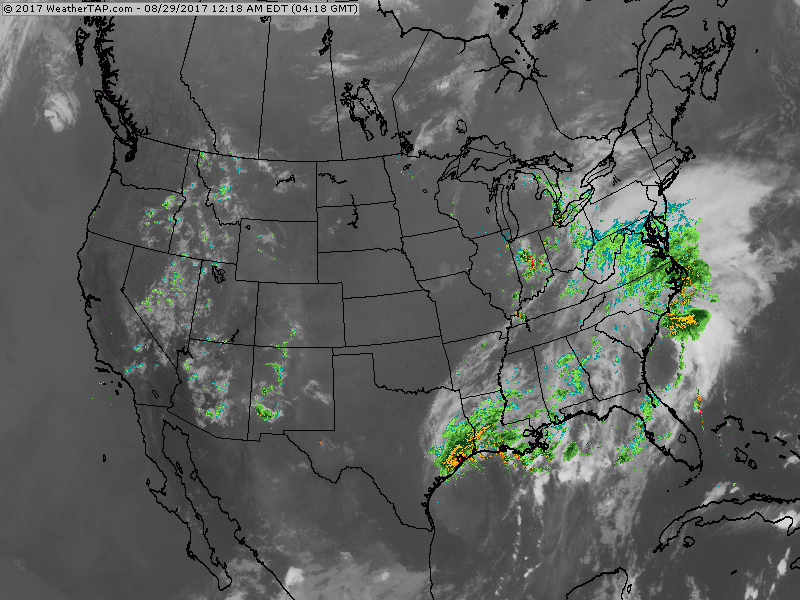
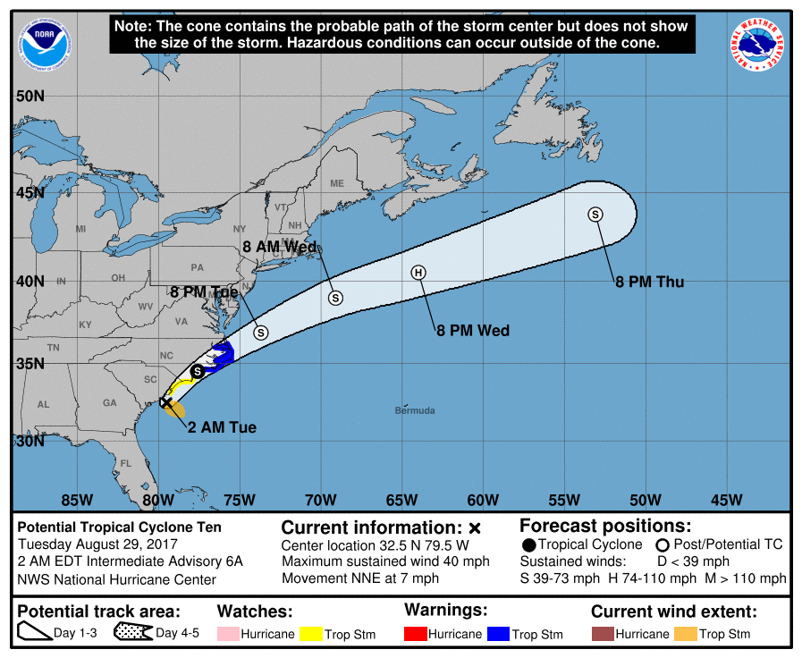
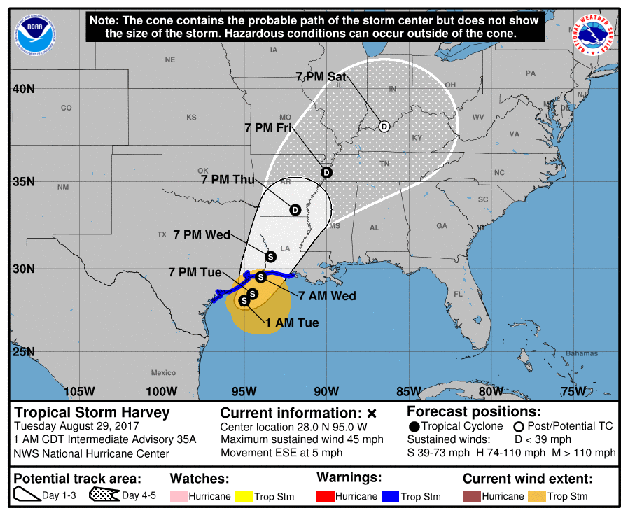
Satellite/radar shows 2 main features: Harvey ....tropical disturbance off Carolinas. System off East Coast brings rain and some wind to Mid Atlantic today and out tonight. Harvey doesn't give up. He will begin to move northeast later this week and will bring wet weather to Ohio Valley Saturday...Northeast on Sunday and then good bye. Below...track of Harvey and East Coast System.
Picture
Picture
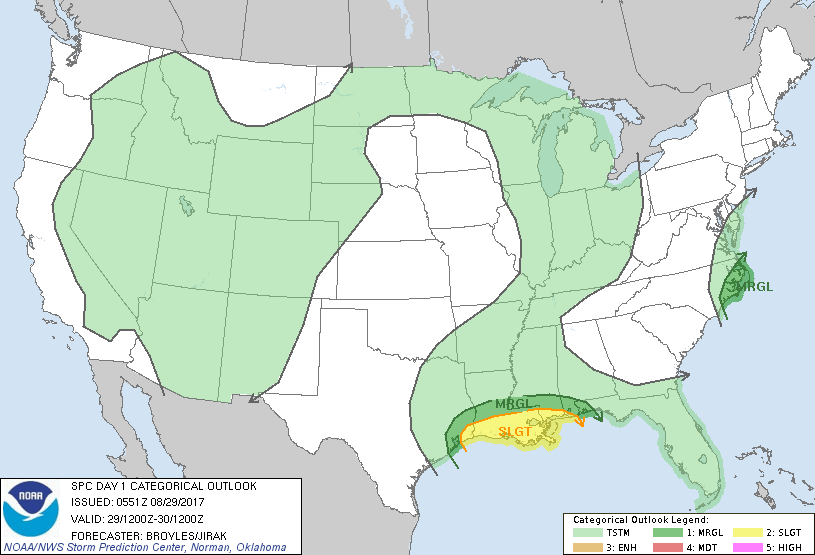
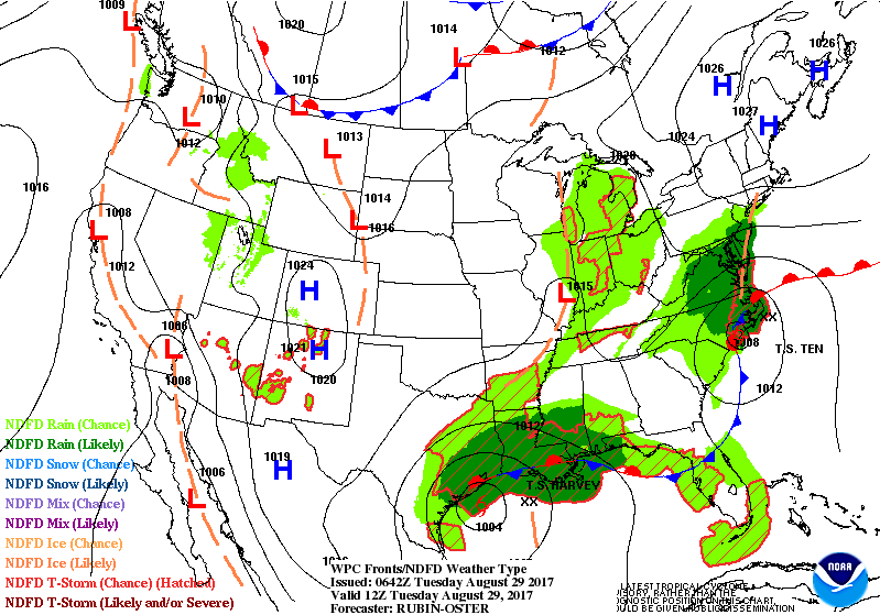
​Below - threat of severe weather today in dark green and yellow.
Picture
Picture
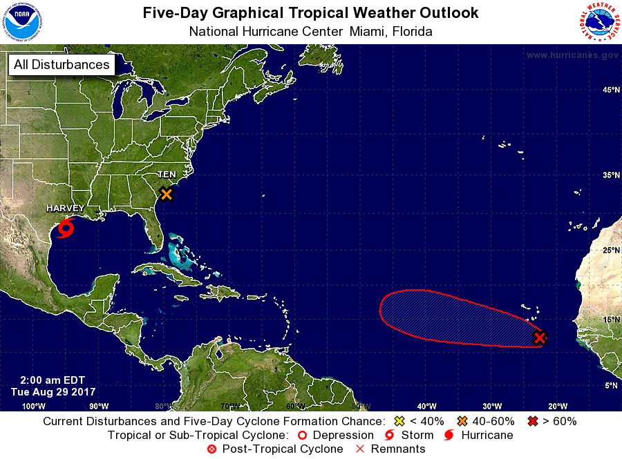
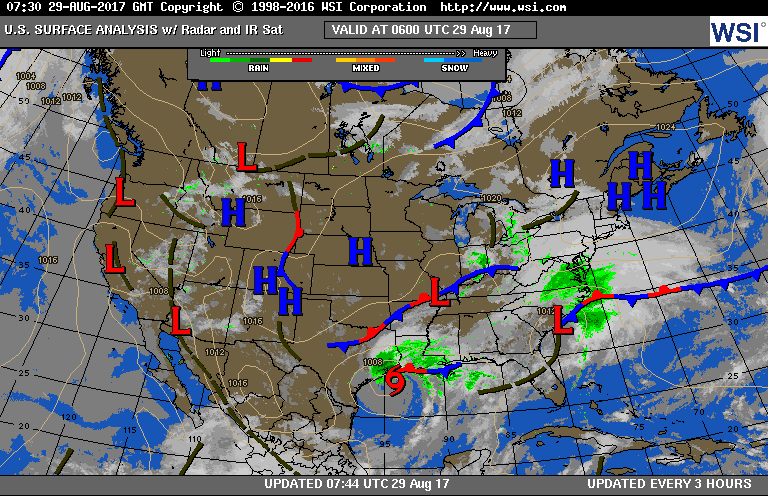
Below - Atlantic Basin. System off Africa is expected to become a major hurricane as it crosses The Atlantic. It will be watched carefully. Following that.....current weather map - followed by animation over next 2 days.  Be safe.

Picture
Picture
0 Comments


Leave a Reply.

    Genesis of a Tornado
    We'll have daily weather discussions, talking about major systems on the horizon along with anything noteworthy that pops up on our radar.

    Pat Pagano,
    Mike Merin

    Follow us on Twitter and like us on Facebook to get updates whenever we post a new entry!

    RSS Feed

Powered by Create your own unique website with customizable templates.