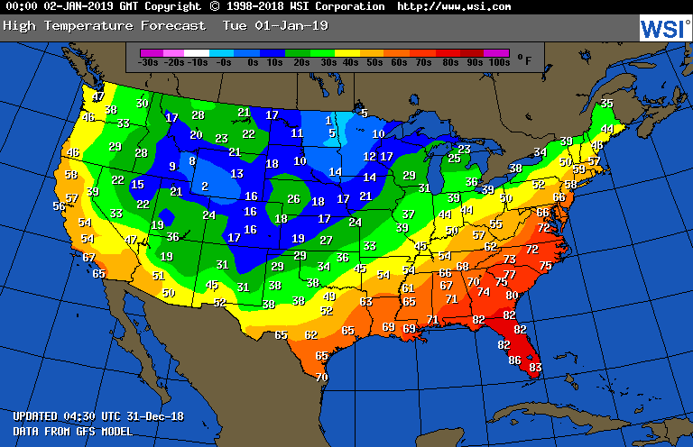
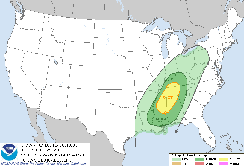
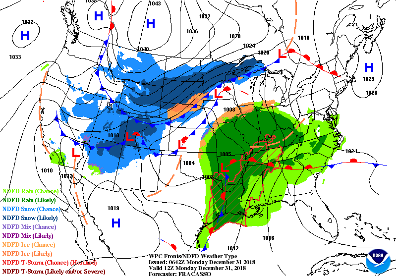
Above.,..New Year's Day - high temperatures. May be mild enough to take down those outside decorations in the East. Below - satellite and radar showing wet storm moving into the East...while snow - wind and bitter cold hit the Upper Midwest again. Following - today's risk of severe weather in green and yellow.

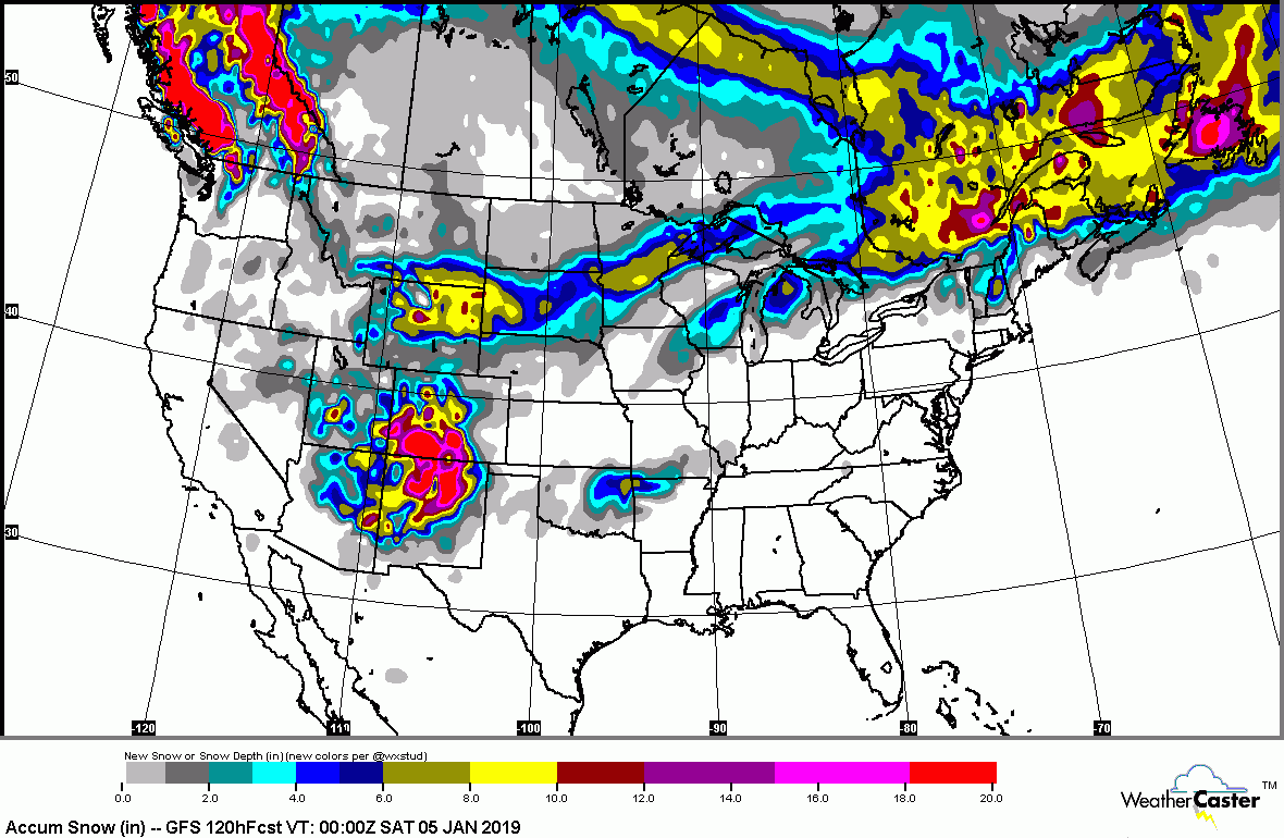
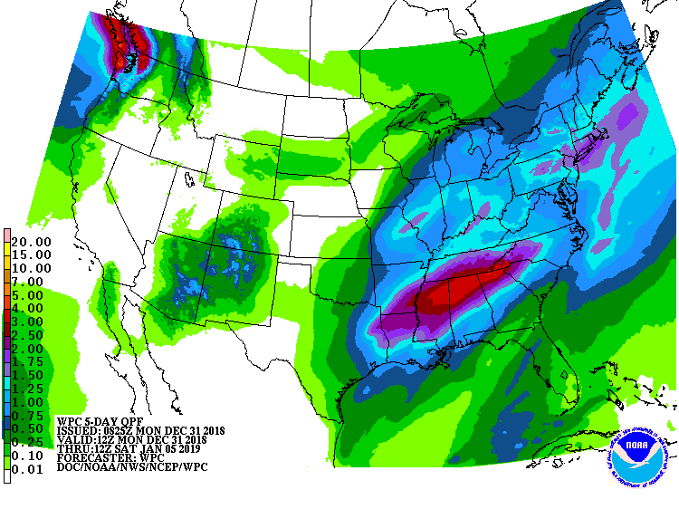
Below - expected snowfall and rainfall for the next 5 days.
Below - animated maps next 2 days.
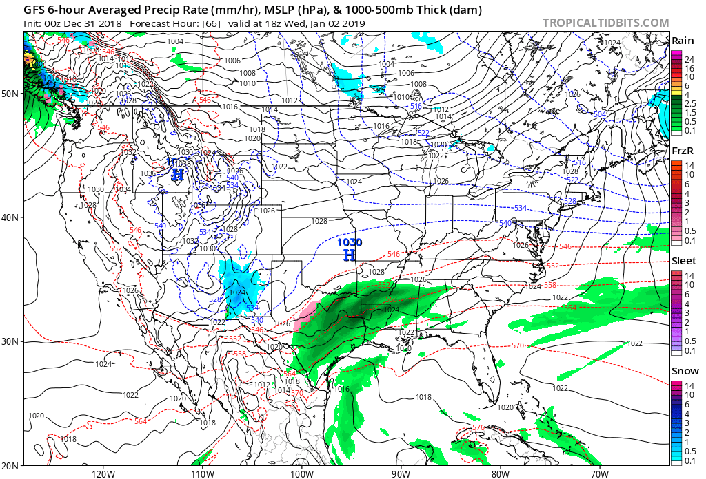
Above. GFS Model for New Year's Day. Rain - Texas into Gulf States...some snow New Mexico. Very cold - North Central. Texas storm needs to be watched for East Coast late week. Happy and Healthy New Year to all...and be safe.

 RSS Feed
