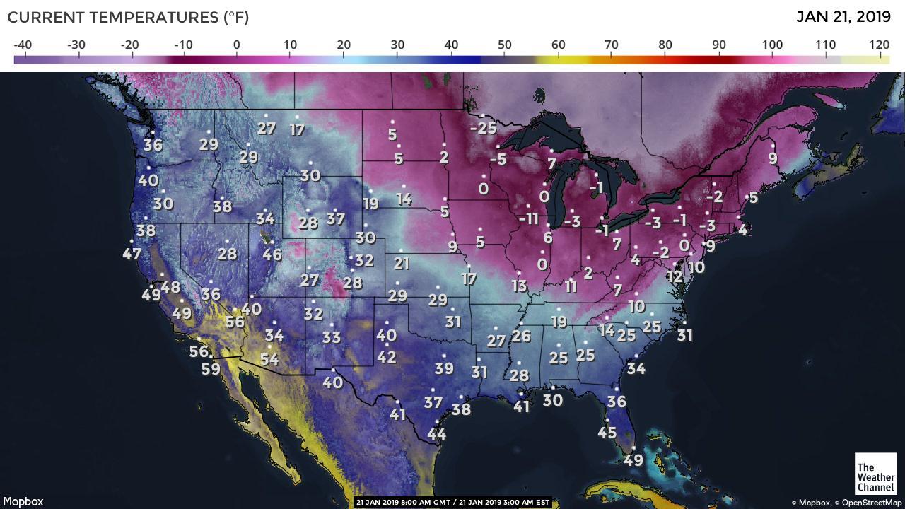
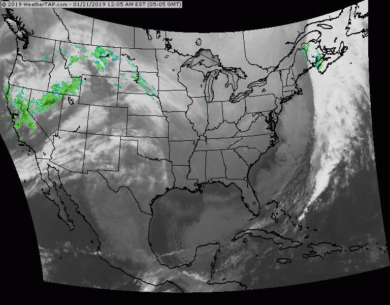
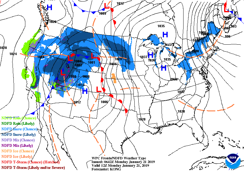
Pre-dawn temperatures and still falling. Add winds over 40 mph in The Northeast and it is nothing short of Seward's Icebox. Below - satellite - radar. Next system sweeping across the Plains will bring a wintry mix to Northeast Wednesday..changing to rain into Thursday. A new arctic air mass returns by this weekend.
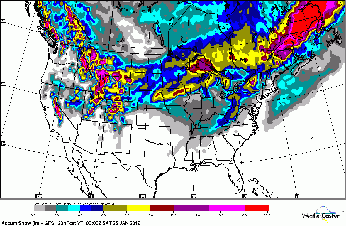
Below - animated maps for the next couple - followed by snowfall and rainfall predictions into Saturday.

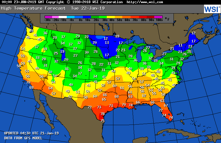
High temperatures for Tuesday. Be safe.

 RSS Feed
