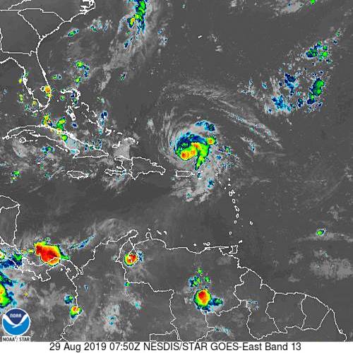
Satellite above shows Dorian to continue to intensify with 85+ mph winds. He is expected to become a CAT 3 as he approaches Florida - Sunday/Monday. Most of the hurricane models aim for Central Fla., but the Euro continues to insist on So. Florida...and then up the East Coast.
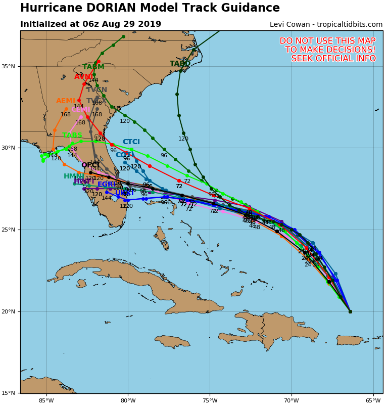
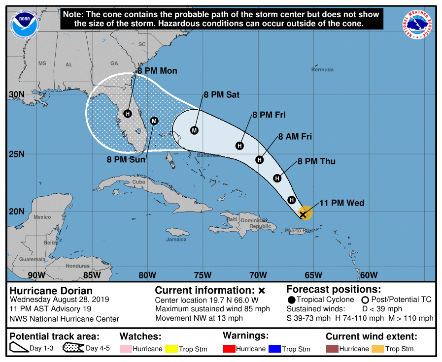
In any event...The SE U.S. has to be on alert. Below - tracks by the various computer models...followed by official track of The Hurricane Center.
In any event...The SE U.S. has to be on alert. Below - tracks by the various computer models...followed by official track of The Hurricane Center.
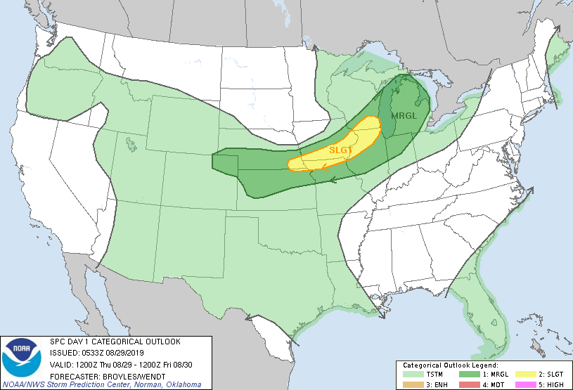
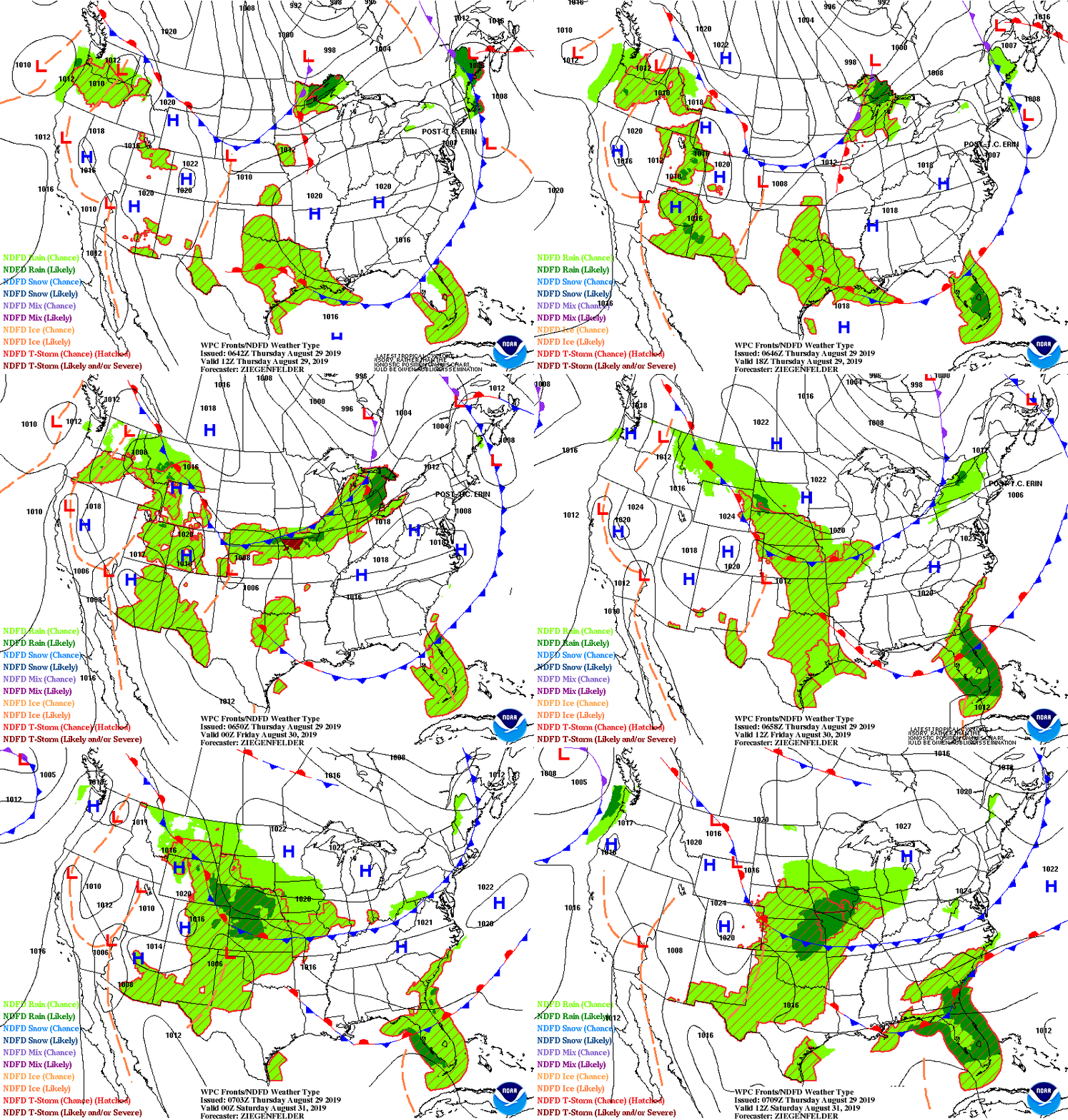
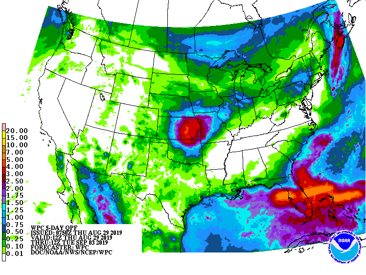
Below - today's risk of severe weather in dark green and yellow....animated maps for next 2 days....rainfall into Tuesday of next week.
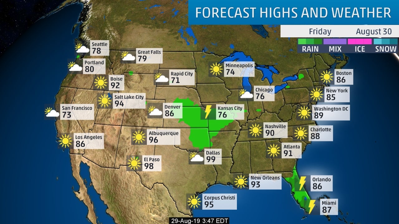
Below- snapshot weather for Friday. Be safe.

 RSS Feed
