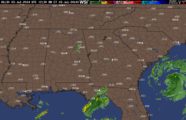
Radar shows Arthur to be well formed as the season's first Hurricane with 75 mph winds. He will move north and hit
eastern North Carolina tonight. After that he will turn
northeast and pass south of Cape Cod late Friday evening.
eastern North Carolina tonight. After that he will turn
northeast and pass south of Cape Cod late Friday evening.
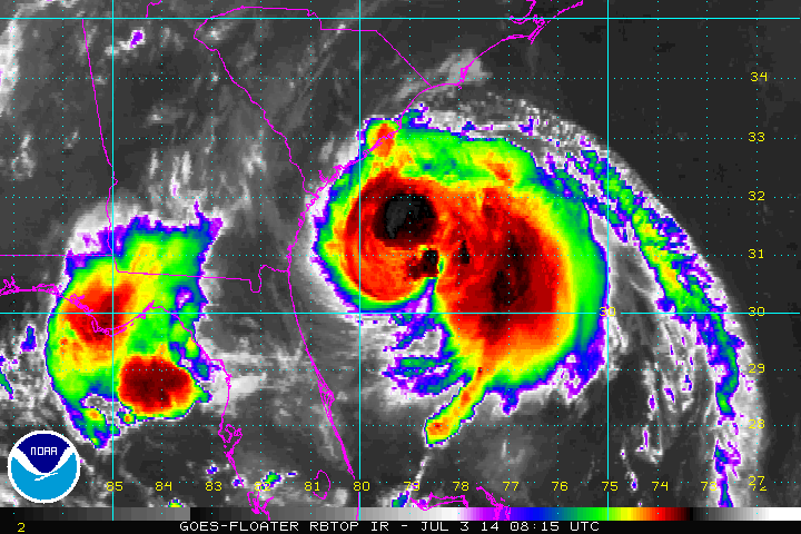
Above...IR Satellite close up of Arthur. The darker the colors the more intense rain.
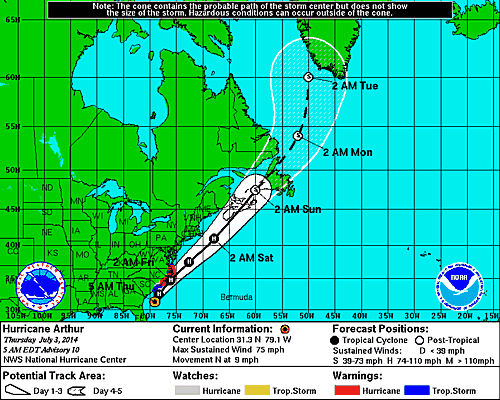
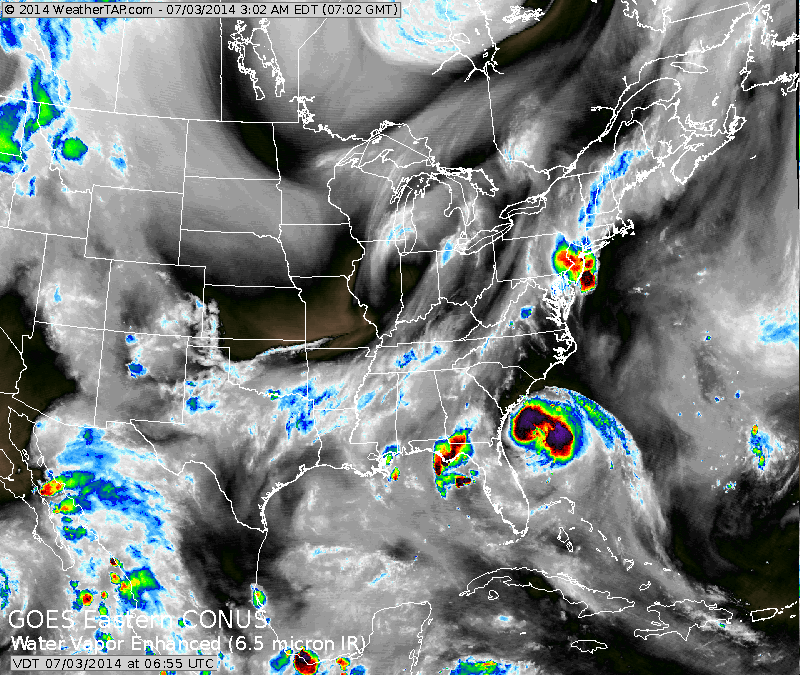
Above...latest track for Hurricane Arthur. Below...satellite picture showing Arthur and cold front along East Coast.. Dry pleasant weather mid section of the nation.
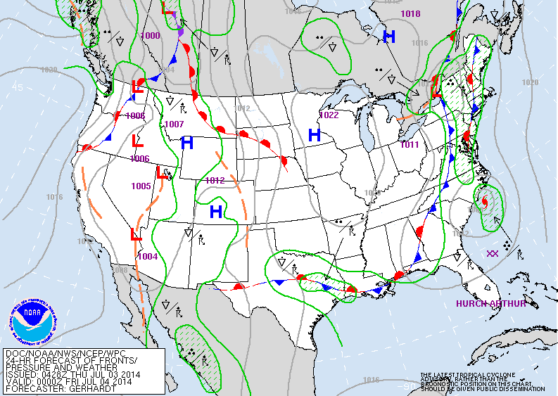
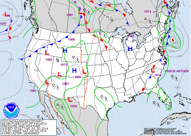
Below...2 maps....first: valid for late today....second: valid for late Friday. You can see how the influence of Arthur will continue wet weather across New England into late Friday.
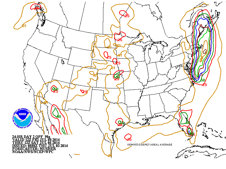
Above...amounts of rain that will fall prior and during the passage of Arthur and cold front over the Northeast. Saturday and Sunday will be just fine over the entire Eastern Half of The Nation. Be safe. Enjoy your weekend.

 RSS Feed
