Metro Weather Inc. Services
Like us, follow us, link to us, contact us!
  • Home
    • Daily Weather Discussion
  • Weather Prepared for You
    • Film and TV Production
    • Radio & Television
    • Government and Industry
    • Forensic Services >
      • Weather Record Request Form
    • Metro Morning Monitor
  • About Metro Weather
    • Senior Staff
  • Your Weather Images
  • Contact Us

Humidity breaks in the East......

7/22/2015

0 Comments

 
Picture
Front stretching from So. Plains to Mid Atlantic will be focus for more storms today. North of the front...less humid and cooler....south of the front....oppressive.
Picture
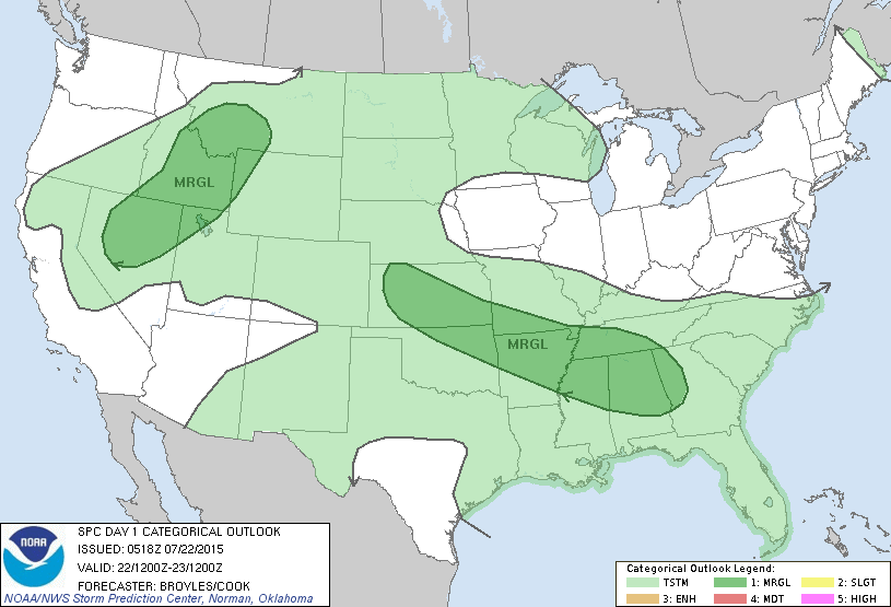
Today's severe risk in dark green.....marginal.
Picture
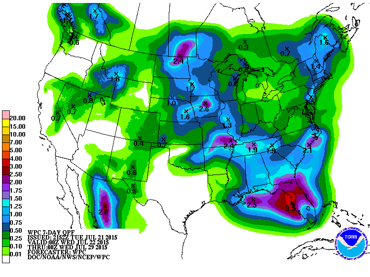
Rainfall predictions for the next 7 days.....clearly Florida will be most likely.
Picture
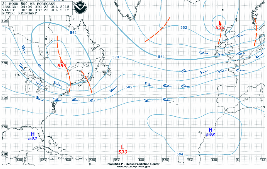
Map above shows upper air over Atlantic. High pressure ridge over Africa...so tropical systems there will be hard to come by.
Picture
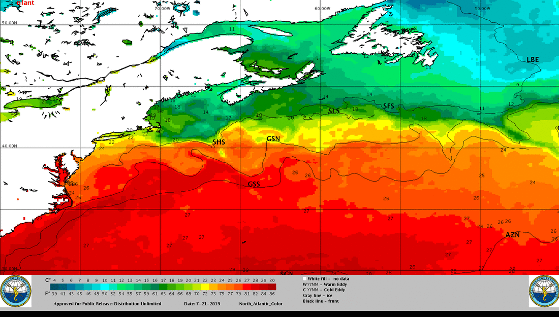
Map shows Atlantic sea surface temperatures. Very warm off the Carolinas and this could be a favorite spot for tropical formation especially next week......keep watching.
Picture
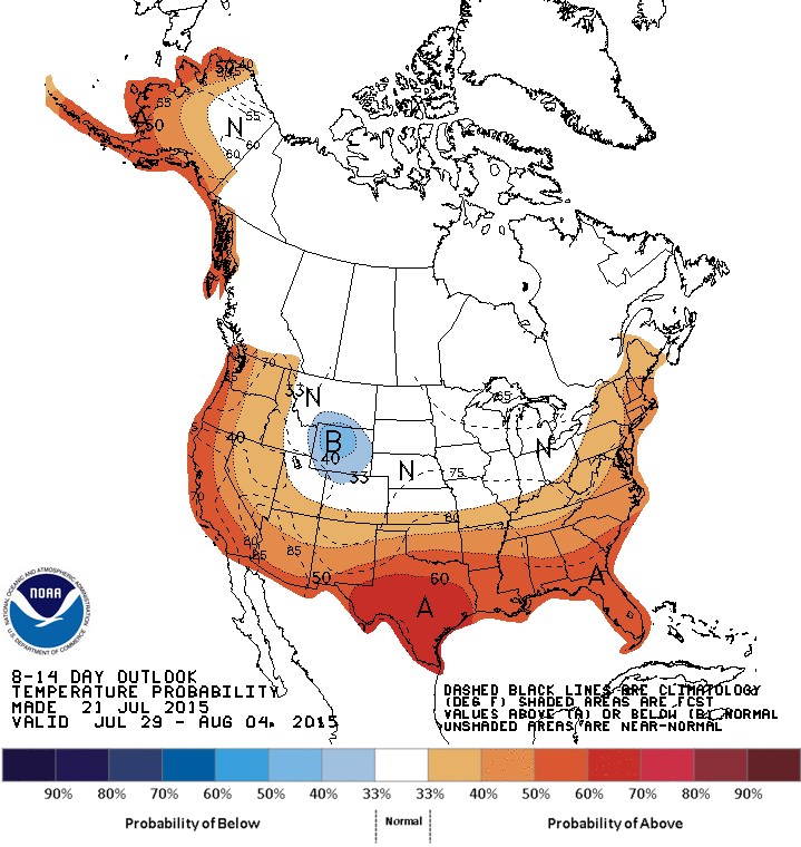
This is a prediction of how daytime temperatures will average through August 4.  Most of the nation at or above normal.
Picture
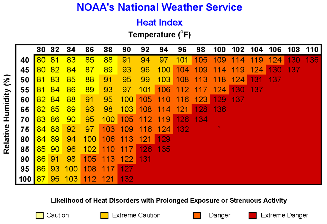
This is the heat - index chart. Download/ print and keep it for handy reference.  Be safe. 
0 Comments


Leave a Reply.

    Genesis of a Tornado
    We'll have daily weather discussions, talking about major systems on the horizon along with anything noteworthy that pops up on our radar.

    Pat Pagano,
    Mike Merin

    Follow us on Twitter and like us on Facebook to get updates whenever we post a new entry!

    RSS Feed

Powered by Create your own unique website with customizable templates.