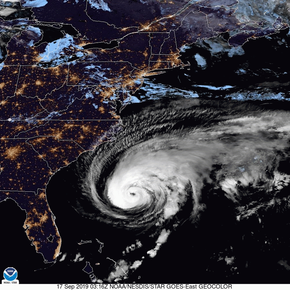
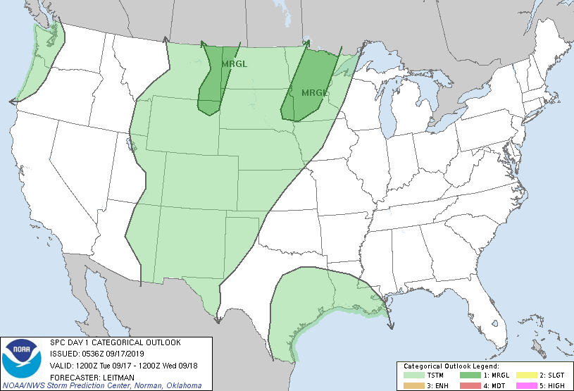
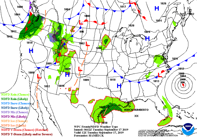
Above...Hurricane Humberto....well formed....moving slowly out to sea...but generating large swells for SE Coast. Below...satellite and radar of the Nation...followed by today's threat of severe weather in dark green.

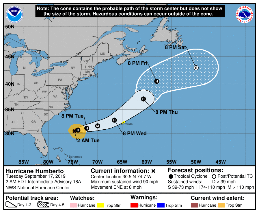
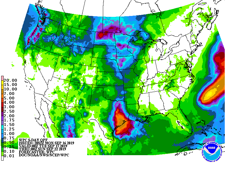
Below - track of Humberto, Atlantic basin showing next system to watch for in So. Central Atlantic followed by rainfall into this weekend.

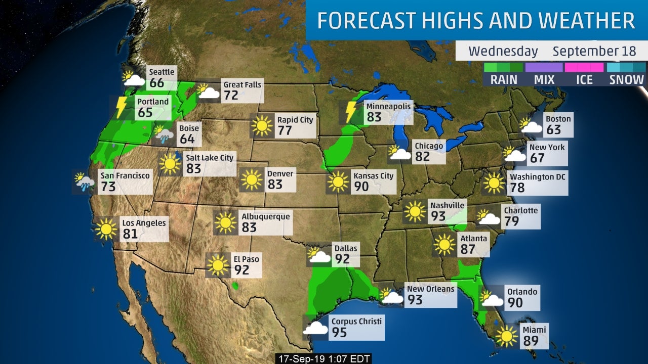
Below - animated maps for the next 2 days followed by snapshot for Wednesday. Be safe.

 RSS Feed
