
Satellite radar shows many areas of wetness...one in Texas...another spinning off the N.Carolina coast as the left overs from Bonnie.
Tonight's map shows cool front moving into the East with showers. That front could haunt the East all weekend. System in Rockies comes east by Sunday and forces jet stream south to bring in some pretty cool air.
Areas in dark green indicate a slight chance of severe weather today.
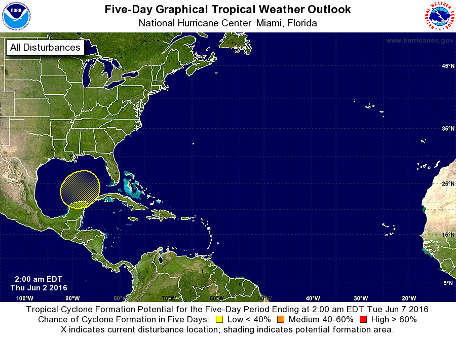
Hurricane center showing a slight chance of developing trouble in the Gulf. Most models do pick up on this but slowly. Only model indicating a more substantial system is the Canadian ..which brings it into Florida on Sunday - Monday - see map below.
Below....upper air map valid for mid next week. It shows ridge out west with heat and dryness....trof East with cool...unsettled weather. Stay safe.

 RSS Feed
