Metro Weather Inc. Services
Like us, follow us, link to us, contact us!
  • Home
    • Daily Weather Discussion
  • Weather Prepared for You
    • Film and TV Production
    • Radio & Television
    • Government and Industry
    • Forensic Services >
      • Weather Record Request Form
    • Metro Morning Monitor
  • About Metro Weather
    • Senior Staff
  • Your Weather Images
  • Contact Us

Hot West, Cooler East

8/14/2020

0 Comments

 
Picture
Satellite - radar above - watching a low over N.Carolina. It will move into Atlantic and could become tropical over weekend and bring gusty winds and some rain to Mid Atlantic Coast.  Severe storms from No. Rockies to Upper Midwest today where some tornadoes are possible. Below - animated maps - today's severe weather - rainfall through Tuesday.
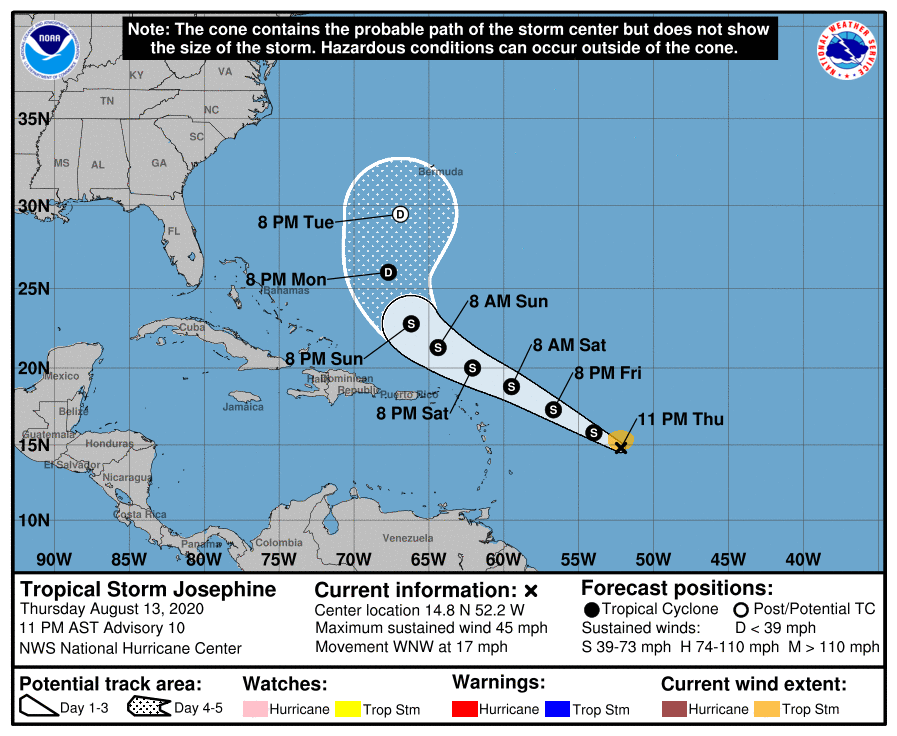
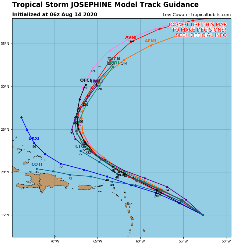
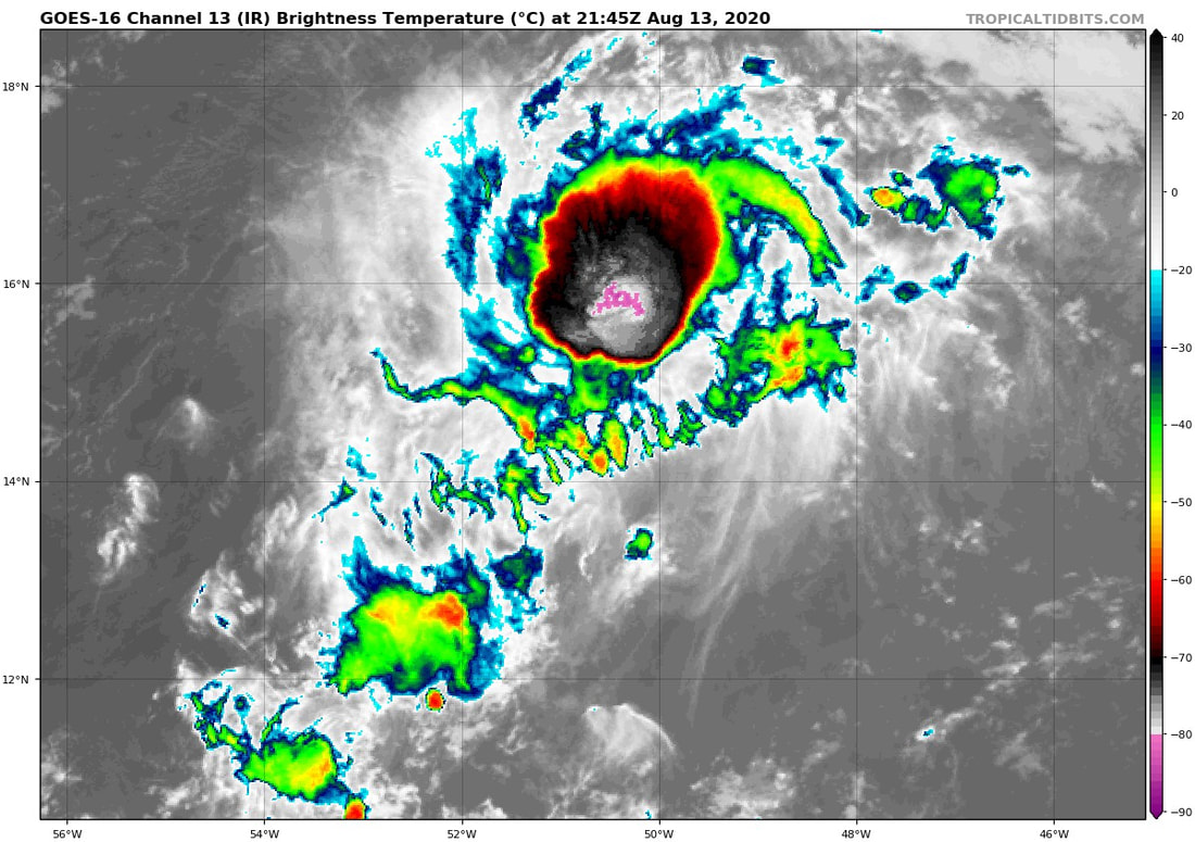
​Below - latest hurricane center track - models tracks - satellite of Atlantic and close up satellite of Josephine.
​Below - snapshot weather for Saturday. Have a nice but SAFE weekend.
Picture
0 Comments


Leave a Reply.

    Genesis of a Tornado
    We'll have daily weather discussions, talking about major systems on the horizon along with anything noteworthy that pops up on our radar.

    Pat Pagano,
    Mike Merin

    Follow us on Twitter and like us on Facebook to get updates whenever we post a new entry!

    RSS Feed

Powered by Create your own unique website with customizable templates.