Metro Weather Inc. Services
Like us, follow us, link to us, contact us!
  • Home
    • Daily Weather Discussion
  • Weather Prepared for You
    • Film and TV Production
    • Radio & Television
    • Government and Industry
    • Forensic Services >
      • Weather Record Request Form
    • Metro Morning Monitor
  • About Metro Weather
    • Senior Staff
  • Your Weather Images
  • Contact Us

Highly Unsettled....

4/29/2019

0 Comments

 
Picture
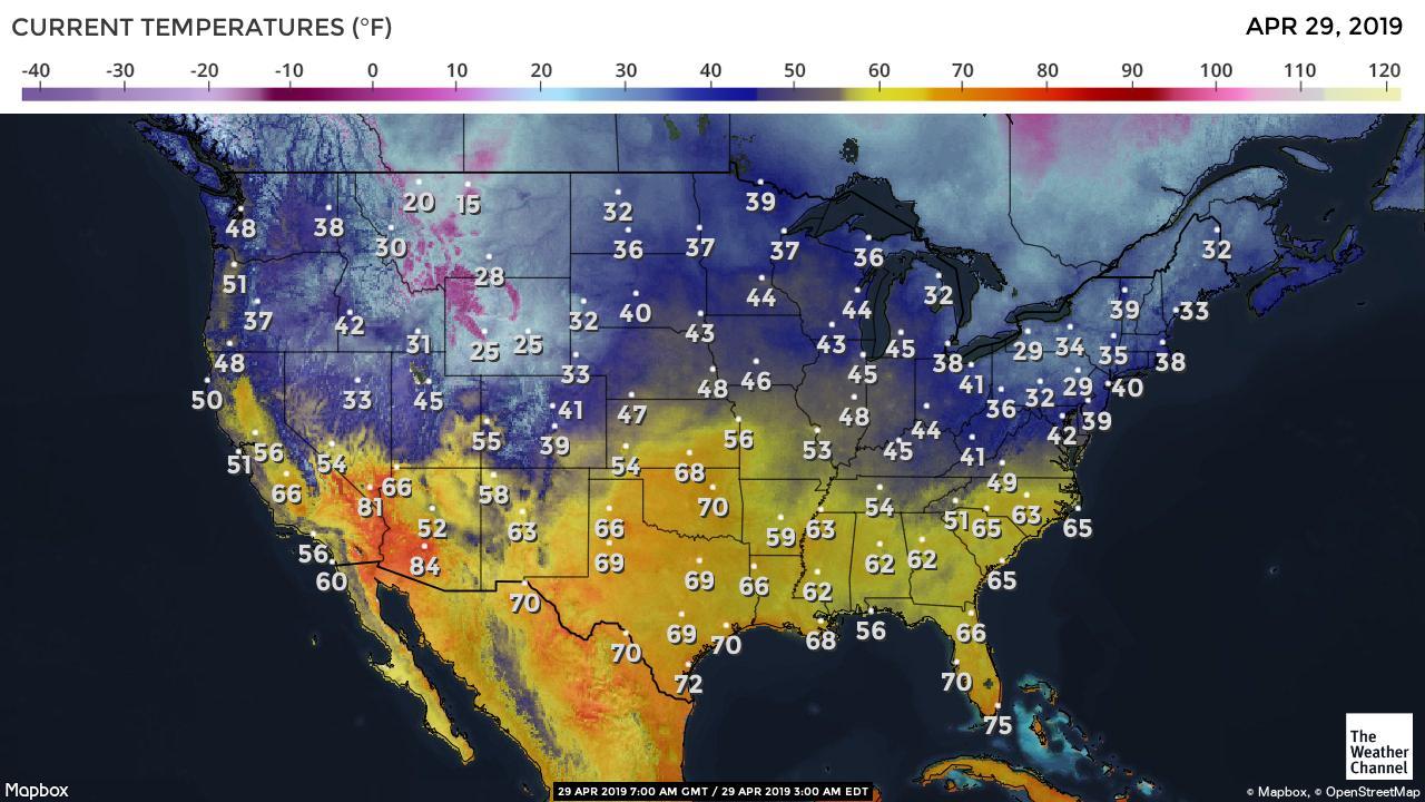
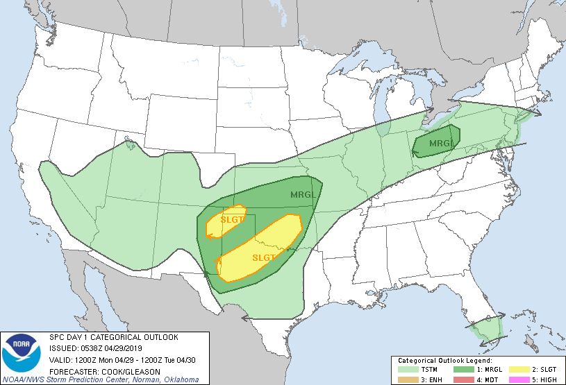
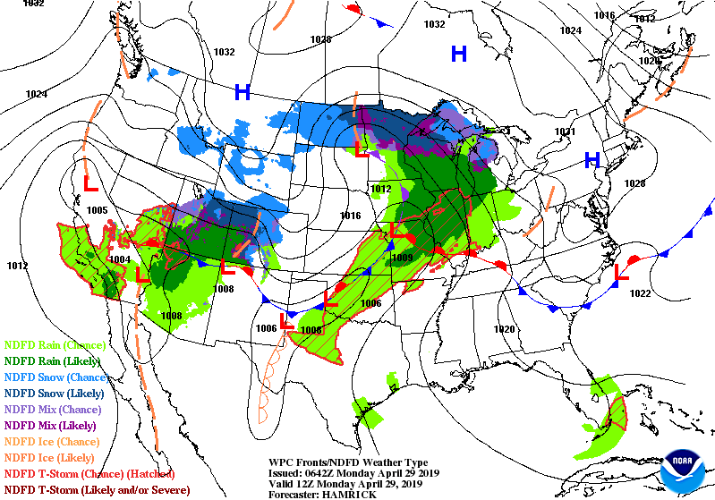
Above - early MOnday temperatures. The boundary between blue and yellow represent a wavy front which will mean rain and drizzle to the north in the cooler air...showers and storms in the warmer air - yellow. Below - threat of severe storms today in dark green and yellow.
Picture
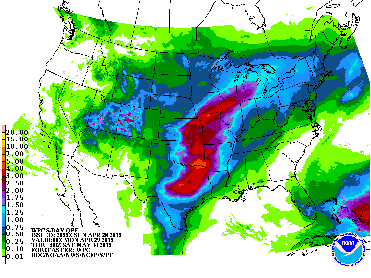
​Below- satellite- radar showing the areas of rain .....followed by amounts of rain through the end of this week.
Picture
Picture
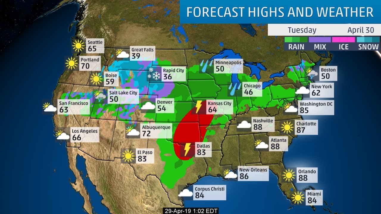
​Below - animated maps for the next couple...followed by weather map for Tuesday.  Notice on that map...Boston has a high of 62...Washington DC has a high of 85....there is the boundary. Be safe.
Picture
Picture
0 Comments


Leave a Reply.

    Genesis of a Tornado
    We'll have daily weather discussions, talking about major systems on the horizon along with anything noteworthy that pops up on our radar.

    Pat Pagano,
    Mike Merin

    Follow us on Twitter and like us on Facebook to get updates whenever we post a new entry!

    RSS Feed

Powered by Create your own unique website with customizable templates.