Metro Weather Inc. Services
Like us, follow us, link to us, contact us!
  • Home
    • Daily Weather Discussion
  • Weather Prepared for You
    • Film and TV Production
    • Radio & Television
    • Government and Industry
    • Forensic Services >
      • Weather Record Request Form
    • Metro Morning Monitor
  • About Metro Weather
    • Senior Staff
  • Your Weather Images
  • Contact Us

Hello Winter.....

12/21/2017

0 Comments

 
Picture
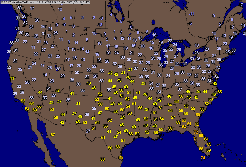
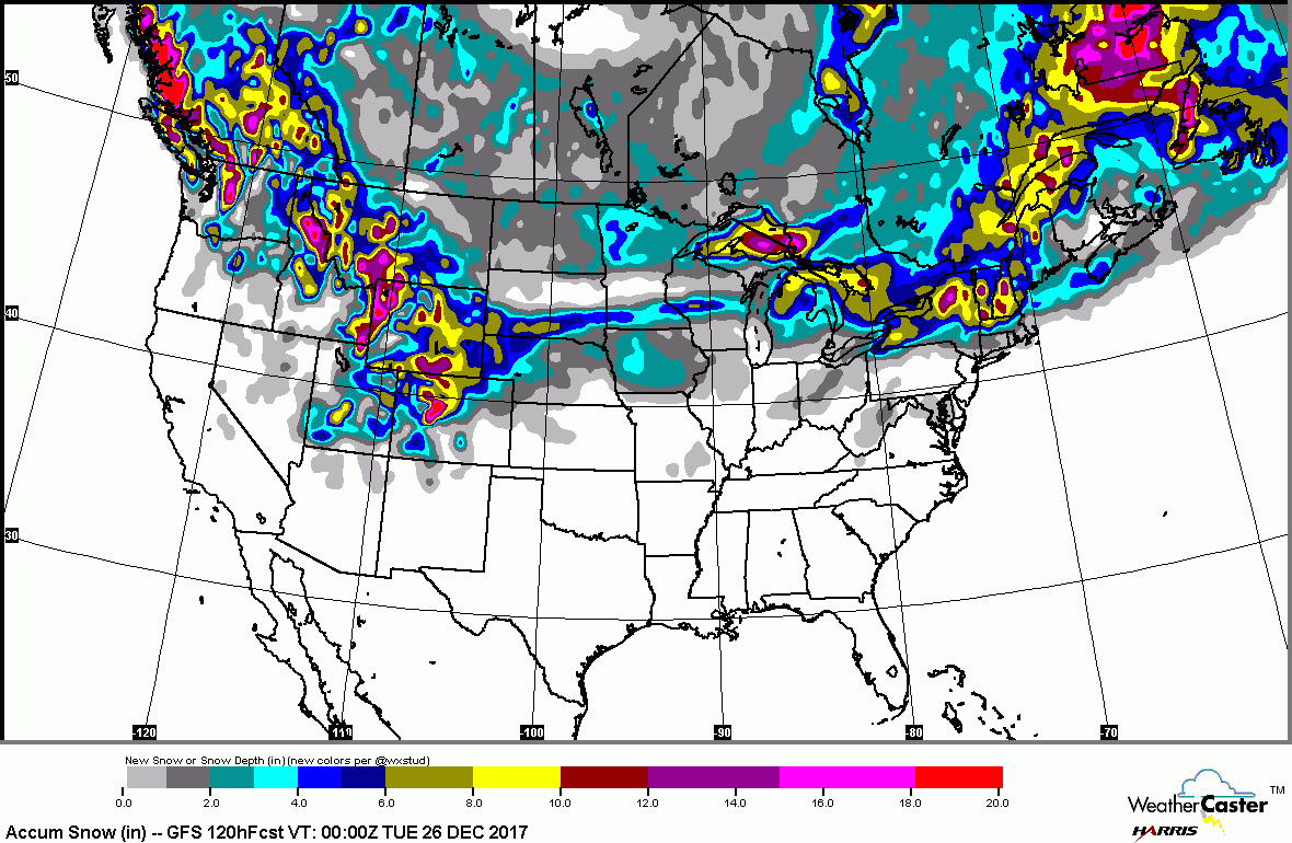
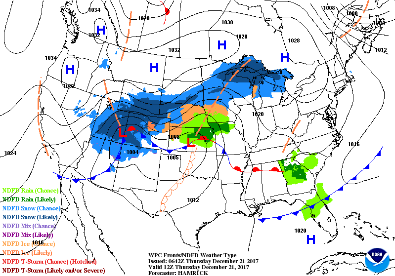
Northern jet stream bringing snow from Dakotas to Great Lakes and will bring several inches to New England Friday. System in the Northwest will dive in and bring wet weather to east this weekend...with a change to snow on Christmas Day before ending.  Not good for travel.  Below..current temperatures and outlook for snowfall over the next 5 days. 
Picture
Picture
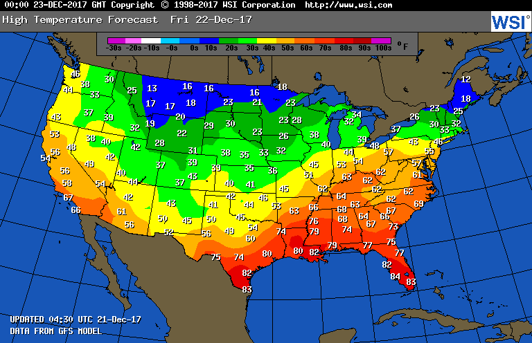
​Below - animated maps for the next couple followed by projected highs for Friday.
Picture
Picture
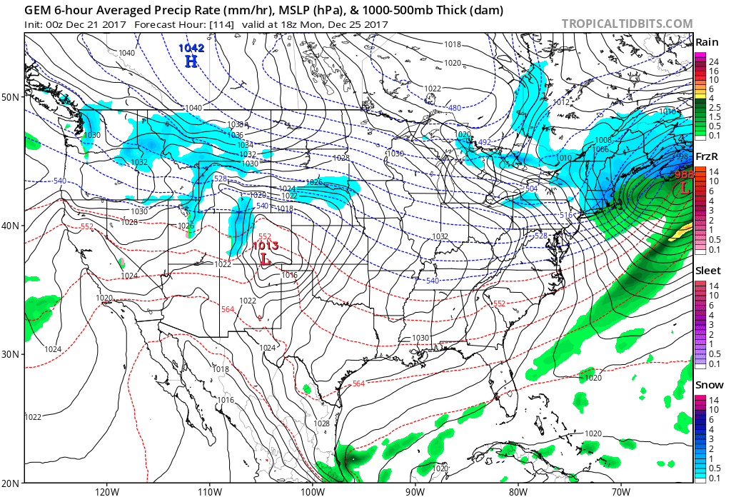
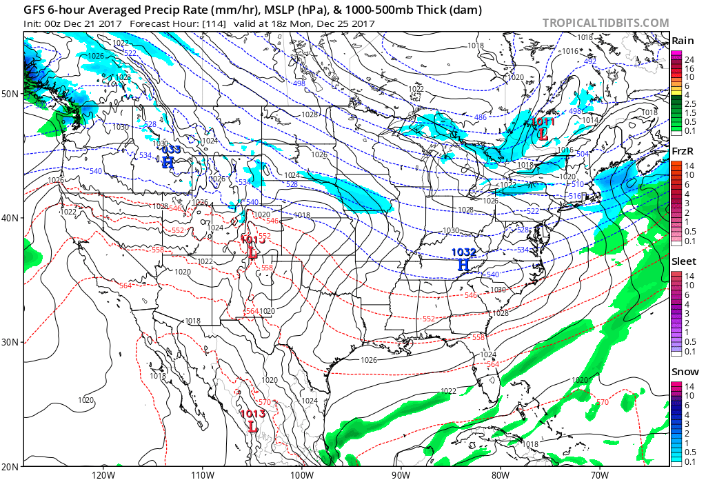
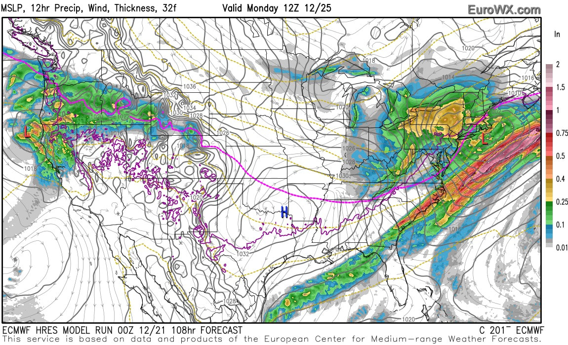
Above - models for Christmas Day: left - Canadian - snow ending by Christmas afternoon....center - GFS - some snowshowers - right - Euro - large storm with rain near coast ending as rain - heavy snow inland. That's my choice...a couple of more days to make it final. Be safe.
0 Comments


Leave a Reply.

    Genesis of a Tornado
    We'll have daily weather discussions, talking about major systems on the horizon along with anything noteworthy that pops up on our radar.

    Pat Pagano,
    Mike Merin

    Follow us on Twitter and like us on Facebook to get updates whenever we post a new entry!

    RSS Feed

Powered by Create your own unique website with customizable templates.