Metro Weather Inc. Services
Like us, follow us, link to us, contact us!
  • Home
    • Daily Weather Discussion
  • Weather Prepared for You
    • Film and TV Production
    • Radio & Television
    • Government and Industry
    • Forensic Services >
      • Weather Record Request Form
    • Metro Morning Monitor
  • About Metro Weather
    • Senior Staff
  • Your Weather Images
  • Contact Us

Heavy Snow for The East, Again !

3/4/2015

0 Comments

 
Picture
Satellite shows a band of moisture from Texas to Northeast. That will translate to heavy snow from southern New England to Mid Atlantic tonight and Thursday which will total anywhere from 4" to 10". 
Picture
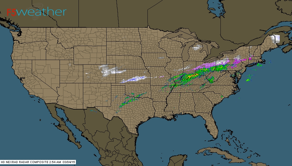
This radar coincides with the satellite...showing the moisture which is falling with this front.
Picture
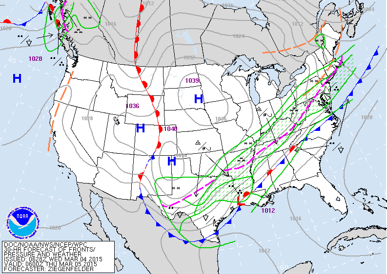
Now when you add the surface weather map features you can see how clear the pattern is. Once the front moves south...it turns colder by Friday but dry. Moderating temps are expected this weekend.
Picture
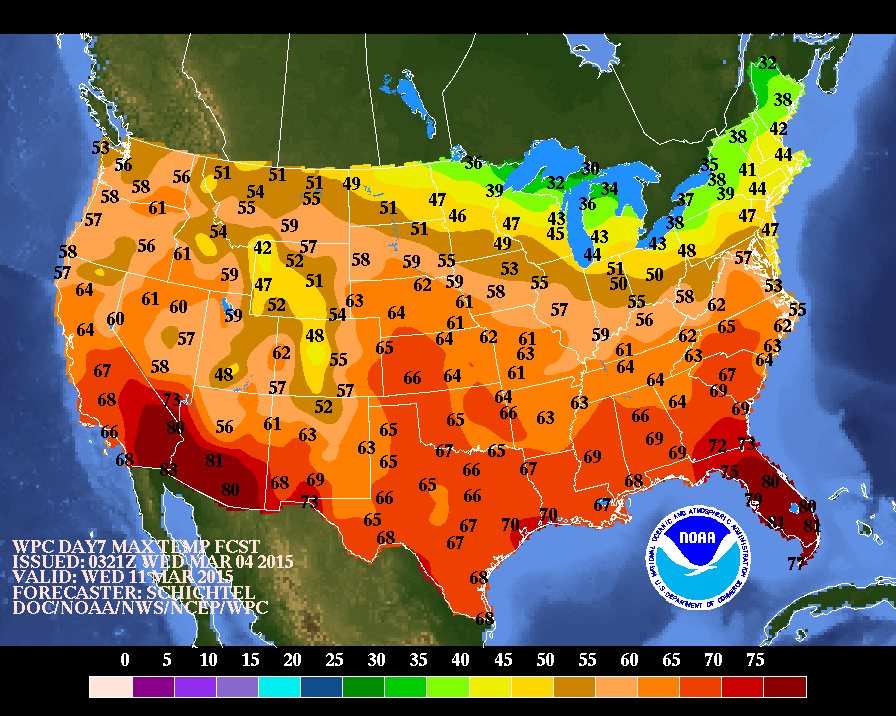
These are expected high temperatures for 1 week from today......next Wednesday. Nice to see the absence of cold air.....perhaps a sign of more springlike conditions. We can only hope.  Be safe.
0 Comments


Leave a Reply.

    Genesis of a Tornado
    We'll have daily weather discussions, talking about major systems on the horizon along with anything noteworthy that pops up on our radar.

    Pat Pagano,
    Mike Merin

    Follow us on Twitter and like us on Facebook to get updates whenever we post a new entry!

    RSS Feed

Powered by Create your own unique website with customizable templates.