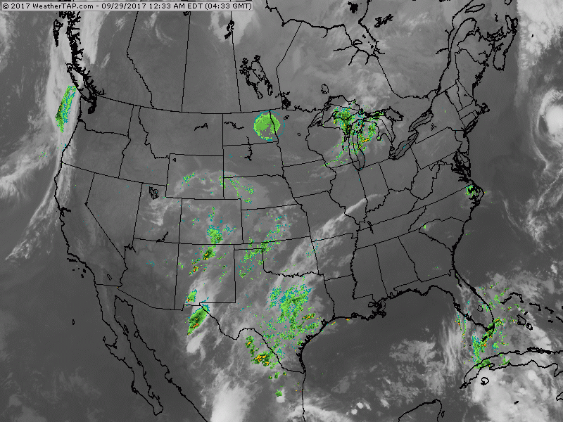
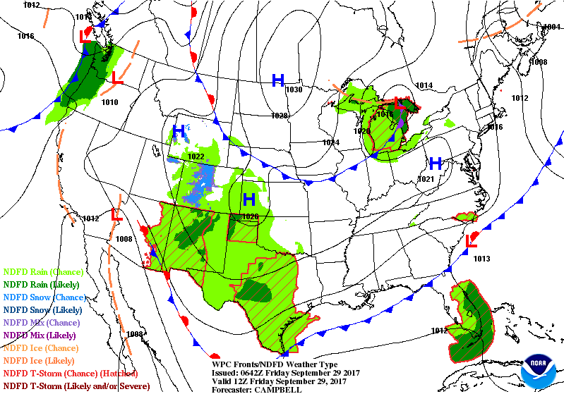
Satellite - radar shows cold front over Great Lakes with showers headed for Northeast Saturday. Showers southern Plains. Wet weather pushing up to Florida...tropical disturbance there . Below....animated maps for the next couple of days. .....not changing much from above.
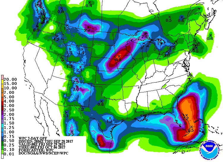
Below - rainfall projections for the next 7 days......looks like Florida hits the jackpot with over 5" of rain....and more to come.
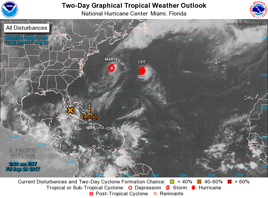
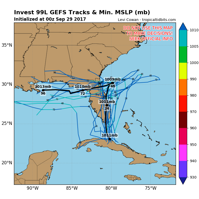
Below - tropical Atlantic Basin. System from Cuba could become Nate...and it could bring heavy rains across Florida during next week. Track for that disturbance also included.
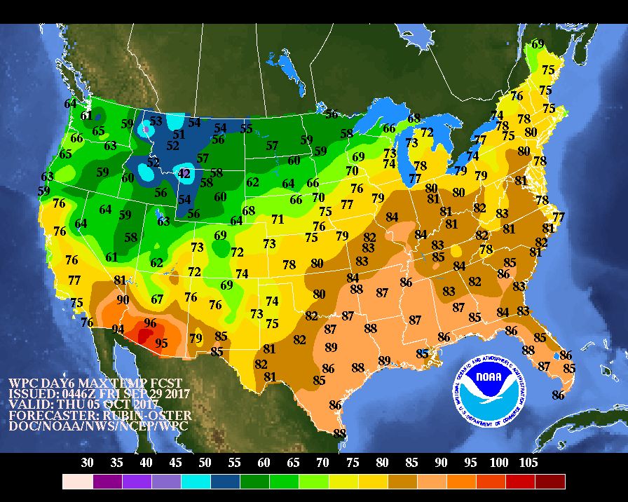
Finally - look at high temperatures for next Thursday. A complete flip-flop from this weekend's scheme of things. Be safe.

 RSS Feed
