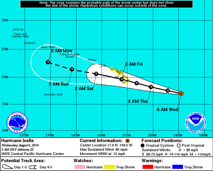
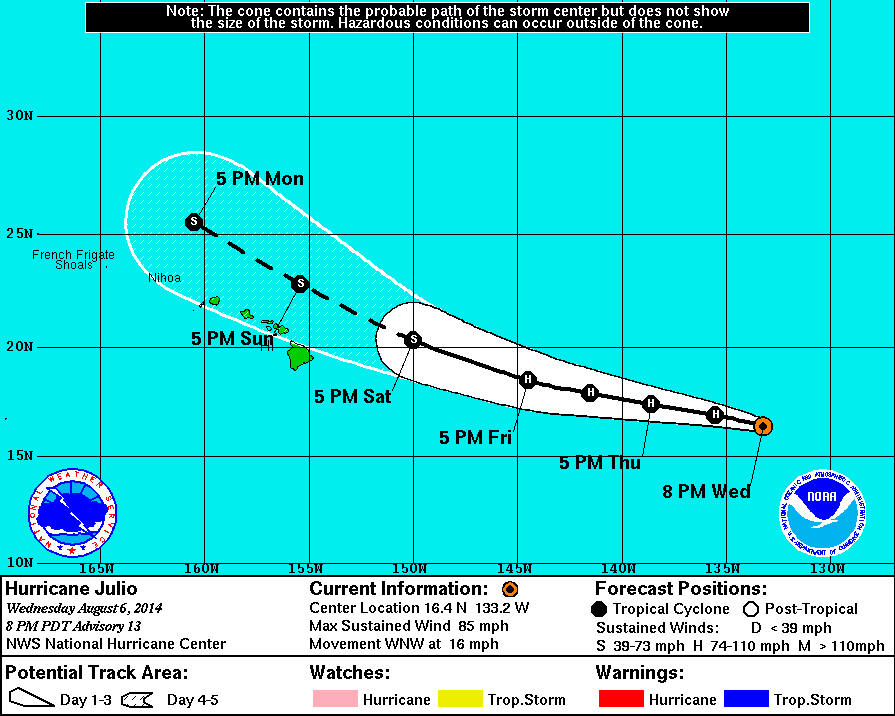
Iselle will cross the Big Island of Hawaii late tonight as a tropical storm and then move south of the chain early Friday. Winds will gust to 90 mph and this will be a potential storm for Hawaii. On it's heels....Hurricane Julio...likely moving north of the chain this weekend with non-direct affects.....but still bring squally winds.
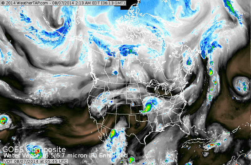
Above...satellite picture showing 2 pinwheels in the Pacific...they are Iselle and Julio. Blob of color in mid section of the nation will head southeast and bring heavy rains to Mid Atlantic this Saturday.
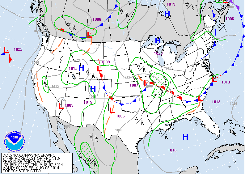
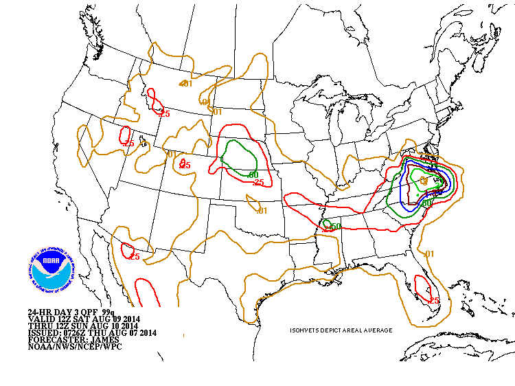
Low is Missouri today moves to North Carolina and brings very wet weather this weekend. Below...amounts of rain expected Saturday.
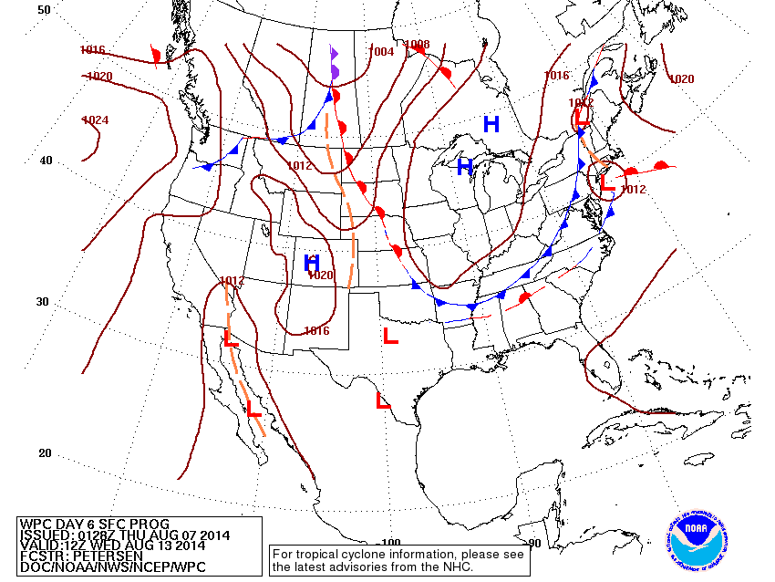
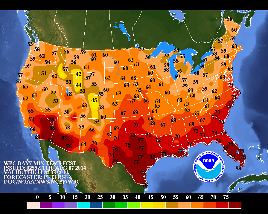
Below....map for next Wednesday showing a complex low pressure system along the East Coast. It will bring rain and storms to the East....followed by a blast of cooler air for this time of year....as you will see in the map that follows. Shades of Fall ? Some stores in Northeast already have Halloween Candy displayed....a bit early ? Be safe.

 RSS Feed
