Hurricane Matthew is headed for a Cat 3 storm with over 100 mph winds....south of Haiti. He will continue west then turn north. Most models are taking him away from the N.Carolina coast next week and out to sea....but he needs to be watched carefully. Below....his track by The Hurricane Center.
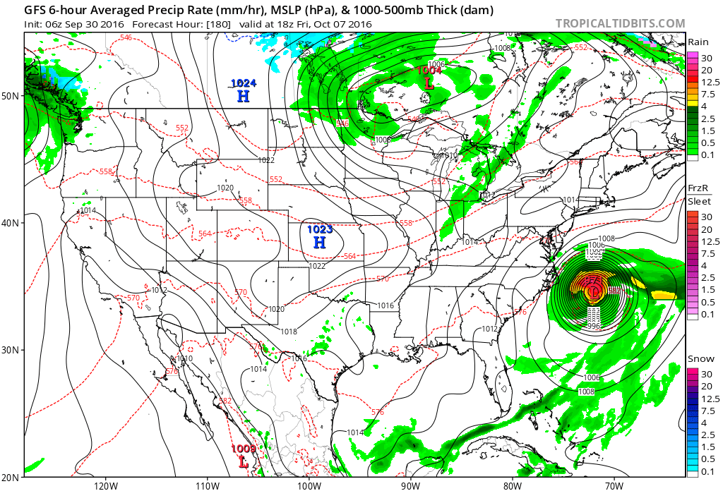
Below...The GFS Model - valid for late next week - shows Hurricane Matthew off N. Carolina and then it turns it out to sea. Most of the models do that...but hurricanes can do anything and it's too far out to call the shots at this time.
Satellite - radar showing storm in Ohio Valley bringing the wet weather to the east all weekend. Below that....map for Saturday night.
Below...map showing amounts of rain for the weekend.

 RSS Feed
