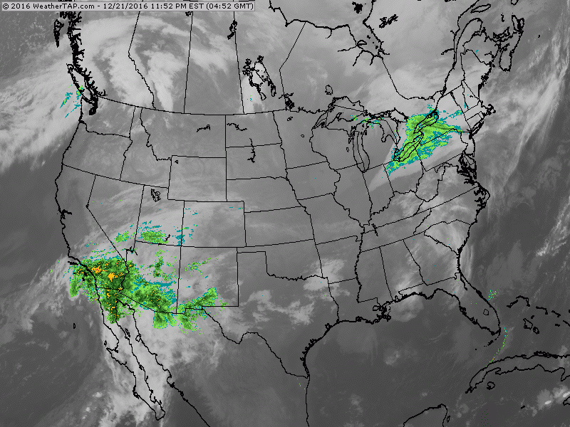
Small disturbance moving across New England with a touch of snow today. Wet storm for Southwest....headed for Rockies and Midwest on Christmas Day.
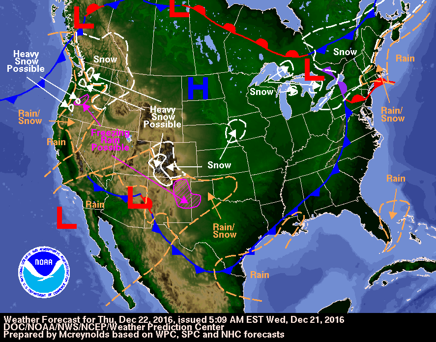
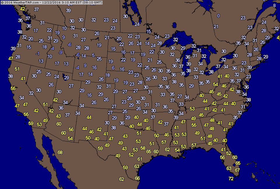
Today's weather map showing that small system in Northeast and the bigger system in Southwest. Below...a sampling of temps this morning.
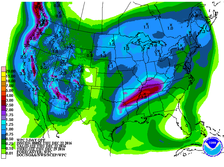
Amounts of precipitation forecast for the next 7 days. Below...
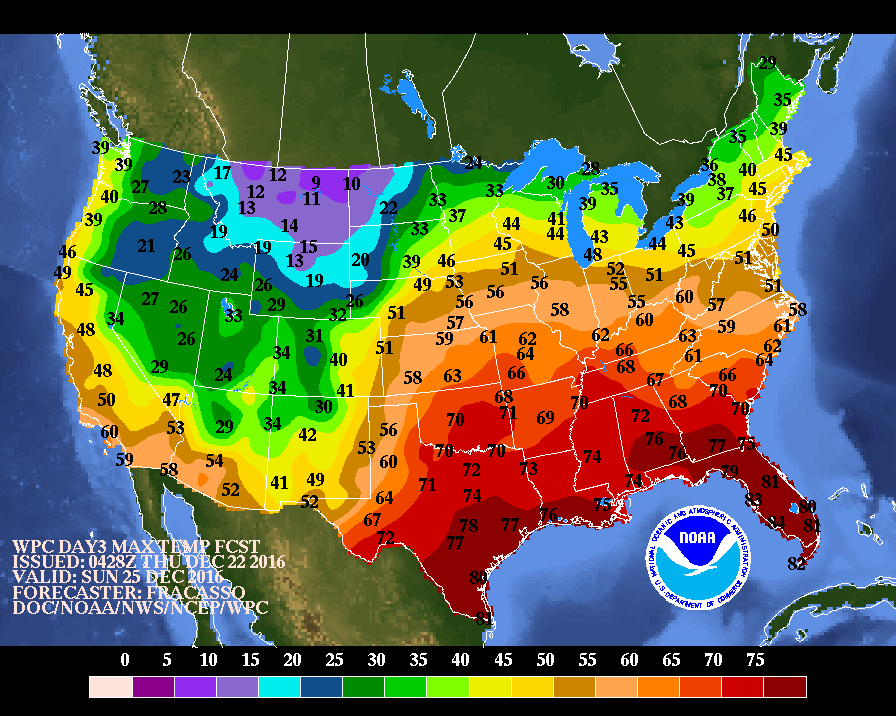
low temperatures for CHristmas morning...followed by high temperatures for Christmas Day.
low temperatures for CHristmas morning...followed by high temperatures for Christmas Day.
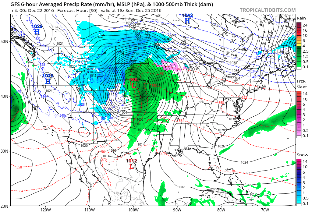
Above - GFS model for Christmas Day: intense storm in Nebraska with blizzard conditions for No. Rockies and Dakotas..wintry Mix upper Midwest....rain and wind for Plains including thunderstorms which may be severe.
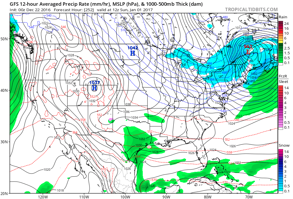
Above - GFS Model for New Year's Day: Cold wave - wind and snow from Great Lakes into Northeast. Some rain for Texas...rest of the Nation...quiet. Be safe.

 RSS Feed
