Metro Weather Inc. Services
Like us, follow us, link to us, contact us!
  • Home
    • Daily Weather Discussion
  • Weather Prepared for You
    • Film and TV Production
    • Radio & Television
    • Government and Industry
    • Forensic Services >
      • Weather Record Request Form
    • Metro Morning Monitor
  • About Metro Weather
    • Senior Staff
  • Your Weather Images
  • Contact Us

Gradually Colder.....

1/8/2019

0 Comments

 
Picture
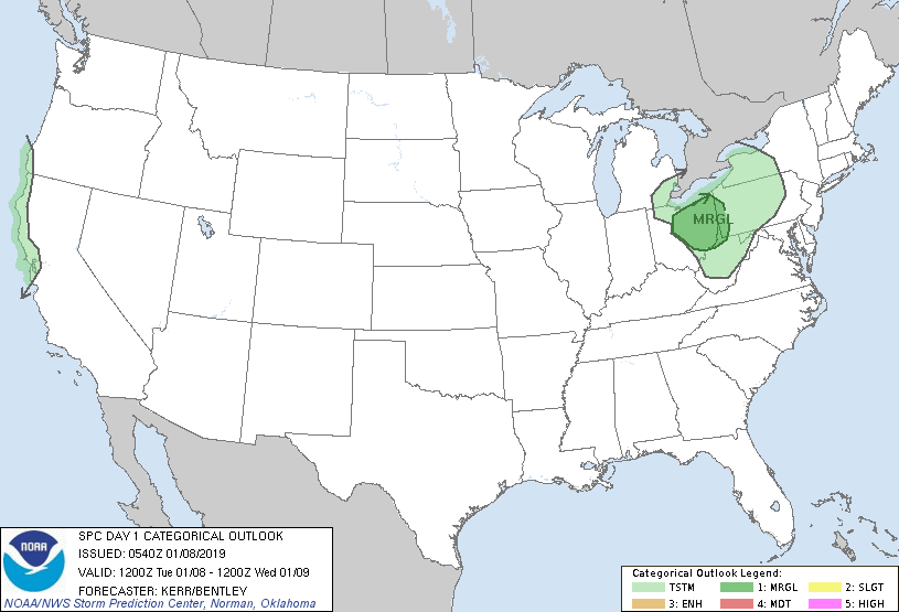
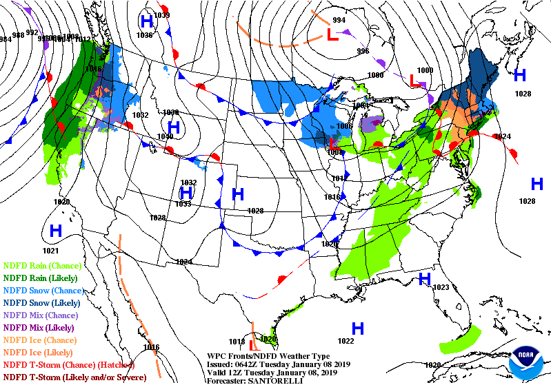
One system pushing through Northeast today...snow - New England - some rain Mid Atlantic. Next system in Great Lakes will bring rain most of the Northeast. System approach west coast could mean a storm for The East on Sunday. Below - today's risk of thunderstorms in green.
Picture
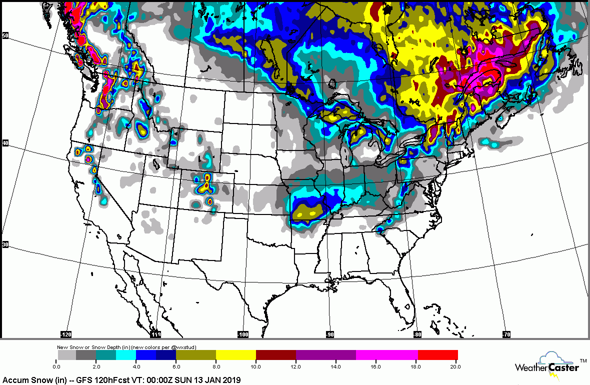
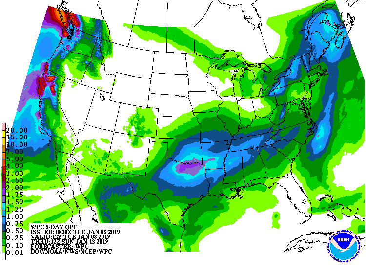
Below- snowfall predictions through Saturday night....rainfall into Sunday.
Picture
Picture
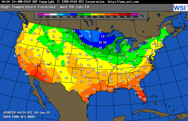
​Below - animated maps for next 2 days followed by high temperatures for Wednesday.
Picture
Picture
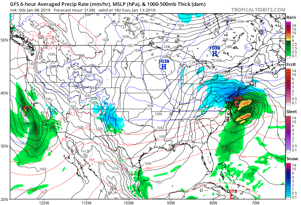
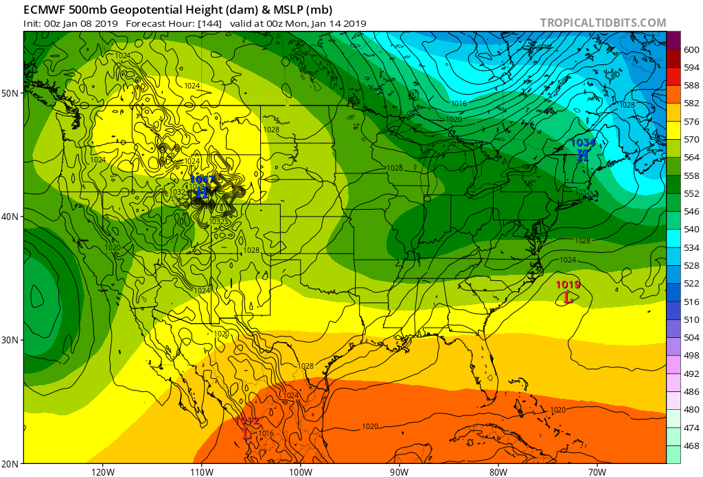
Below - tough call for Northeast/Mid Atlantic this weekend. GFS Model insisting on coastal storm....Euro model saying no....staying well south and off shore. Euro has been more consistent than GFS....but that doesn't mean much. Wait and see. Be safe.
Picture
Picture
0 Comments


Leave a Reply.

    Genesis of a Tornado
    We'll have daily weather discussions, talking about major systems on the horizon along with anything noteworthy that pops up on our radar.

    Pat Pagano,
    Mike Merin

    Follow us on Twitter and like us on Facebook to get updates whenever we post a new entry!

    RSS Feed

Powered by Create your own unique website with customizable templates.