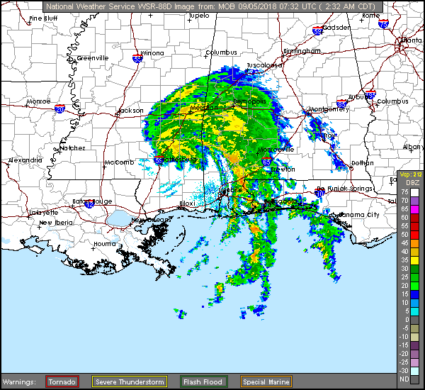
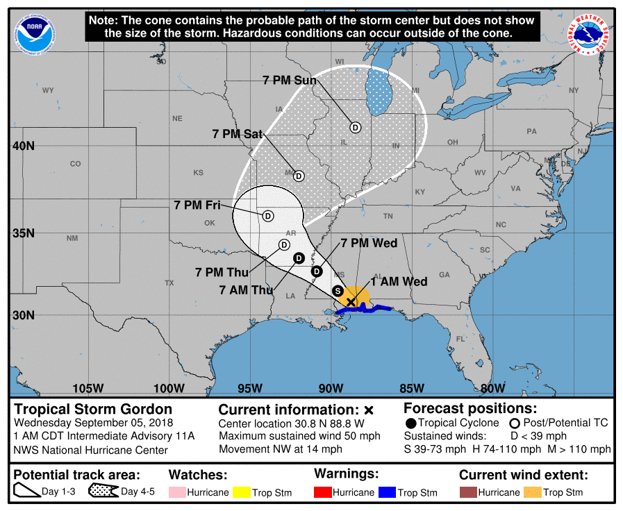
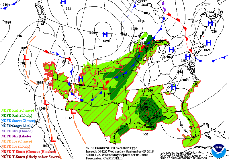
Above...early morning radar of Gordon. Heavy rains over Mississippi & Alabama. Below - track of Gordon....and look at Atlantic basin.
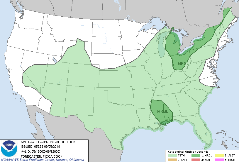
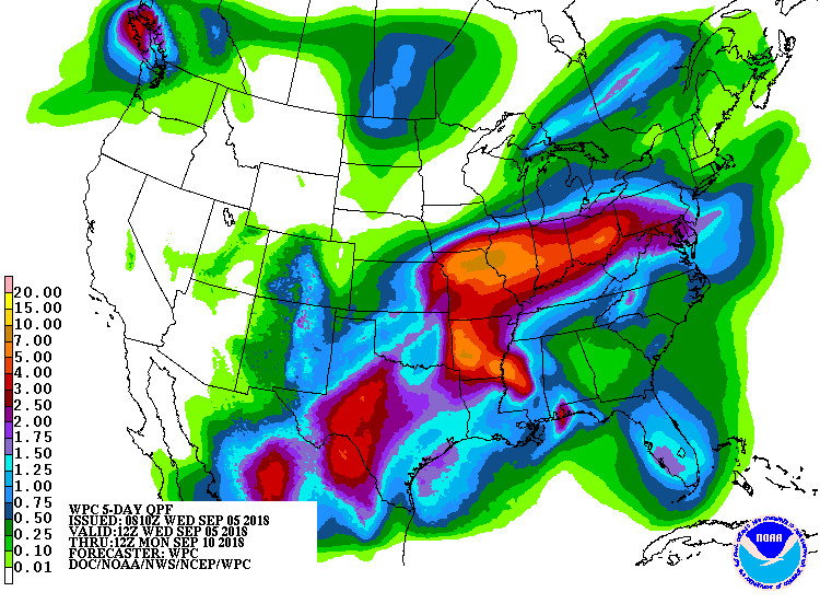
Below- today's risk of severe thunderstorms in dark green followed by animated maps for next 2 days and rainfall for next 7 days. Heaviest rain along the track of Gordon's left over moisture.
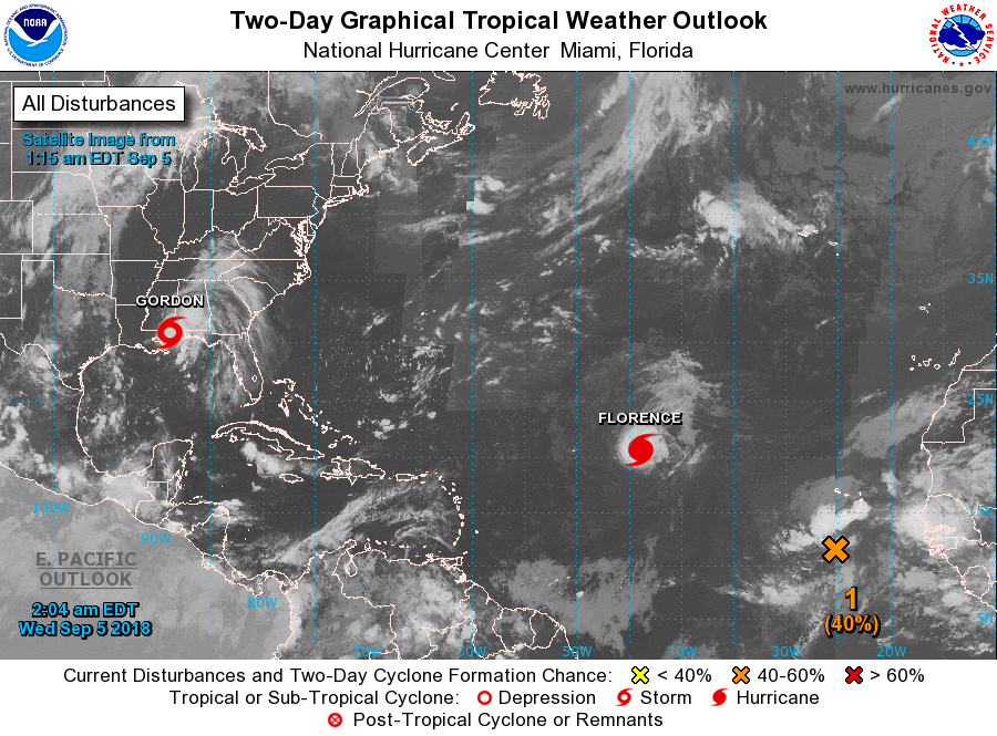
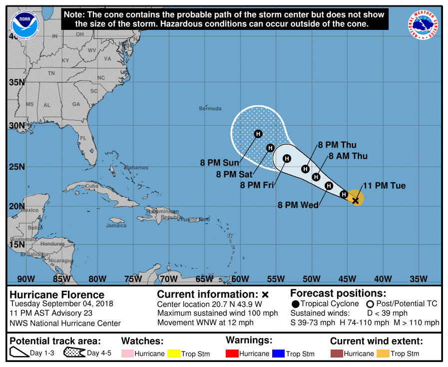
Lastly....track of Florence. Interesting note...while most of the models keep her offshore next week...The Euro Model wants to bring her into the SE Atlantic coast toward the Carolinas. Be safe.

 RSS Feed
