
Gonzalo satellite pix. He's a major hurricane with sustained winds of 125 mph and will get stronger before hitting Bermuda on Friday. Currently east-northeast of western Bahamas.
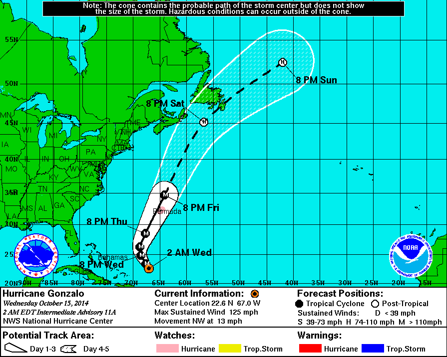
Hurricane center predicted track takes Gonzalo just to the left of Bermuda...putting it in the most dangerous portion of the storm. After that...New Foundland is in it's path.
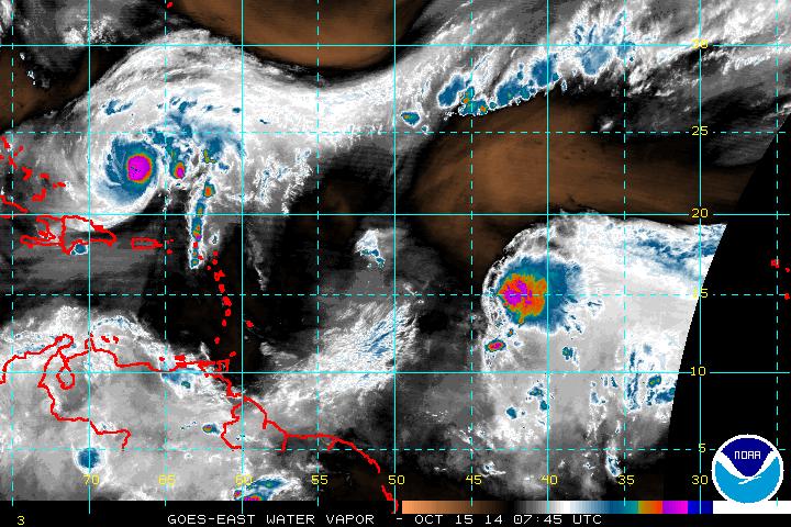
A second disturbance in Central Atlantic is trying to hold together...and it could take a similar path to Gonzalo. If it were to become a tropical storm it would be Hanna.
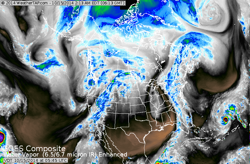
Today's satellite shows the defined cold front near the East Coast which will dump 1-2" of rain today and Thursday. Gonzalo at far right. Next cold front in Rockies. Strong storm sliding southeast from Gulf of Alaska once had tropical characteristics. It will all make for interesting weather for the latter part of October.
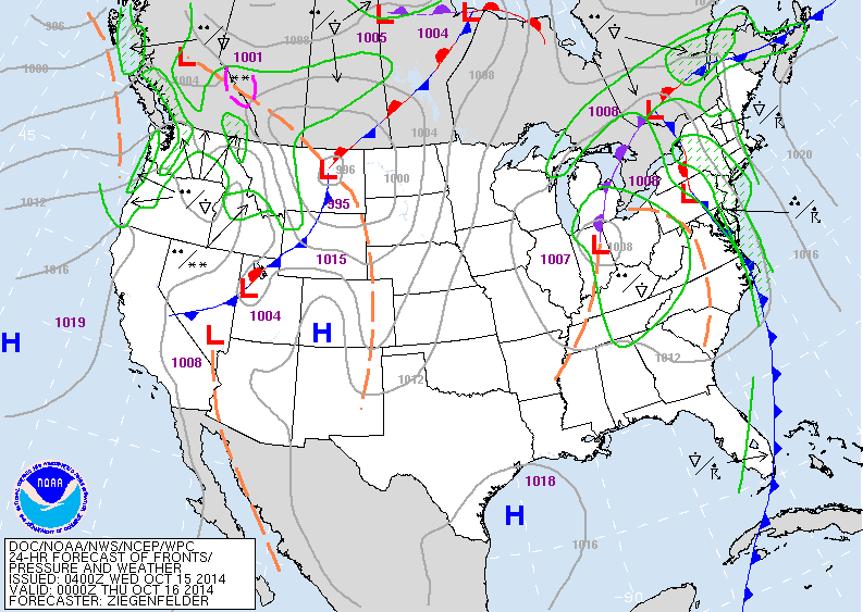
Map valid for late today...shows the wet cold front in The East....next front moving across the Rockies.
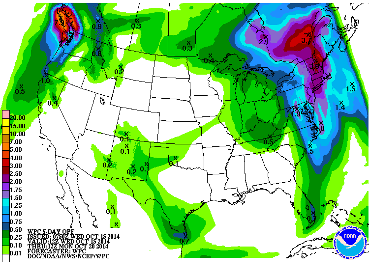
Amouonts of rain expected from today thru Sunday.
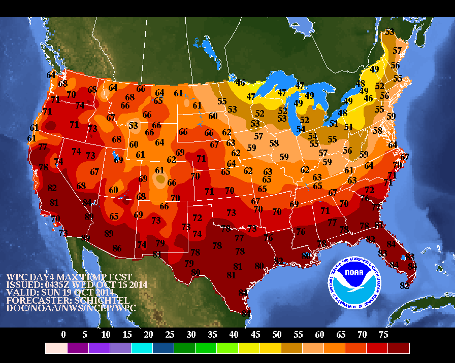
Below....map showing high temperatures for this Sunday.
Be safe everyone.
Below....map showing high temperatures for this Sunday.
Be safe everyone.

 RSS Feed
