
Satellite shows the jet stream far south enabling very cold airctic air to invade much of the U.S. with the exception of the west. Locally heavy snowshowers and snowsqualls will hit the Great Lakes and Northeast today. Thursday shaping up to be the coldest day of the week if not the season for many in the East.
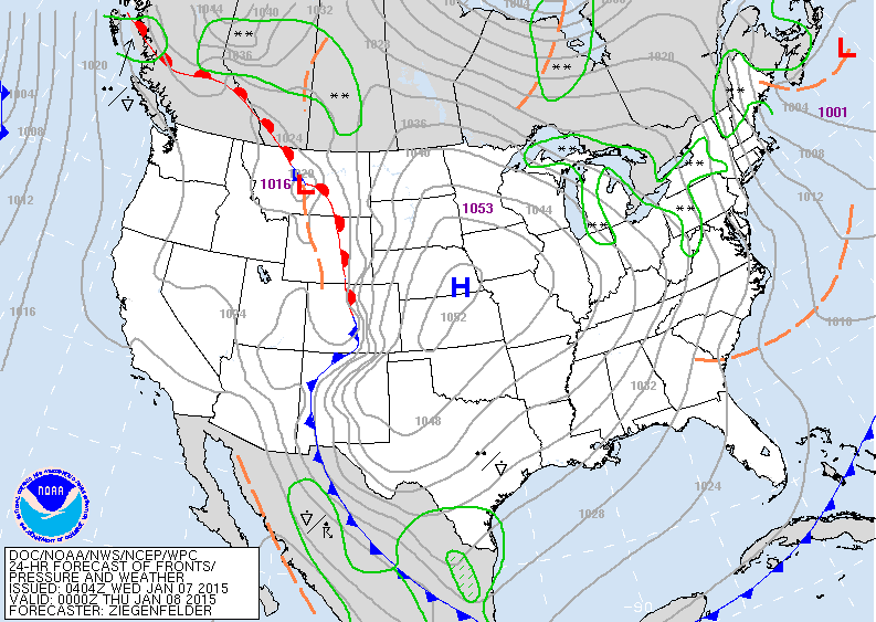
Map above valid for early tonight. High in Plains is the center of arctic air which covers from The Rockies to East Coast. Even Miami will fall into mid 50s tonight...New Orleans will drop to mid 20s.
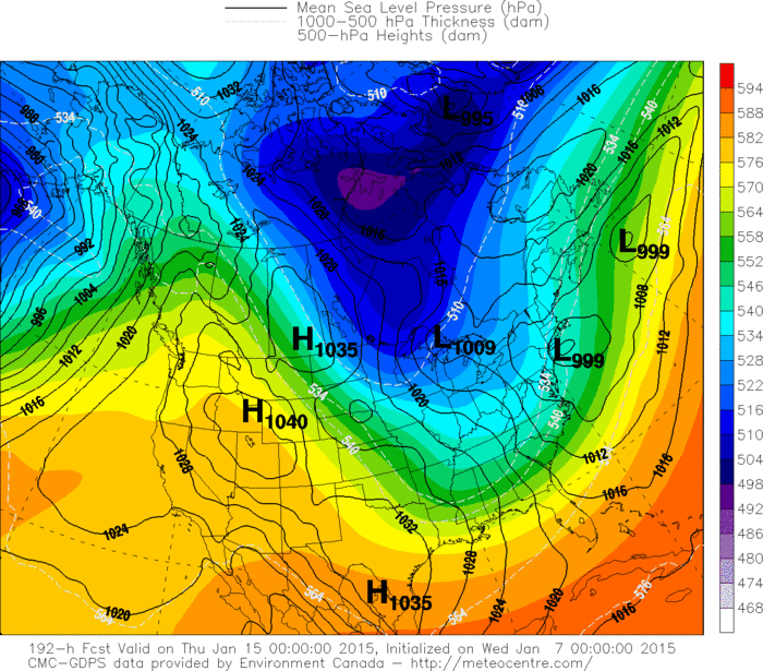
Canadian model above still trying to churn up a storm for Northeast next Wednesday.
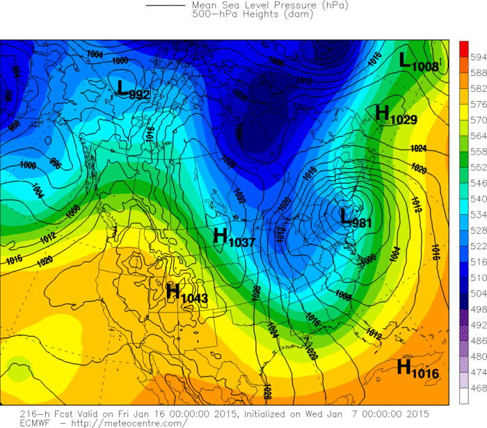
Euro models wants to hit the East with a big storm next
Thursday. This model is now the more intense and telling us it won't be all snow...but a wintry mix. We'll follow it.
Remember..venturing outside ...wear a hat and several layers of clothing. Be safe.
Thursday. This model is now the more intense and telling us it won't be all snow...but a wintry mix. We'll follow it.
Remember..venturing outside ...wear a hat and several layers of clothing. Be safe.

 RSS Feed
