Metro Weather Inc. Services
Like us, follow us, link to us, contact us!
  • Home
    • Daily Weather Discussion
  • Weather Prepared for You
    • Film and TV Production
    • Radio & Television
    • Government and Industry
    • Forensic Services >
      • Weather Record Request Form
    • Metro Morning Monitor
  • About Metro Weather
    • Senior Staff
  • Your Weather Images
  • Contact Us

Getting wetter from west to east..............

5/13/2014

0 Comments

 
Picture
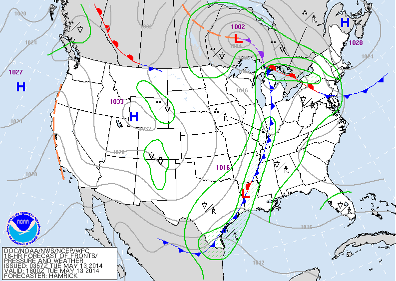
Cold front over Great Lakes will not reach the East Coast until Saturday. As it creeps east...wetness will slowly increase coming to a head Friday/Saturday for East Coast with 1-3" of rainfall.  Below..satellite picture shows moisture moving from south to north with cold front over mid section of the Nation.
Picture
Below...map showing amounts of rain from Friday into Saturday...with an average of 1-2"...locally more than that over the Appalachians. 
Picture
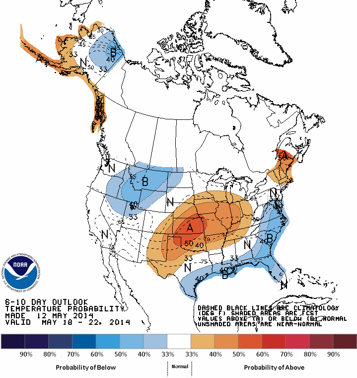
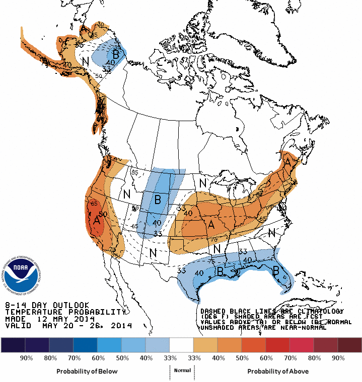
Above...map shows how temperatures will average by day thru May 22nd. Orange = warm .....blue = colder.   Below - map shows how daytime temperatures will average from May 22 to May 26....which includes Memorial Day Weekend. Good luck !
Picture
0 Comments


Leave a Reply.

    Genesis of a Tornado
    We'll have daily weather discussions, talking about major systems on the horizon along with anything noteworthy that pops up on our radar.

    Pat Pagano,
    Mike Merin

    Follow us on Twitter and like us on Facebook to get updates whenever we post a new entry!

    RSS Feed

Powered by Create your own unique website with customizable templates.