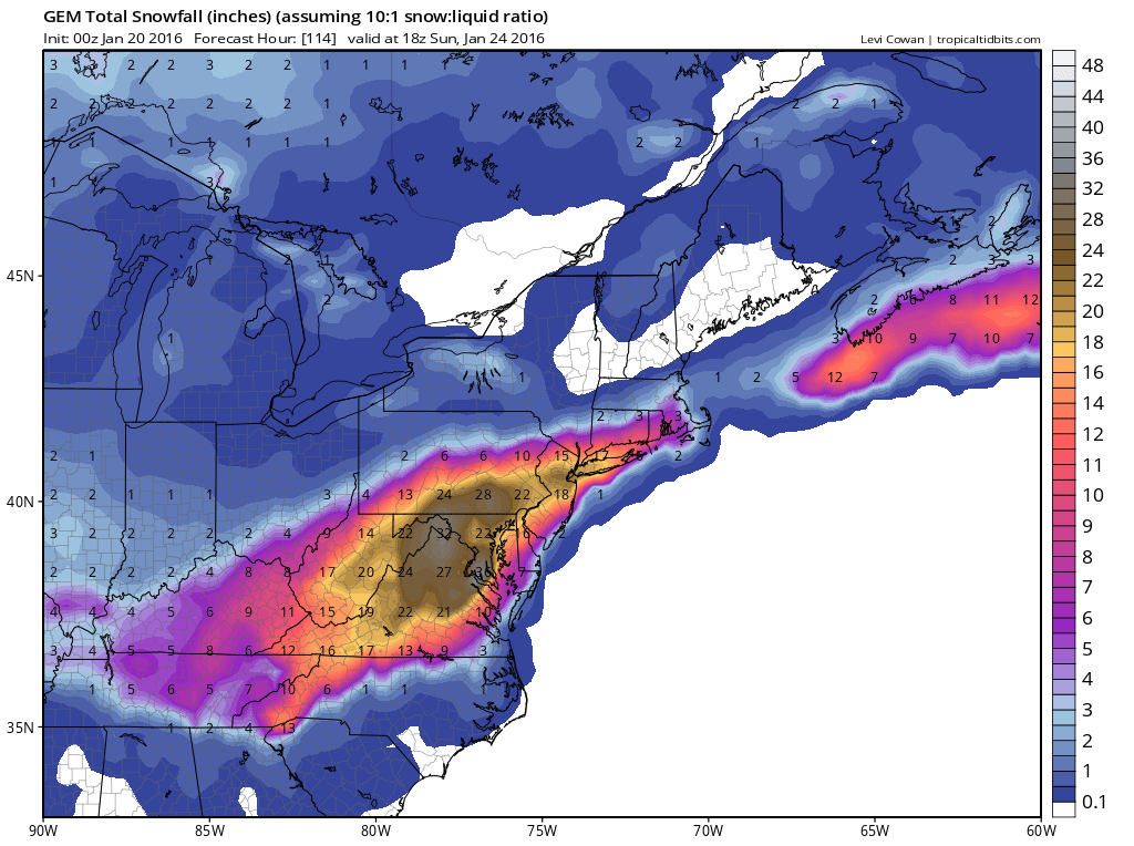
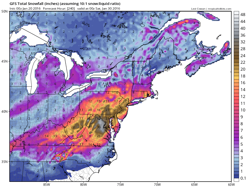
Below are the total snowfall predictions by The Canadian Model then the GFS.

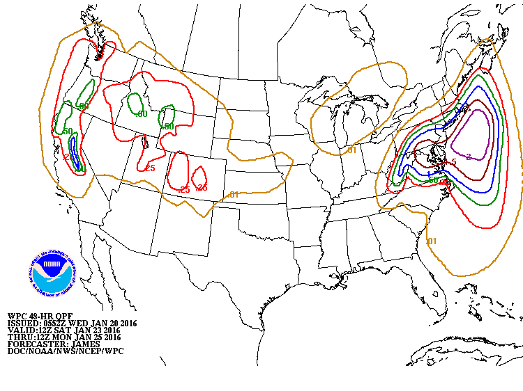
The energy that will be causing this storm is now moving across The Rockies. Now that models see it..there will be more data to base the forecast on...and it should only get better from here as far as forecast accuracy is concerned. Below in the amounts of
precipitation expected with this storm. On the average...10" of snow to every inch of rain......so begin calculating for your region.....unless you accept the computer model forecasts above.
precipitation expected with this storm. On the average...10" of snow to every inch of rain......so begin calculating for your region.....unless you accept the computer model forecasts above.
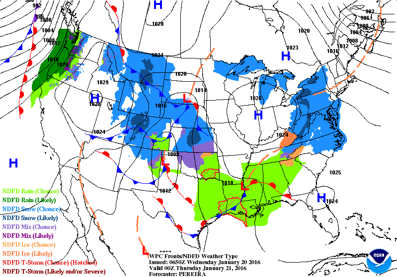
Map for this evening shows the storm moving through the Plains. Cold air in place over the East.
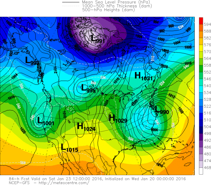
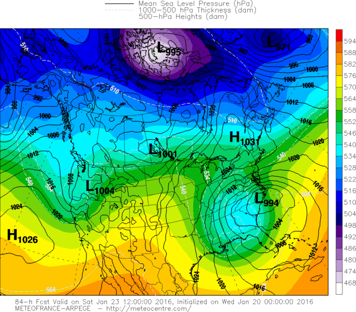
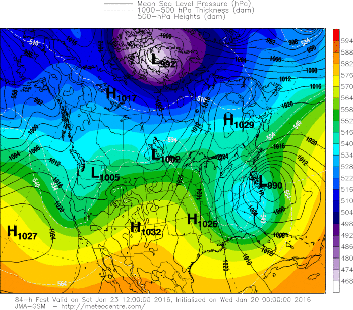
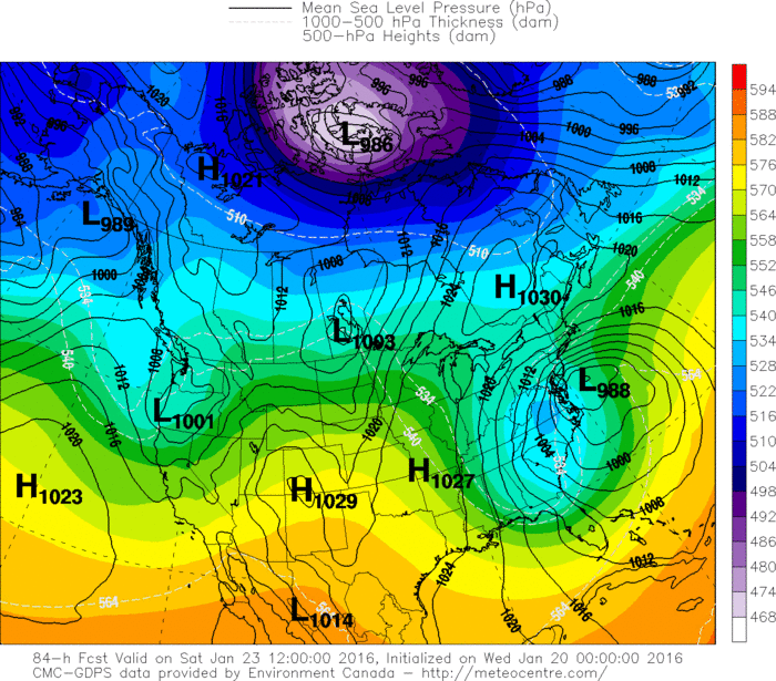
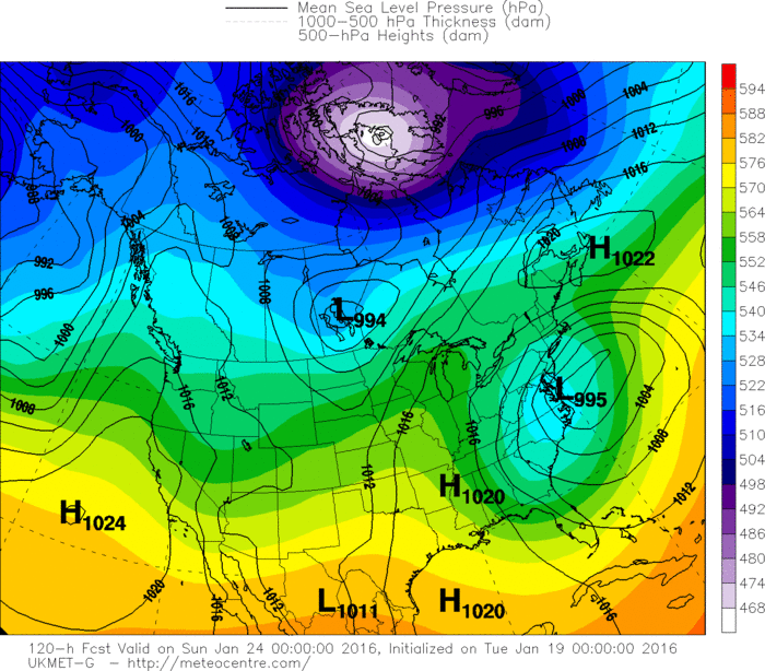
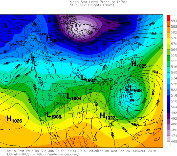
Below....the projection of most of our models for Saturday with focus on storm on East Coast. As you can see...most of them are in the same ballpark. Biggest problem is determining how far north the heavy snow travels into New England. Back in
1996 and 2010 - those storms managed to bring heavy snow
to Southern Half of New England. We shall see.
1996 and 2010 - those storms managed to bring heavy snow
to Southern Half of New England. We shall see.
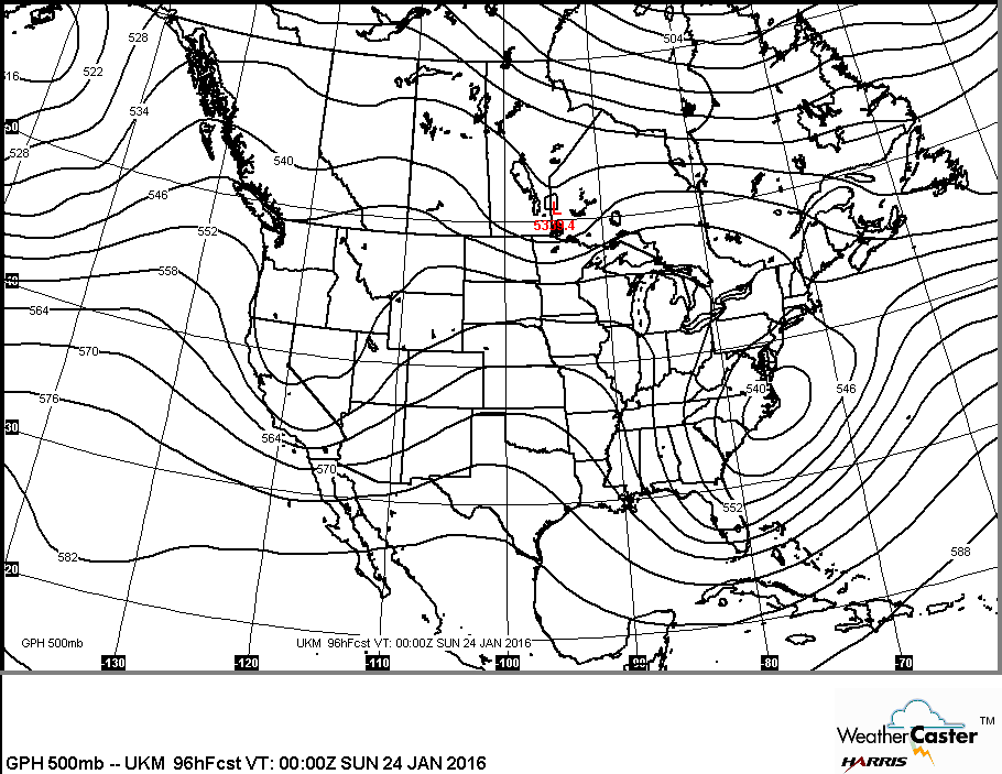
Below....using the UKMET to show what the average upper air (500 Mb) pattern will look like this weekend.
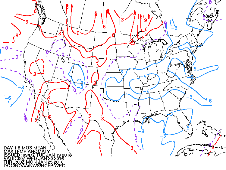
Lastly....how will daytime temperatures average through Jan. 25th ? More on this coming storm through the day. Be safe.

 RSS Feed
