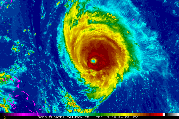
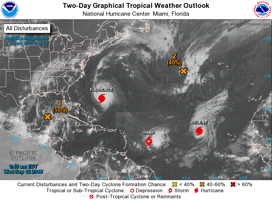
Very Dangerous Florence is already sending feeder bands of rain toward the Carolinas. 140 mph winds could increase today. Storm will slow or stall upon approaching the coasts of the Carolinas. Models still target No. Carolina..but Euro Model wants to bring it south along the coast and then move it inland near Savannah, Ga. May not be wrong. No matter what..life threatening storm surge..flooding and winds will hit the coasts from N.C.
to Georgia. No one along these coasts should try to ride this one out..if so..they should put their telephone numbers on the soles of their shoes.
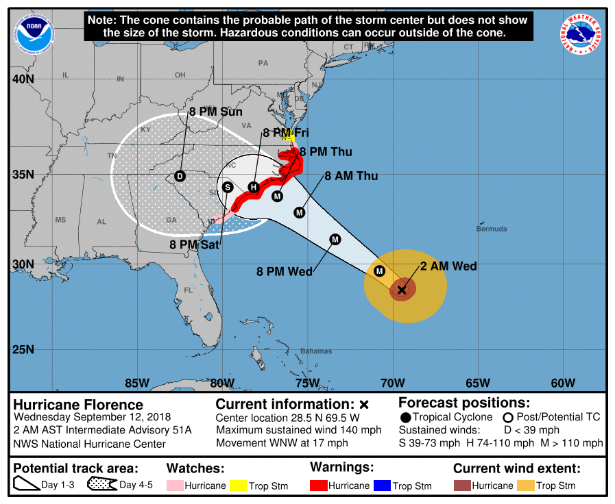
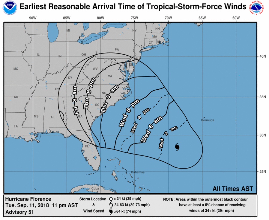
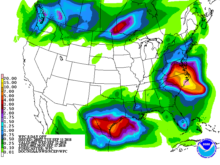
Below- latest track of Florence & expected wind time table...and rainfall.
to Georgia. No one along these coasts should try to ride this one out..if so..they should put their telephone numbers on the soles of their shoes.
Below- latest track of Florence & expected wind time table...and rainfall.
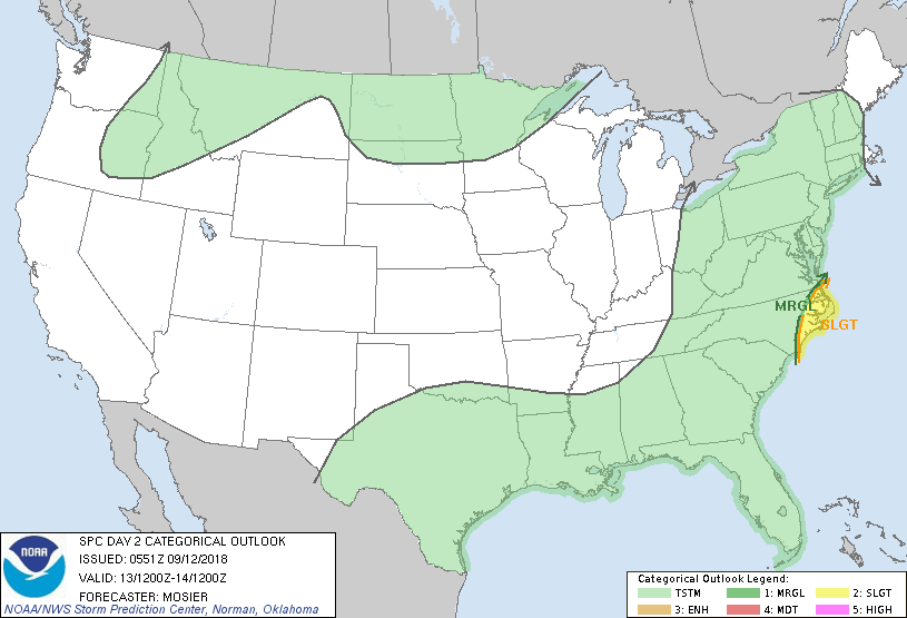
Below-= today's risk of severe weather in dark green and yellow...followed by animated maps.
Lastly - a look at the Atlantic basic. System in Gulf will likely become Joyce and head to Texas this weekend. Issac may eventually join up with Florence before moving out of the picture. Be safe.

 RSS Feed
