
Satellite shows the 2 jet streams...if they were to merge..big storms...but right now..not in the future. Looks like a wave train of moisture will head out of Rockies and sweep to the East Coast right into next week. The rain/snow line which
has been running from Chicago to NYC will likely remain there....so not much change.
has been running from Chicago to NYC will likely remain there....so not much change.
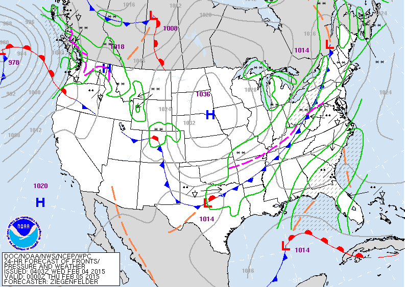
Map is for this evening. Cold front over East will bring
some light snow to Northeast.....and you can see the lows
along that front up back thru The Rockies. Low in Gulf will bring wet weather to Florida and Carolinas. Arctic cold in Plains will head east and really chill the Northeast and Mid Atlantic by Friday a.m.
some light snow to Northeast.....and you can see the lows
along that front up back thru The Rockies. Low in Gulf will bring wet weather to Florida and Carolinas. Arctic cold in Plains will head east and really chill the Northeast and Mid Atlantic by Friday a.m.
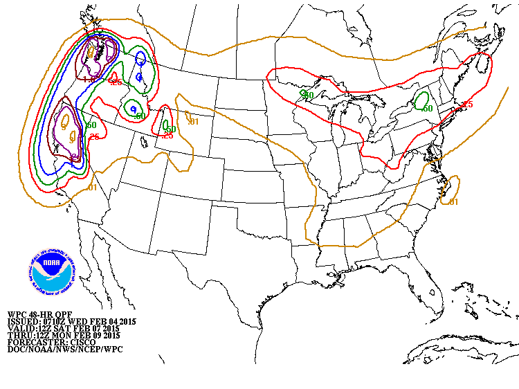
Map above shows amounts of precipitation for this weekend. Notice the heavy rains from Central Ca. up the coast. San Fran needs rain....so that's a good thing. Heavy snow for Sierra Nevada and Cascades. Lighter snows from upper Midwest to Northeast. Be safe.

 RSS Feed
