
Satellite above...shows arcing cold front from Gt. Lakes to
Gulf States. That front producing showers and t-storms in
East today. Blue showing up from California to Colorado will be next system to bring wet weather quickly from west to east late this week.
Gulf States. That front producing showers and t-storms in
East today. Blue showing up from California to Colorado will be next system to bring wet weather quickly from west to east late this week.
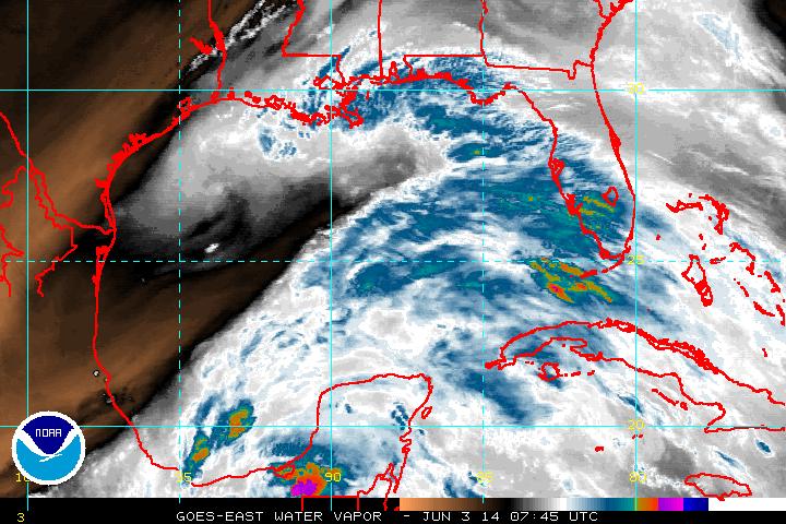
Above - satellite of Gulf of Mexico. Lots of moisture from Yucatan to Florida. Even though hurricane center does not highlight this area....something could form here and bring
heavy rains to Florida....so we will keep watching.
heavy rains to Florida....so we will keep watching.
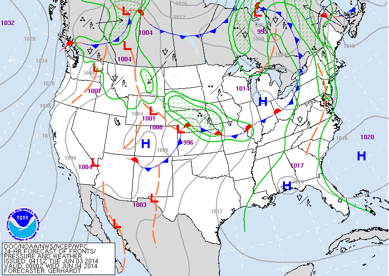
Above..today's map showing cold font moving into Northeast. Keep your eyes on LOW in Plains....that will be a mjor weather producer as it comes east.
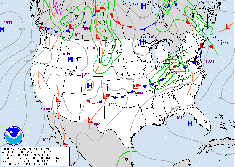
Above...map for late Wednesday. Notice the low in Ohio.
It will bring a heavy swath of rain with it..and will head for Mid Atlantic and Northeast Thursday.
It will bring a heavy swath of rain with it..and will head for Mid Atlantic and Northeast Thursday.
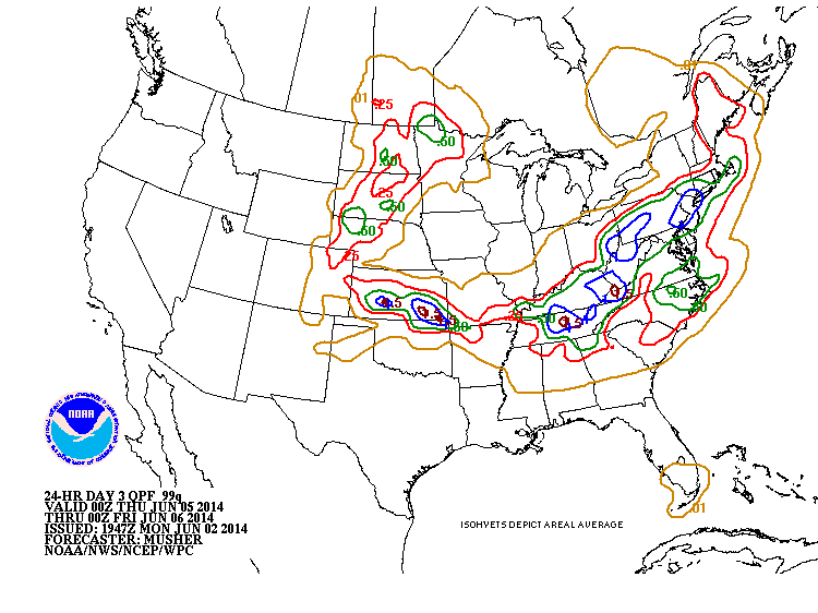
Above...amounts of rain generated by low moving out of The Plains.
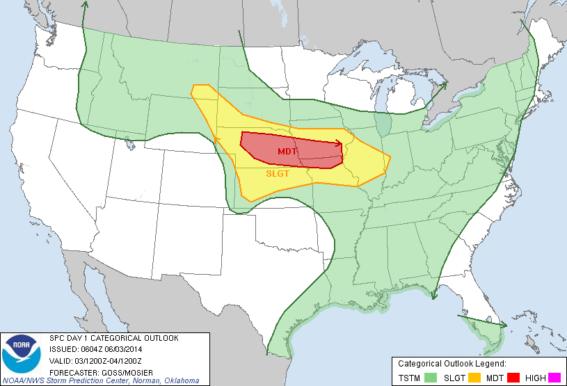
Today's threat of severe weather in yellow...red indicates a moderate chance...where tornadoes are possible. Be safe everyone.

 RSS Feed
