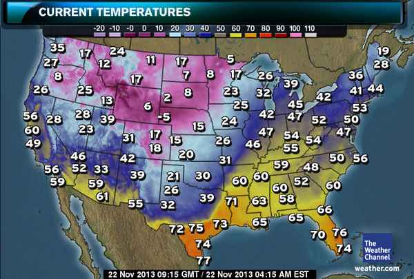
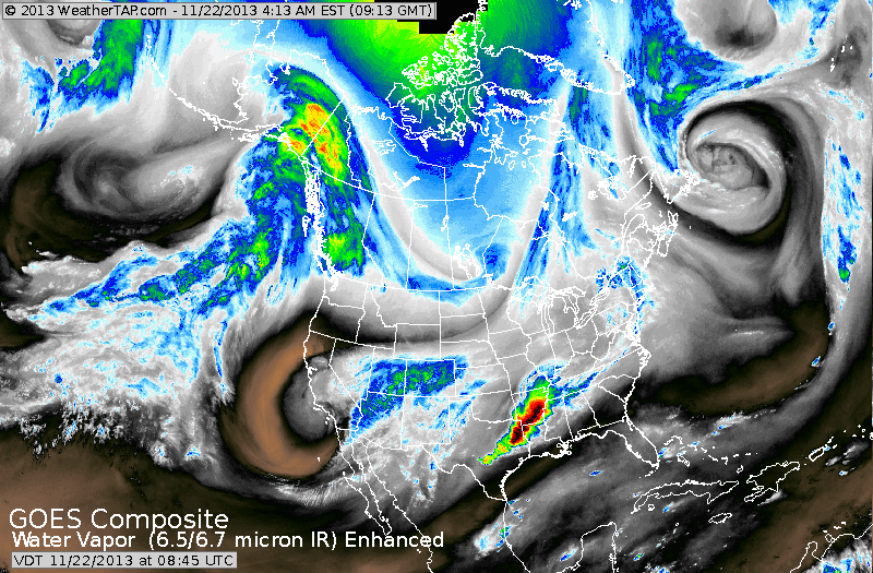
Arctic air is moving south and east from The Northern Plains..map just below shows early morning temperatures. Below that...water vapor satellite clearly depicts cold front and cold air in center of our Nation.
So...summarizing this weekend....progressively colder in The East...winds could gust over 50 mph Sunday in NE Qtr of the Nation.
Lake effect snow could easily be well over 6" in Western NY & PA.
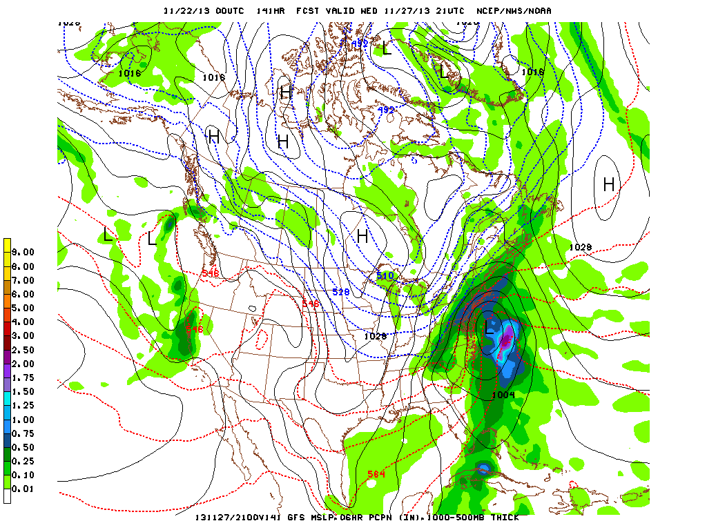
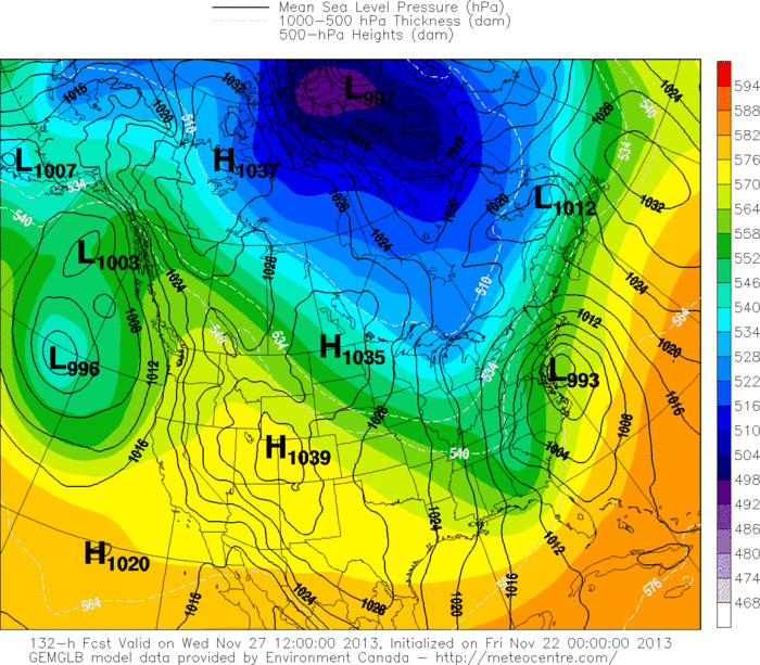
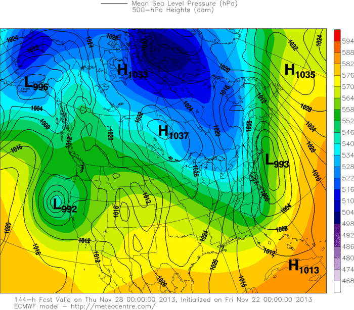
Below..you will find the 3 models: GFS...CANADIAN..EUROPEAN.All
models in agreement for east coast storm on Wednesday with wind and rain...wet snow inland ....certainly to disrupt the busiest travel day. More on this thru the weekend and next week. Later.
Lake effect snow could easily be well over 6" in Western NY & PA.
Below..you will find the 3 models: GFS...CANADIAN..EUROPEAN.All
models in agreement for east coast storm on Wednesday with wind and rain...wet snow inland ....certainly to disrupt the busiest travel day. More on this thru the weekend and next week. Later.

 RSS Feed
