
Trailing frontalong east coast could bring some pesty rain to Northeast next few...while heavier rains possible over Mid Atlantic. Spiral moisture over Bahamas should be watched. Lines of blue over Southern Canada is an arctic cold front that will plunge south and bring some snow to Rockies. Chilly air for East by weekend.
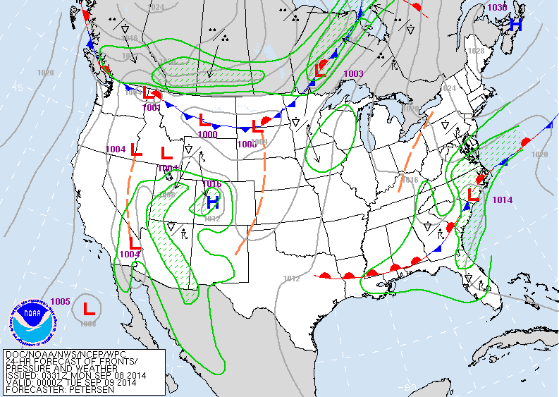
Today's weather map shows front on East coast....arctic cold front dropping out of Canada. While front on east coast will bring heavy rain to Mid Atlantic...that arctic cold front will be the big weather maker this week.
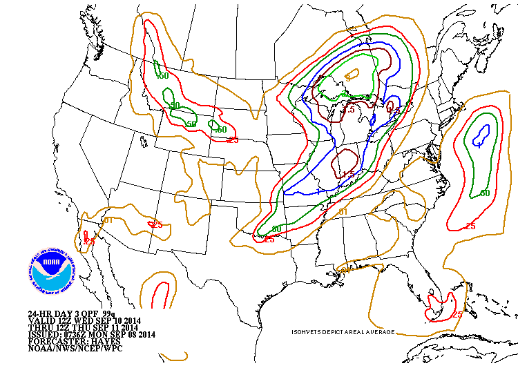
Rainfall expected Wednesday ....all associated with Arctic cold front. The strip of moisture in The Rockies could be snow.

Satellite shows you what is left of Norbert off Baja California. Lots of dry air in The Pacific (orange) destroying the storm's structure.
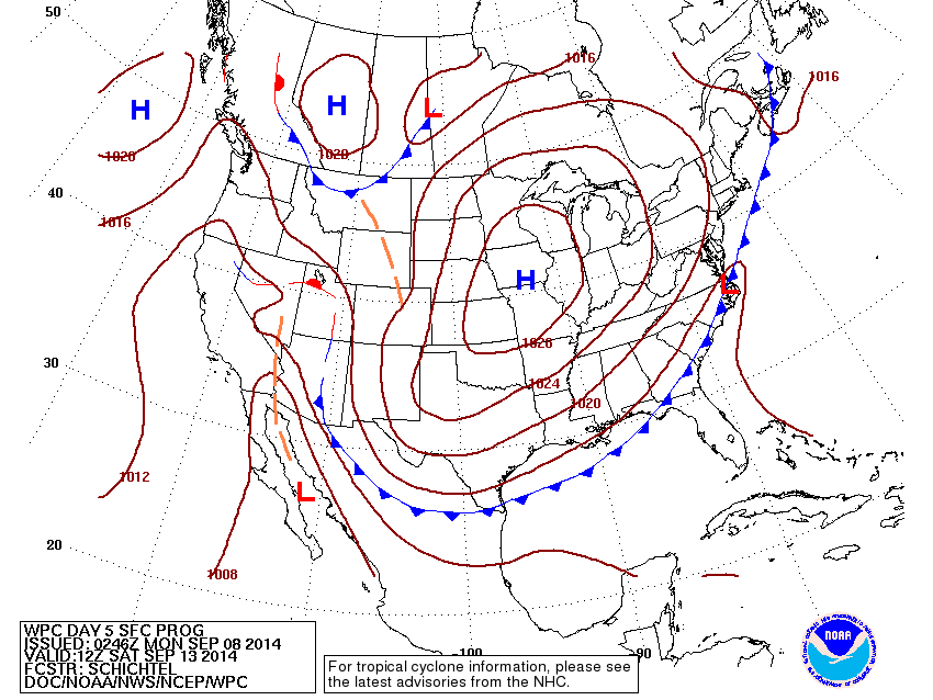
Map above is for Saturday coming. High pressure sprawled out over the center of The Nation....cold to chilly from Rockies to East coast.....except Florida. Be safe.

 RSS Feed
