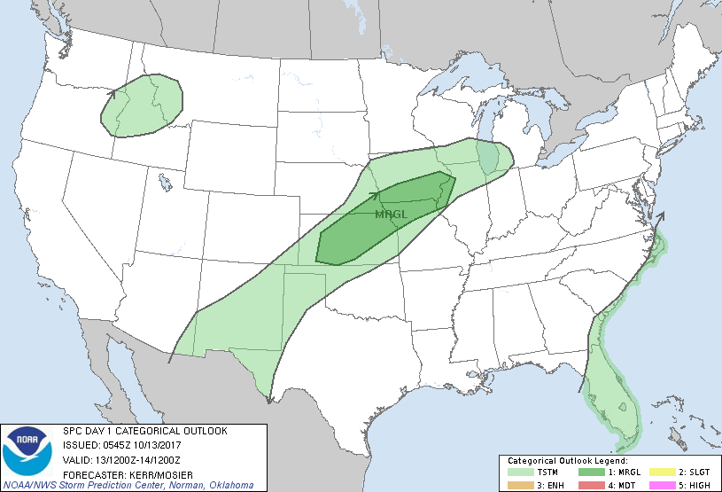
Satellite - radar shows a cold front over the Upper Midwest headed east. It will arrive along the East Coast by Monday. Prior to that - warmer weather for East. Below...today's risk of severe weather in dark green.
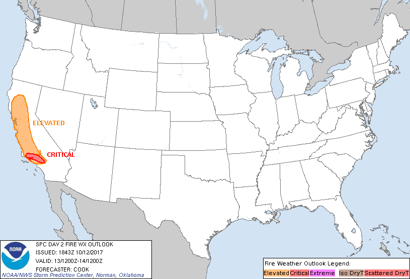
Below- fire danger risk for Saturday.....red shows stronger chances.
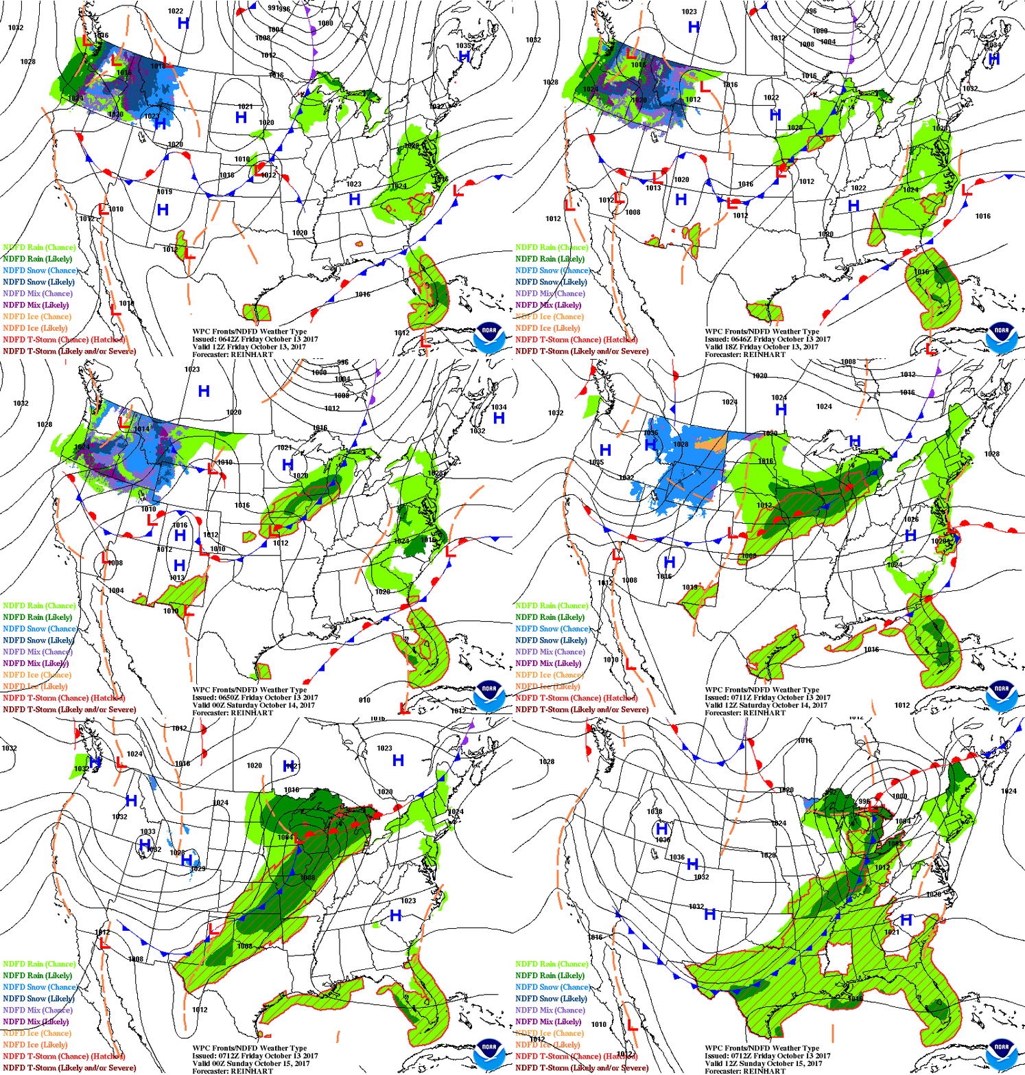
Next - animated maps for the next couple of days.
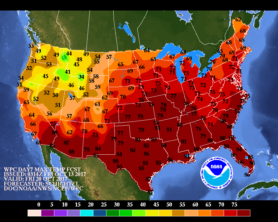
Below- expected temperatures for next Friday.....clearly showing above normal for much of the Nation.
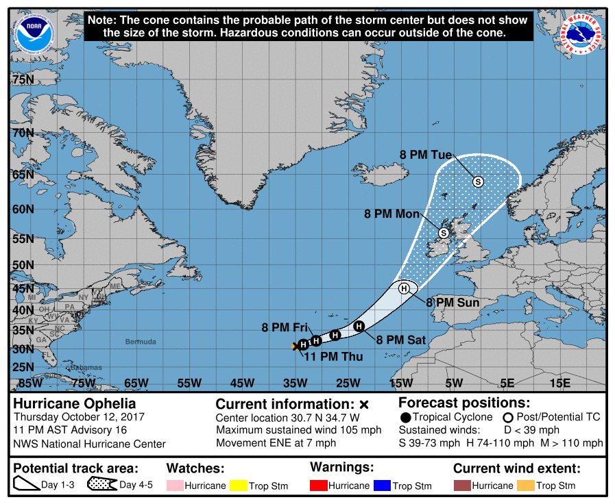
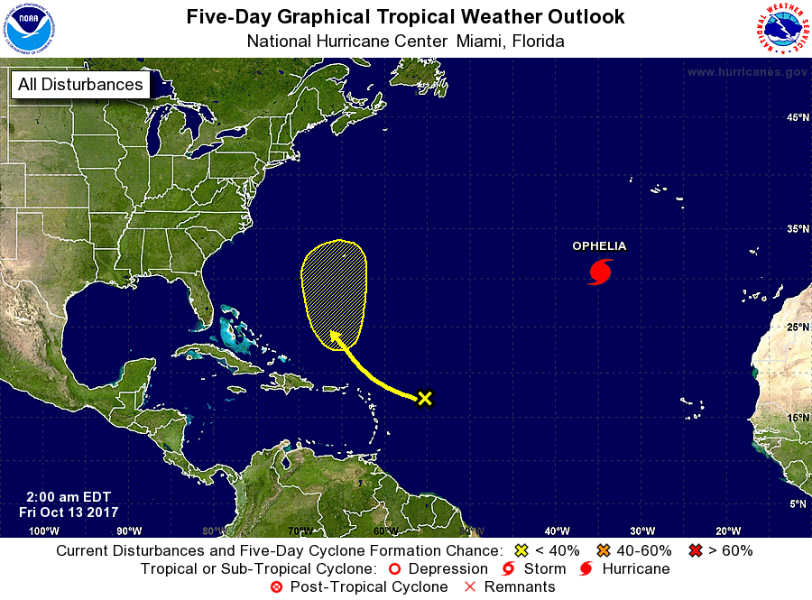
Next - track of Ophelia - which will head for Ireland.....new disturbance in Atlantic should stay in the Ocean.
Have a nice - safe weekend.


 RSS Feed
