Unseasonably cool air over The No. Plains....eastward to So. Quebec.
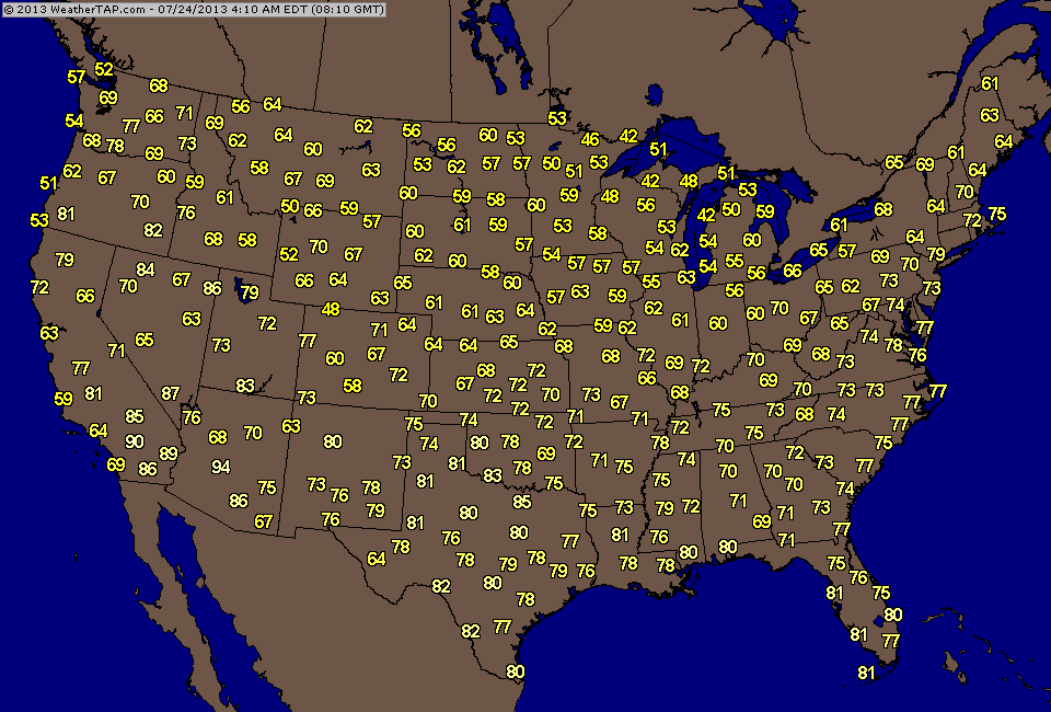
Cold front moves offshore today....models want to stall it and bring back showers late week for Mid At. & Northeast. Not ready to buy that. Showers will graze N.England coast....elsewhere clouds will be present...but tend to think more dry than wet. Here's this a.m. temps.
Cold front moves offshore today....models want to stall it and bring back showers late week for Mid At. & Northeast. Not ready to buy that. Showers will graze N.England coast....elsewhere clouds will be present...but tend to think more dry than wet. Here's this a.m. temps.
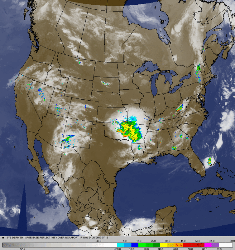
Our satellite shows dry for much of the Nation...except deep south.
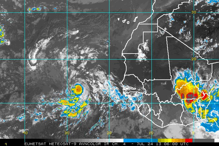
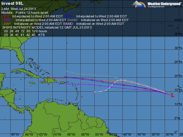
Looks like Dorian may be born before the day is out. The 4th tropical depression is off Cape Verde Africa....35 mph and moving west. As I pointed out yesterday...system has no way to go but west and will head for the SE U.S. next week. Below...Satellite pix...track.
A look at the 500 Mb flow for next Friday....indicating more cooler weather for the North. Later.


 RSS Feed
