
Satellite shows fair skies over much of the Nation. Showers in Rockies
will head east to affect The East Coast by Friday/Saturday.
will head east to affect The East Coast by Friday/Saturday.
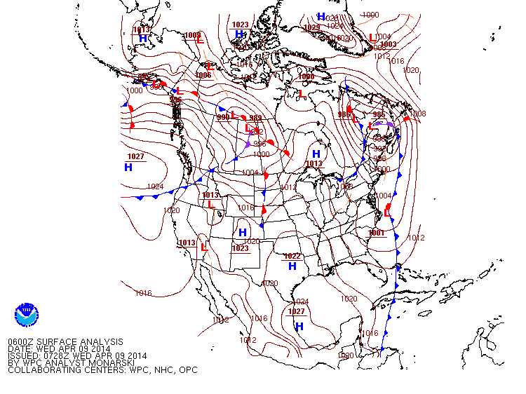
Above...current map for North America. Storms stay in Canada and drag fronts across The U.S. This is much more typical of April and spring.
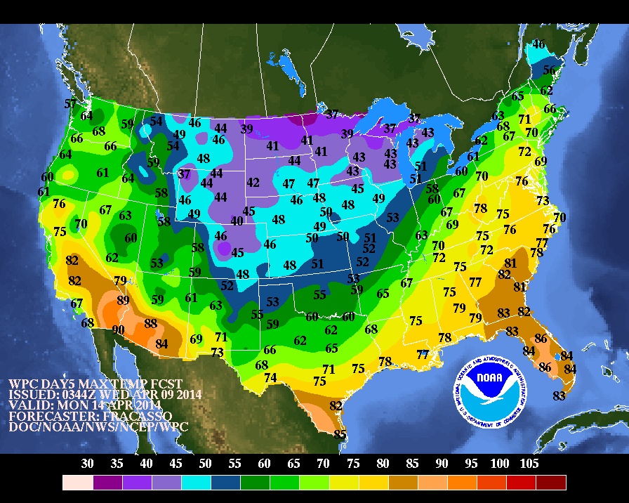
Above...high temperatures expected this Monday as we move into Holy Week. Warming for The East Coast....chilling down over the mid section
of The Nation...and warm out west.
of The Nation...and warm out west.
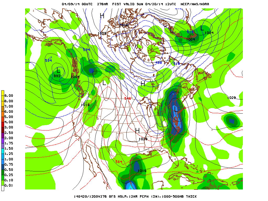
Above...click on image to enlarge. This is the GFS model for Easter Sunday morning. Showers in Pacific Northwest...Fair Plains..Grey and wet for South Texas....and then you have The East Coast. Model shows a storm near NYC...with torrential rains from New England to The Carolinas. Only thing we can hope for there is that the model is slow and the storm pulls out Saturday nite. Even if that happens - Easter Sunday in the East could be blustery and cool. We'll see...it's over 1 week away. Go slow..be safe- later. This Friday - I will post my Spring
forecast for Northeast and Mid Atlantic.
forecast for Northeast and Mid Atlantic.

 RSS Feed
