
Above: Satellite shows conveyor belt of moisture from N.Carolina to New York State. This band will head east and bring 1"-3" of rain to Mid Atl. and Northeast thru tnte. Notice moisture swirl near Chicago. This upper system could still result in a shower or two from Great Lakes into Northeast this weekend....but scattered.
Cooler weather for East...Warm West.
Cooler weather for East...Warm West.
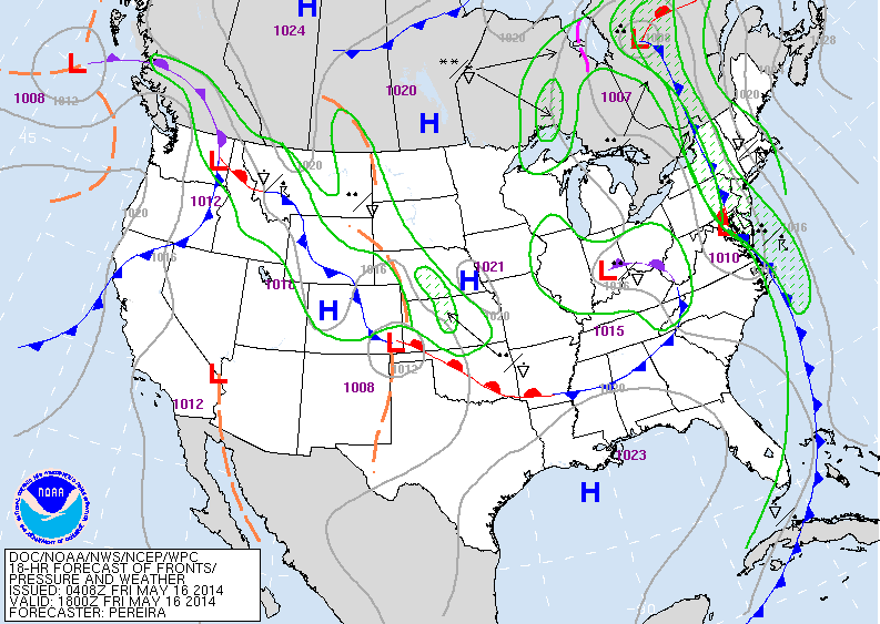
Above...today's map showing the wet front in The East. @nd low in Ohio Valley will be nothing but pesty. The heat out west will temper....cooler air from Great Lakes into the Northeast.
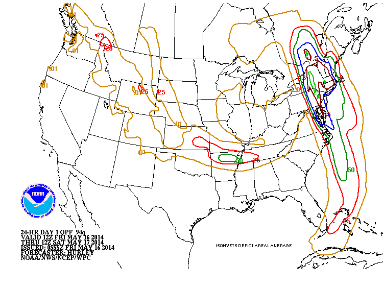
Above....amounts of rain today thru Saturday morning. Heaviest...Northeast...and lower Mississippi Valley. Weather looks to be unsettled next week as we head into Memorial Day Weekend. Too early to call the shots on that. Meanwhile...have a nice safe weekend.

 RSS Feed
