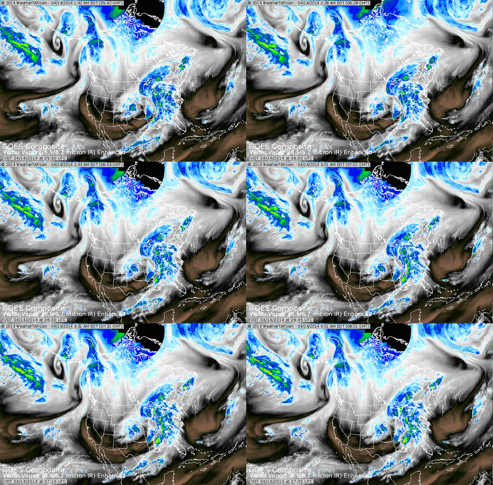
Massive system Great Lakes to Gulf will bring wind..wet weather to
Eastern third...which means viewing of lunar eclipse tonight...not likely. Western 2/3 - better chance. Notice the doughnut like shapes in
The Pacific: 3 of which near Gulf of Alaska and one east of Hawaii. Thoses systems will head east...so sooner or later it denotes many changes ahead from west to east.
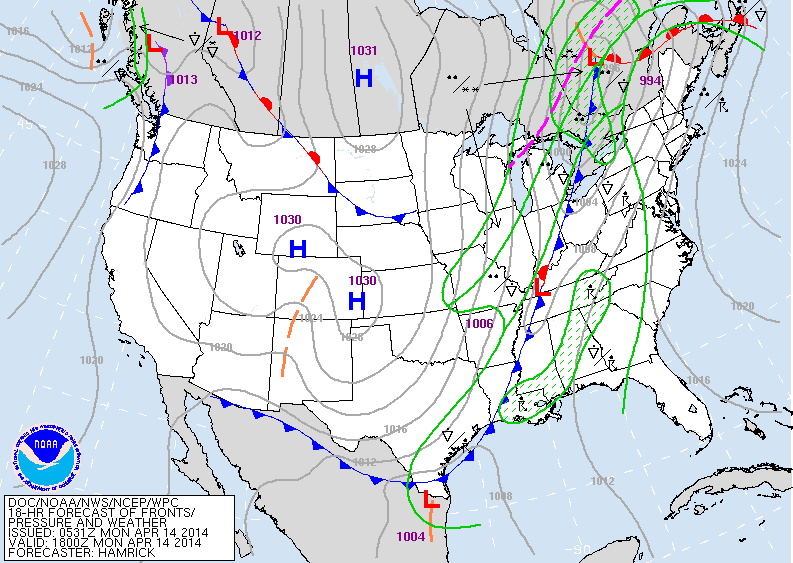
Above....today's map...showing front with wet weather from Great Lakes to Appalachians and down to Gulf. Fair dry chilly weather ofr
much of the western 2/3rd's.
much of the western 2/3rd's.
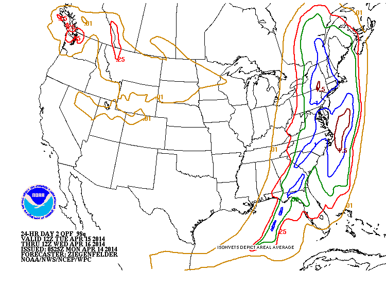
Amounts of rain predicted to fall from Monday night thru Tuesday.
Blue = 1"...brown 1 1/2".
Blue = 1"...brown 1 1/2".
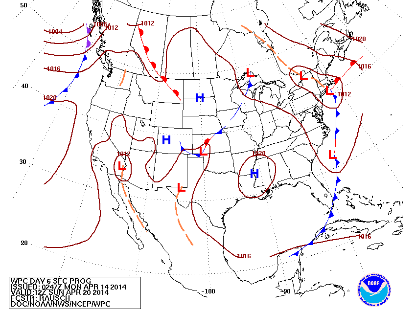
Map for Easter Sunday a.m. Much of The Nation...fair. System in Northeast will likely be a bit faster...so Northern New England may start with clouds and wetness but they should clear. South Fla. may have some early showers and then they clear. So....fair weather should dominate.
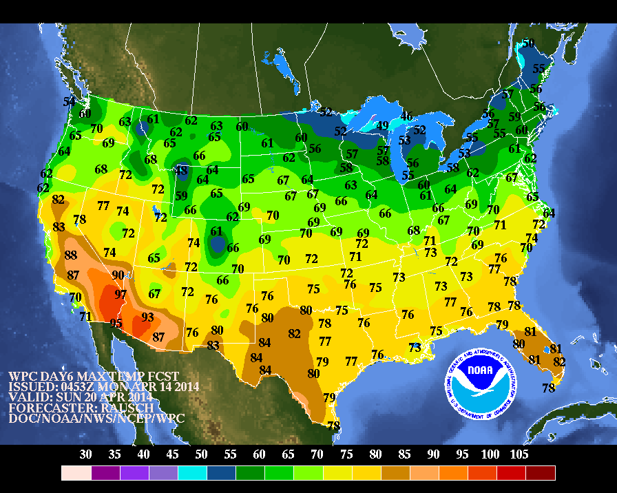
Above...high temperatures expected for Easter Sunday. I think temps. in The Northeast will be a bit warmer as more in the way of sun can be expected and less cloud cover. Stay safe.

 RSS Feed
