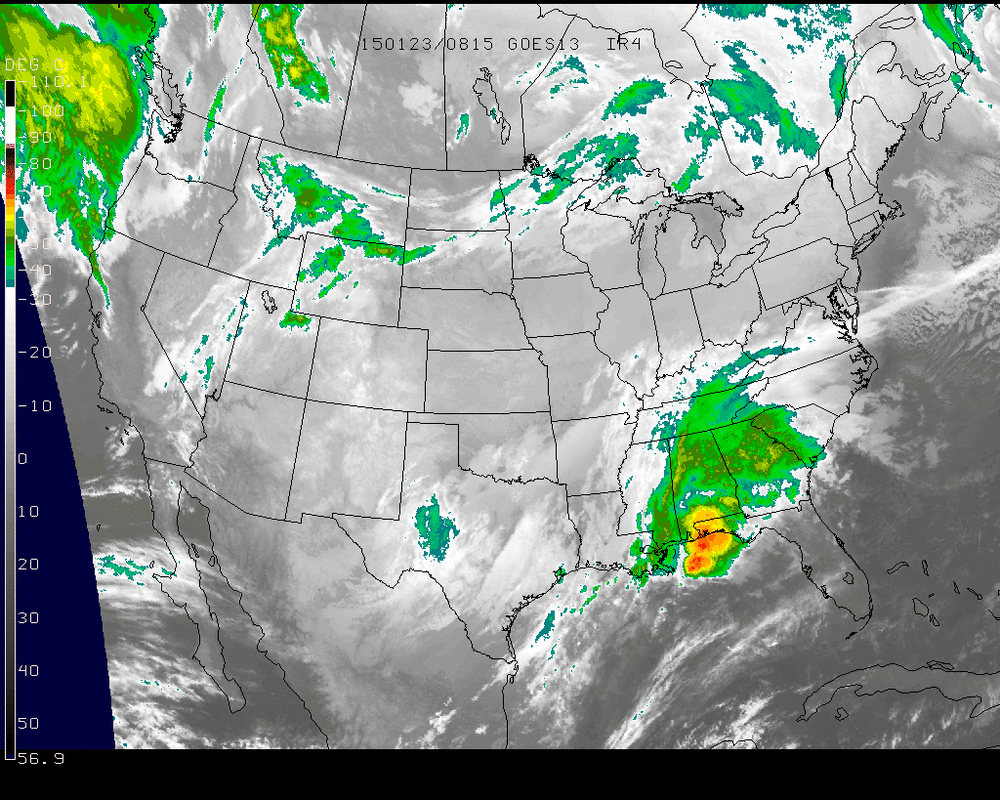
Satellite shows storm in Gulf headed northeast and will bring an assortment of precip to Mid Atlantic and Northeast late tonight and Saturday.
This early a.m. map shows storm in Gulf....colors represent
precipitation.
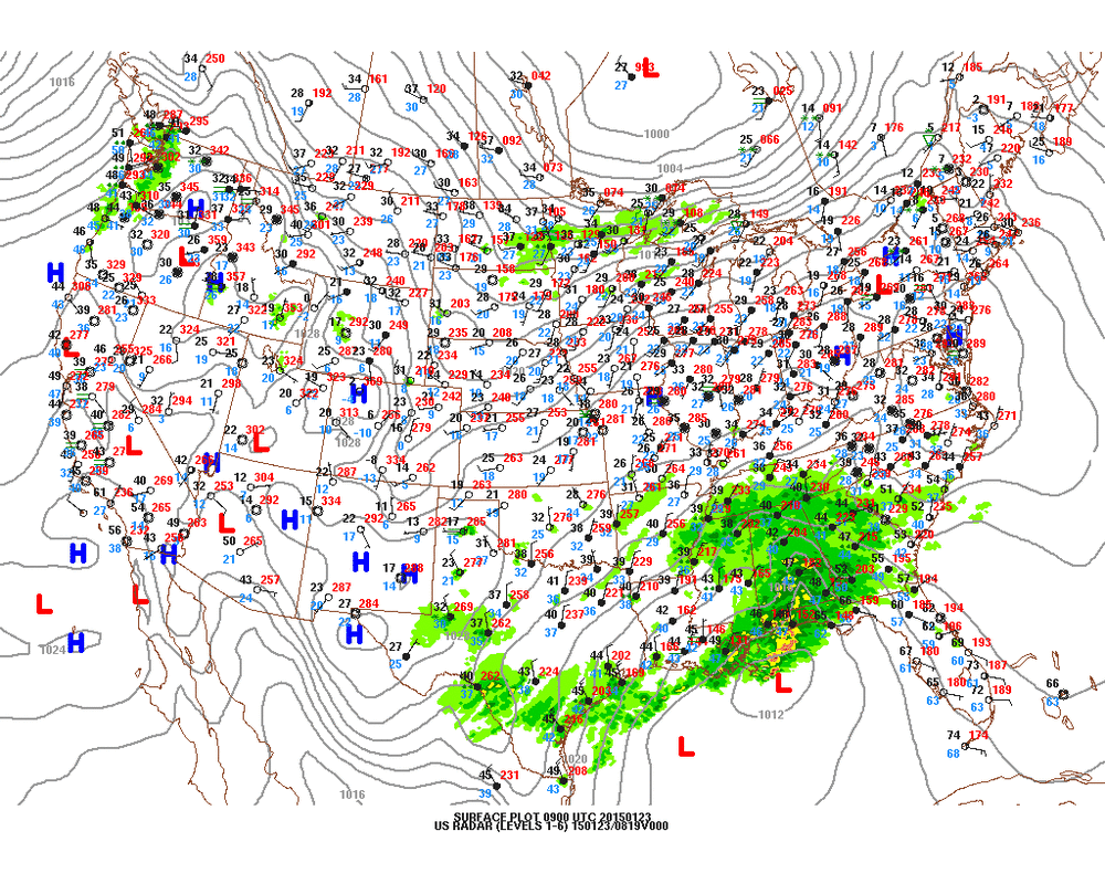
precipitation.
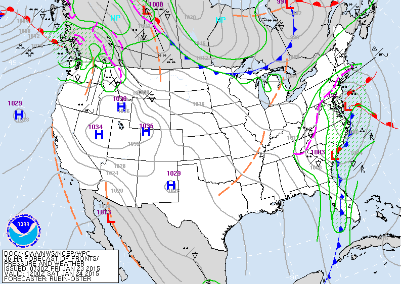
Map above is valid for Saturday afternoon. Coastal storm is off Delmarva....northwest corner of storm is snow and sleet...and interior sections of Conn...NYS could see 3-5".
Closer to coast....snow and sleet goes to rain and ends as snow....when all is said and done...only a few inches.
Closer to coast....snow and sleet goes to rain and ends as snow....when all is said and done...only a few inches.
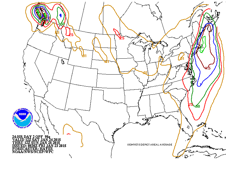
Above....map showing amounts of precip with storm on East coast and in the far northwest.
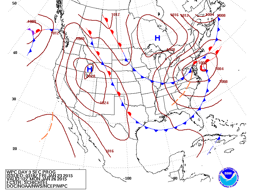
Above...map for Monday morning. Once again...action on Mid At. coast. Placement of this low is critical as to who gets heavy snow. Our belief that modeling today is too far south and heavy snow is a real threat from Phily to NYC to Boston. More on this over weekend. Be safe. Have a nice one.

 RSS Feed
