
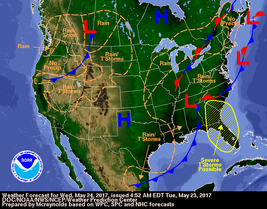
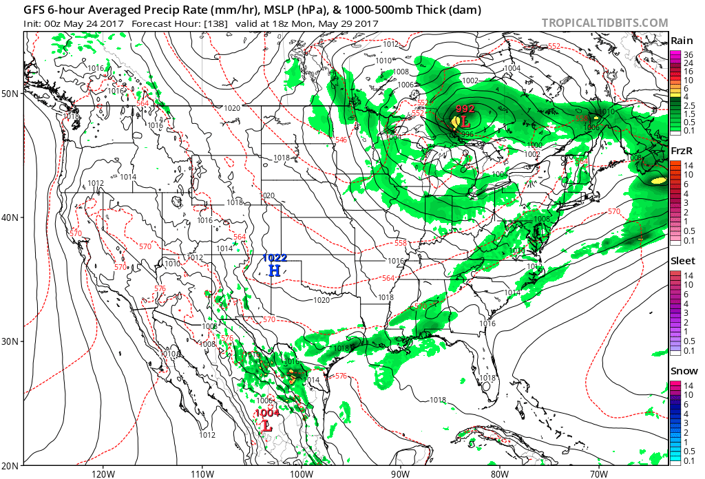
If you look at Iowa-Missouri you can see a circulation. That system will continue to keep the eastern half of the Nation unsettled right through holiday weekend. Below - today's weather map.
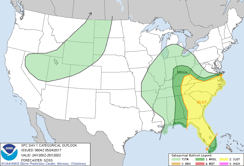
Below - toay's threat of severe weather - covers most of the southeast...dark green and yellow.
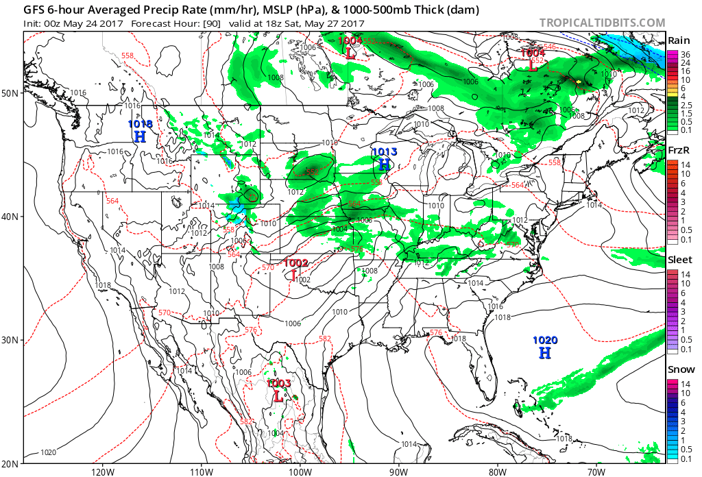
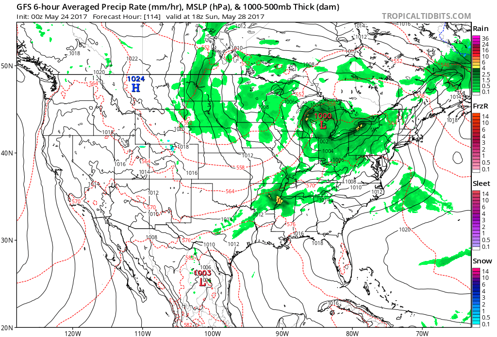
Below - The GFS Model for each afternoon through the holiday weekend. To find out the weather in your area...just look for your location...if it has green shading...you have a chance of wet weather....otherwise you should be fine.
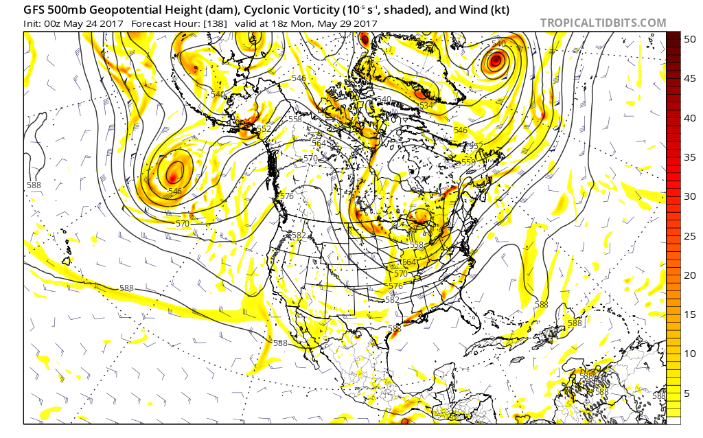
Below - an upper air map showing a trof over the east....and that allows the jet stream to drop south keeping things under the trof...cooler and unsettled. Not signs of that breaking for rest of this month. Be safe.

 RSS Feed
