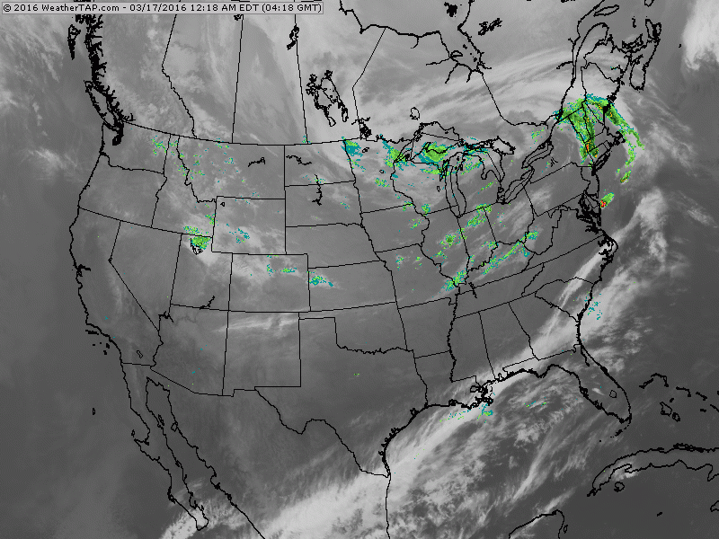
Another front moving out of Great Lakes will touch off some showers for St. Patty's Day into the Northeast. New England may even have a thunderstorm.
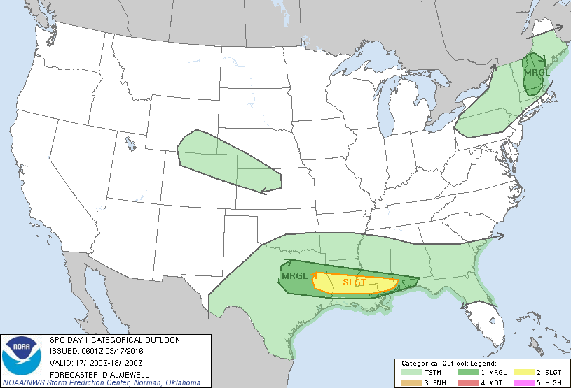
Threat of severe weather today in dark green and yellow.
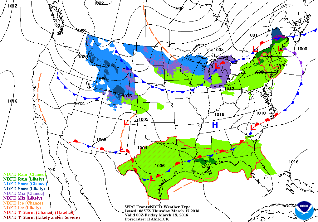
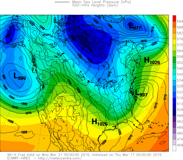
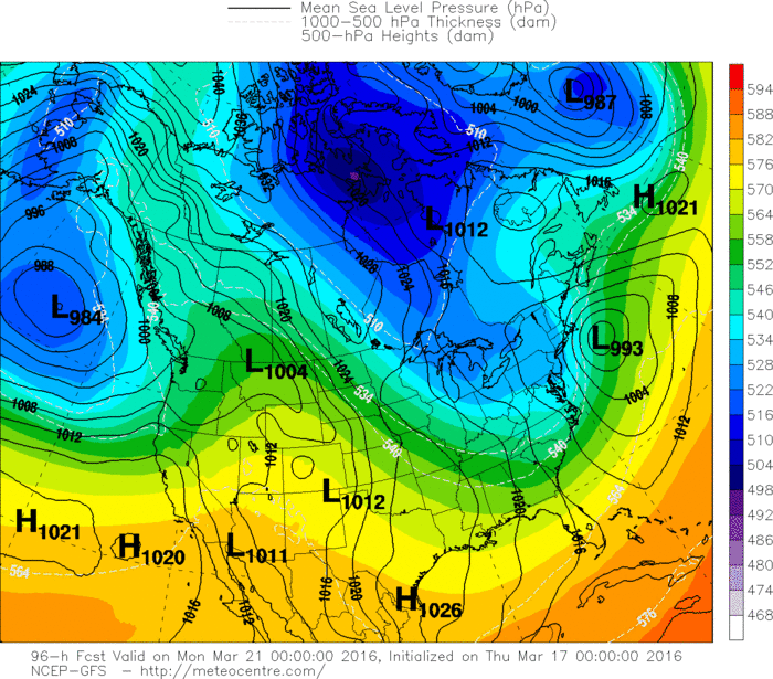
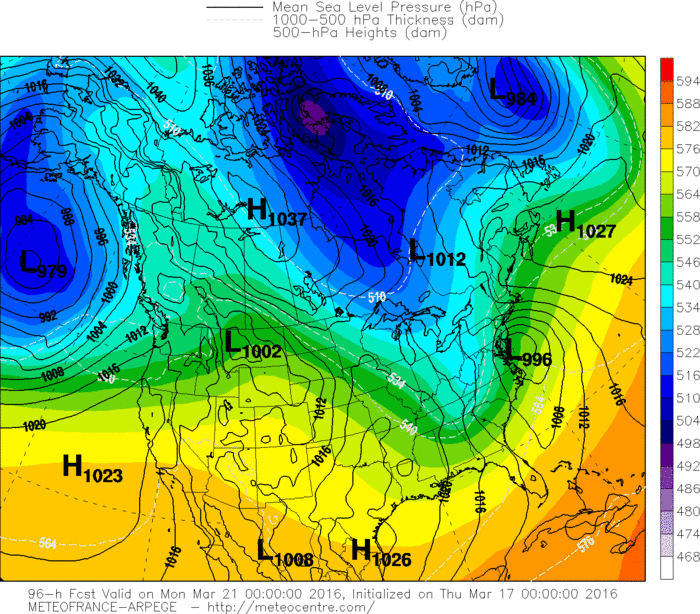
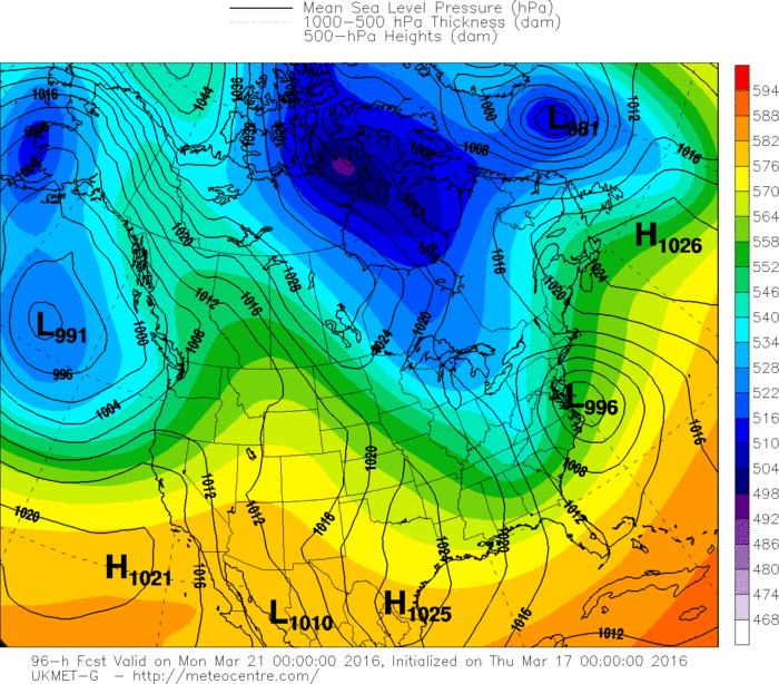
Today's map shows unsettled weather all across the Northern-tier of the U.S....and in the south. That wavy front in the south will produce a storm this weekend....which should get taken up along the east coast Sunday - into Monday. Heavy wet snow is possible from the Northern Appalachians into New England. Many places may see a few inches of wet snow....with the heaviest across New England...depending on how the storm tracks. This is March and anything can happen....so hopefully we will have this fine tuned tomorrow. Below...the various models and how they are predicting this storm for Sunday in the East. Be safe and Happy St. Patty's Day.

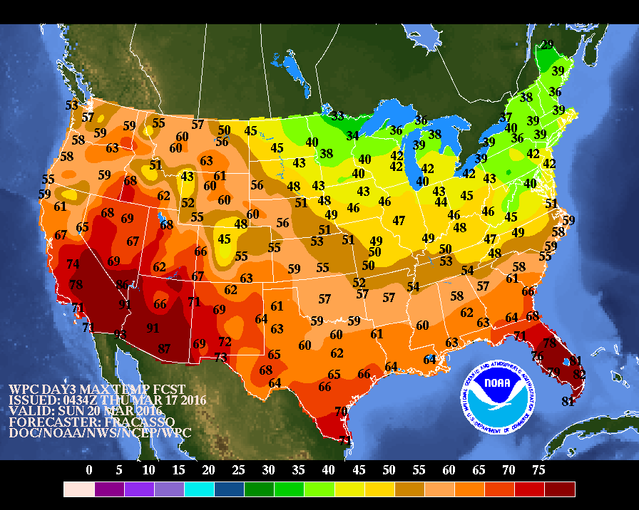
Here is a look of what temperatures will be like this Sunday...the first day of spring.

 RSS Feed
