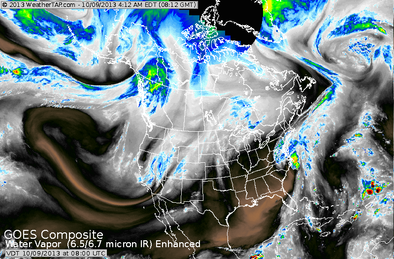
The satellite pictures above show lots of dry air over the nation...(black and brown).......but notice the comma shaped pattern along the East.
This low will play games with mid-Atlantic and New England for rest of week. The cut off line between rain and lots of rain and no rain will be sharp. Vermont/ New Hampshire/Maine may not see a drop...while
Boston and Hartford get drizzle...and Long Island down to Delaware
get flooded out.
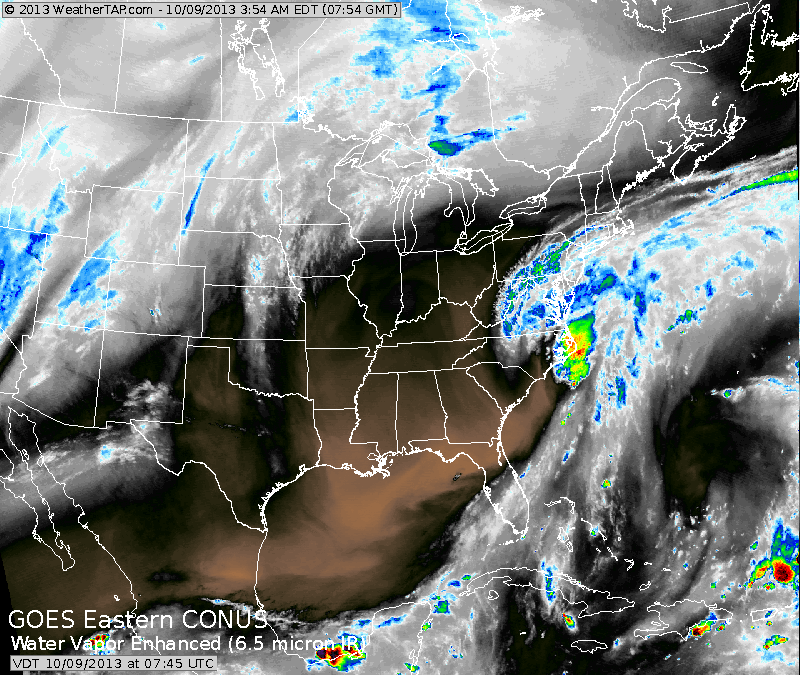
This low will play games with mid-Atlantic and New England for rest of week. The cut off line between rain and lots of rain and no rain will be sharp. Vermont/ New Hampshire/Maine may not see a drop...while
Boston and Hartford get drizzle...and Long Island down to Delaware
get flooded out.
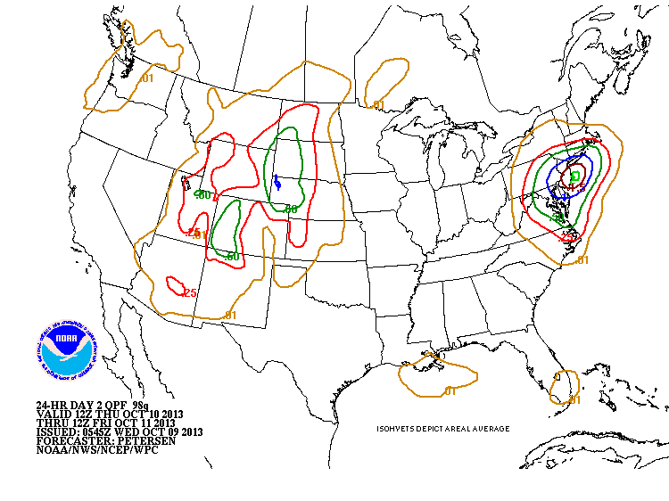
This chart shows total rainfall by Friday morning. 1-2" from southern New England to Mid Atlantic. Personally....think it's overdone in the
north...and expect the heaviest rain from NJ on south.
north...and expect the heaviest rain from NJ on south.
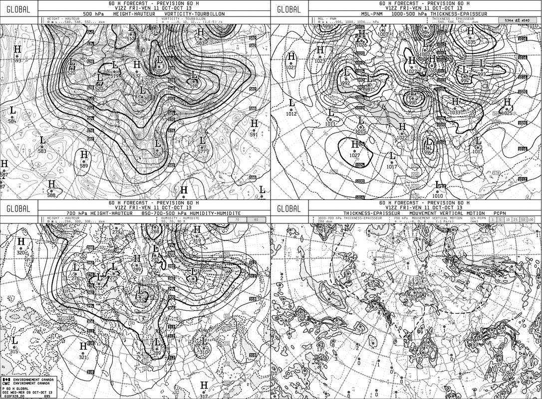
This 4 panel chart may be hard to see......but it's The Canadian....who
bombs the mid Atlantic and Southern New England with rain. It usually is overdone...but it has been insisting on this all week....so perhaps it could be right.....but I still have my doubts. More tomorrow. Later.
bombs the mid Atlantic and Southern New England with rain. It usually is overdone...but it has been insisting on this all week....so perhaps it could be right.....but I still have my doubts. More tomorrow. Later.

 RSS Feed
