
Above- satellite picture showing Laura to have intensified overnight...packing winds of 105 to 110 mph winds and should be even stronger as the day wears on. This is a very dangerous storm for NW Gulf Coast and storm surges will be life threatening. Below - hurricane center track.....track of models.


Satellite + radar above shows Laura in central Gulf. Storms over the Great Lakes could become severe there today. More storms in Rockies.
Below - animated maps for the next 2 days......today's severe weather....and rainfall through Sunday.
Below - animated maps for the next 2 days......today's severe weather....and rainfall through Sunday.

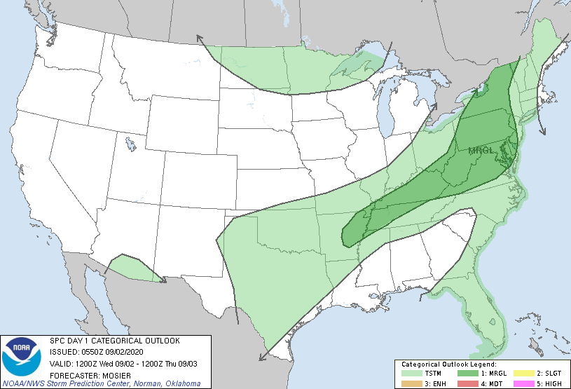

Below - snapshot weather for Thursday. Be safe.

 RSS Feed
