

Above 2 satellite pictures are of Hurricane Gonzalo. He is packing sustained winds of 140 mph with gusts to 165 mph. Life threatening storm surge and flooding possible for Bermuda today into tonight. He will weaken tomorrow as he heads into the North Atlantic brushing New Foundland.
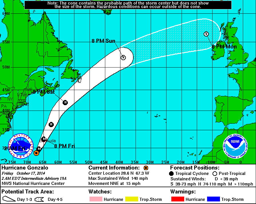
Current track for Gonzalo.

Ana is headed for Hawaii tomorrow. Should be a minimal hurricane...but 2nd one this year for them. Many places there are not ready with shelters and they are under A State of Emergency.
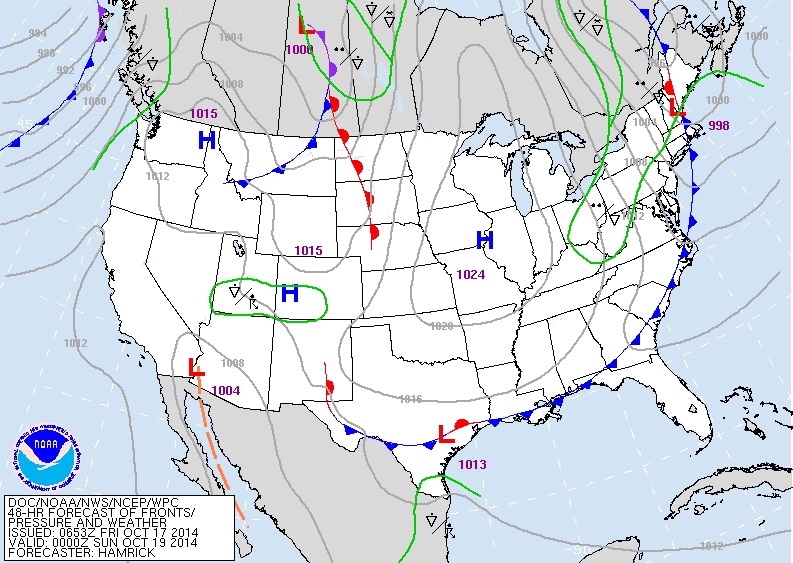
Map above is for late Saturday. Showers over the Northeast and No. Appalachians but elsewhere mainly dry.
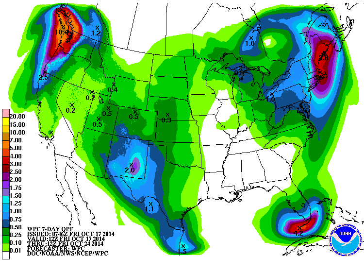
Amounts of rain above...for the next week. Heavy rain for New England as a storm forms off coast Tuesday and sticks around for several days. Some snow will fall from the higher elevations of the Adirondacks to Northern Appalachians next week. Be safe...have a nice weekend.
Due to the importance of tropical weather, winter forecast for the Northeast will be posted next week.
Due to the importance of tropical weather, winter forecast for the Northeast will be posted next week.

 RSS Feed
