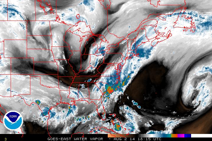
Even though the rain showers have passed on through the Northeast today, the end has yet to come in overall moist conditions for the region.
The zone of moisture can be clearly seen on the water vapor imagery above. The frontal boundary will shift offshore through the rest of today, bringing occasional showers along the coastline. Through the remainder of the weekend, the trough digging into the Mississippi Valley today will move east sending multiple frontal waves past the Appalachian Mountains resulting in scattered shower activity through to Monday. In addition to all of this dampness, the digging trough will continue to result in cooler temperatures to start off the week, with 70's spread throughout the East.
Beyond this, weak high pressure will try and grab the coast for a couple of days but it will be pushed out by Tuesday & Wednesday. Bertha will have entered the US satellite images by this point but the expectations currently are that it will be pushed away from the US into the Atlantic as it moves north, avoiding both the US & Bermuda.
- JL


 RSS Feed
