Just two week of October left and we are beginning to see a more consistent chill to the air. The light jacket will soon be an every day thing and you will see the occasional frost advisory or freeze warning with nightly temperatures dipping into the 30's & 20's.
To the west and south, temperatures continue to surpass seasonal averages with many areas of 60's and 70's for today and into the week.
Many areas in the Northeast tonight have already been issued Frost Advisories and Freeze Warning with cold air moving down from Canada tonight.
To the west and south, temperatures continue to surpass seasonal averages with many areas of 60's and 70's for today and into the week.
Many areas in the Northeast tonight have already been issued Frost Advisories and Freeze Warning with cold air moving down from Canada tonight.
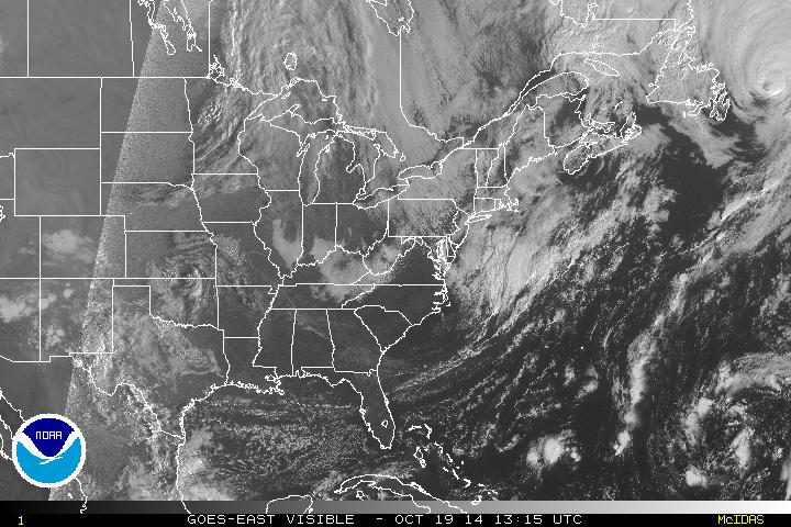
Visible satellite imagery above shows generally tranquil sky conditions through the eastern half of the country. A trough dipping into the Northeast will provide cloud cover and breezy conditions for today, but as high pressure from the west moves towards the coast, it will push out the clouds and bring late day sunshine.
High pressure will quickly move out to the ocean as a coastal low will form by Tuesday and slowly churn along the coast into New England for the remainder of the week. Expect cloudy and damp air with rain showers and breezy conditions to be the story for the remainder of the week.
- JL
High pressure will quickly move out to the ocean as a coastal low will form by Tuesday and slowly churn along the coast into New England for the remainder of the week. Expect cloudy and damp air with rain showers and breezy conditions to be the story for the remainder of the week.
- JL

 RSS Feed
