
Front moving through the east with some showers. Heavy rain and storms in West Texas...just where they do need the rain....staying there for next few days.
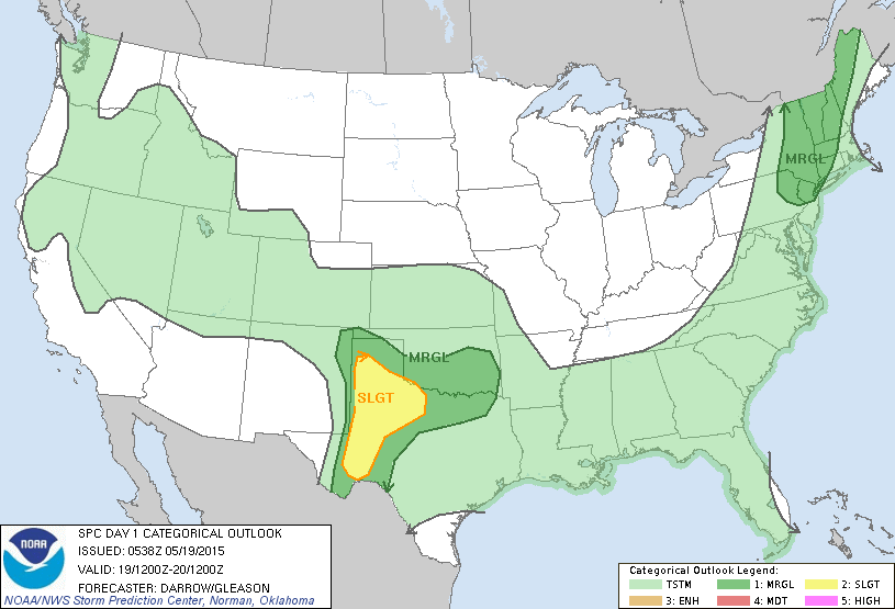
Todays threat for severe weather...Northeast and Western Texas.
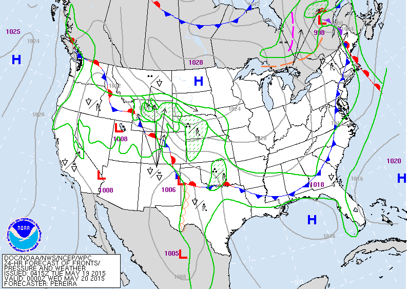
Map above valid for Tuesday evening. Cold front moving
across Eastern Seaboard. Stationery front over Rockies will bring wet weather there and to the Plains.
across Eastern Seaboard. Stationery front over Rockies will bring wet weather there and to the Plains.
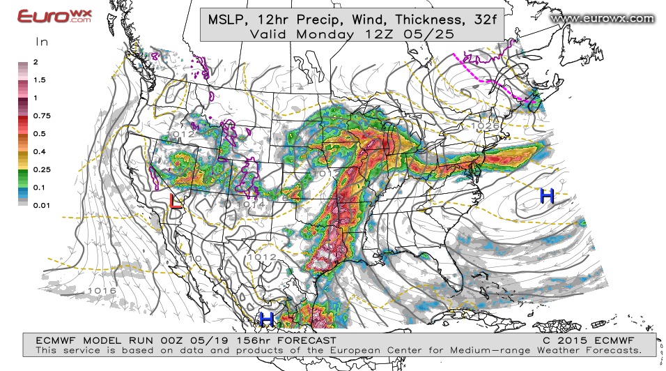
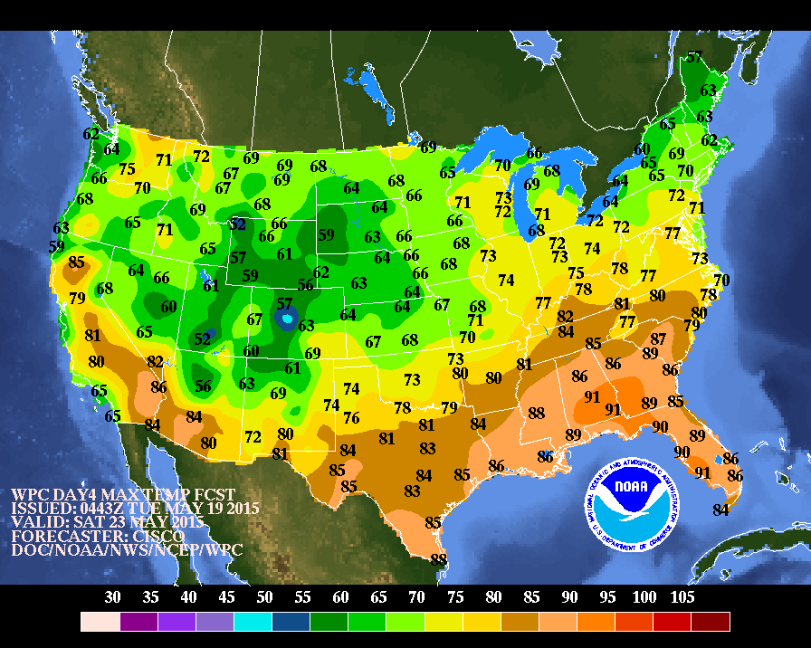
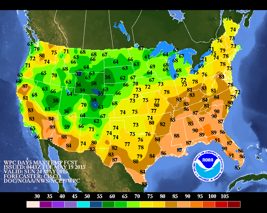
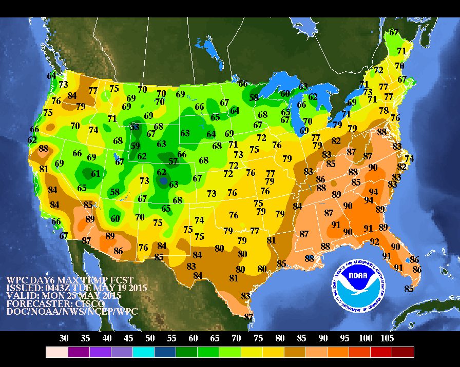
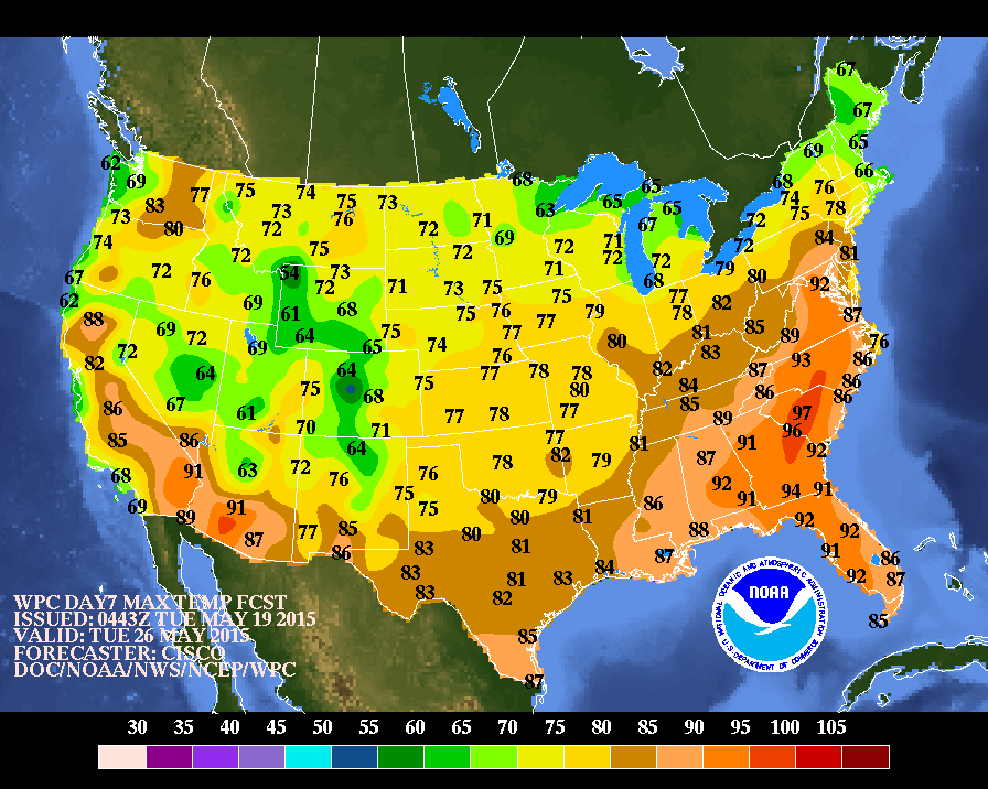
Above...Euro Model for early Monday. Wet weather for Midwest down thru Mississippi Valley. Band of rain with warm front from Ohio Valley to Mid Atlantic. This band will be tricky to forecast....i.e. based on above...NYC would be cloudy with some drizzle... Phily will be wet...but Virginia Beach will be sunny and 90...while Boston will be sunny and 70. Good luck. Below....Daytime high temperatures for the Memorial Day Weekend from Saturday into Tuesday.
Be safe.
Be safe.

 RSS Feed
