The persistent cool and off-and-on rainy pattern should give way to more Summer-like warmth later this week and into next week for the East.
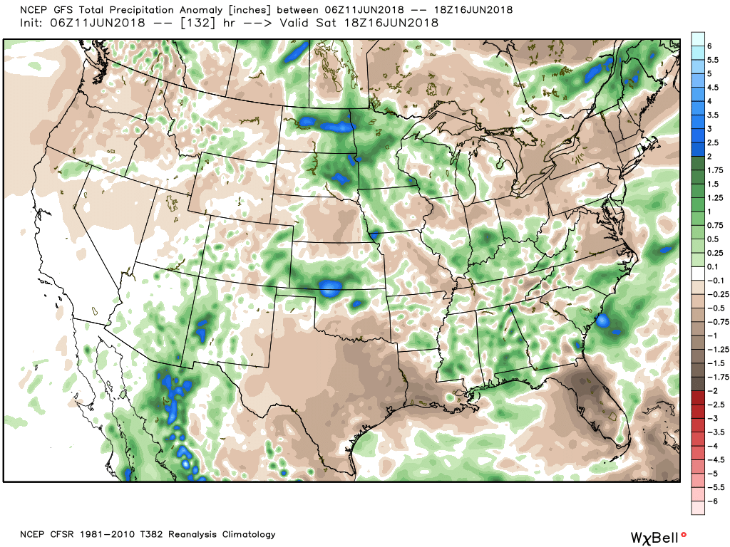
Major flooding in the Mid-Atlantic was the result of a stalled frontal system that is currently weakening and sliding off of the coast. The jet stream will retreat to a Summer position as we go through the week allowing warmer air to move in from the middle of the country. Rain chances will also be fairly minimal in the Northeast through at least Monday, while the Midwest will see rounds of thunderstorms this week.
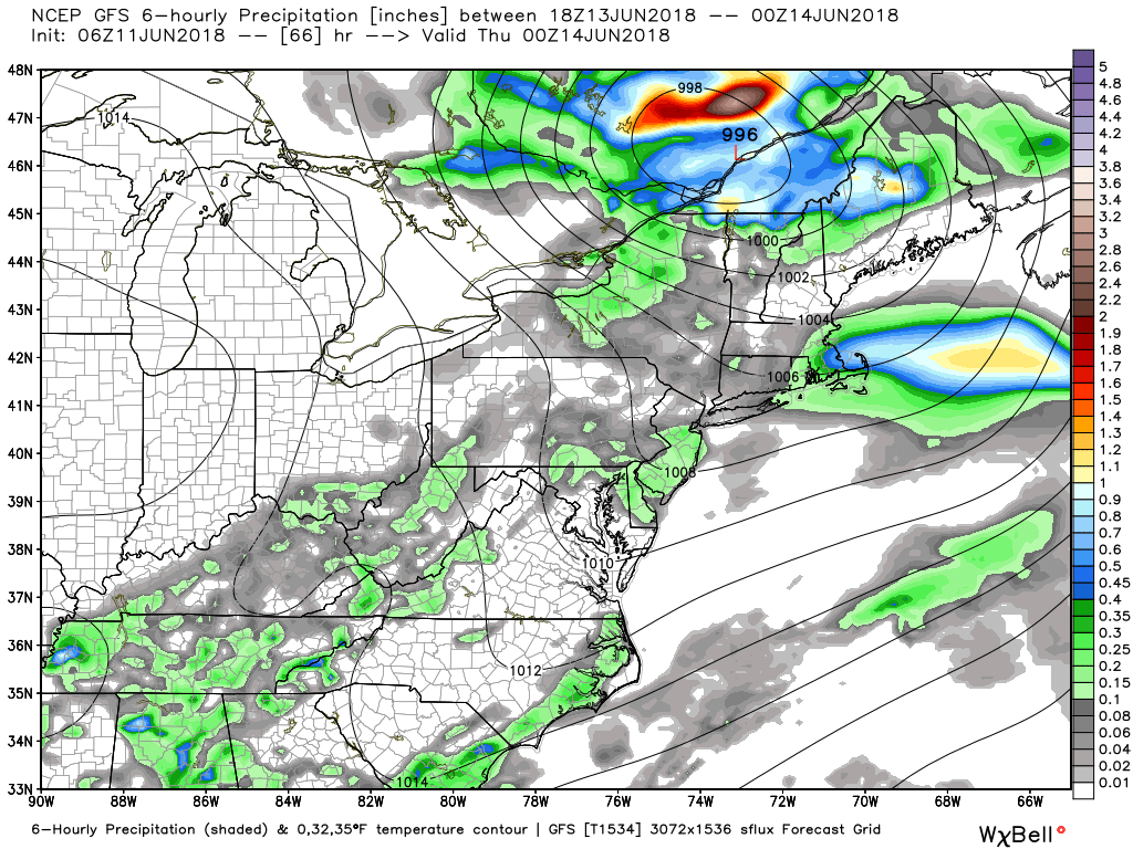
A storm system will track across southern Canada with a training front on Wednesday that will bring scattered thunderstorms from parts of the Mid-Atlantic to New England. Some severe storms may be possible Wednesday afternoon, especially in northern New York state and New England.
Major flooding in the Mid-Atlantic was the result of a stalled frontal system that is currently weakening and sliding off of the coast. The jet stream will retreat to a Summer position as we go through the week allowing warmer air to move in from the middle of the country. Rain chances will also be fairly minimal in the Northeast through at least Monday, while the Midwest will see rounds of thunderstorms this week.
A storm system will track across southern Canada with a training front on Wednesday that will bring scattered thunderstorms from parts of the Mid-Atlantic to New England. Some severe storms may be possible Wednesday afternoon, especially in northern New York state and New England.
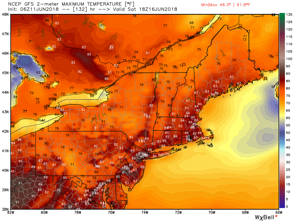
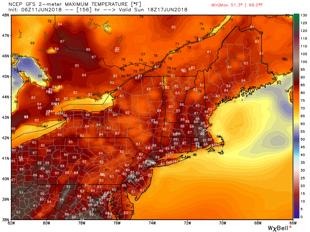
A mostly dry pattern will follow Thursday into Father's Day Weekend. Many areas in the Northeast that have been cool will see highs in the 80s to near 90 degrees.
- Anthony Jay 1045A Monday, 6/11/18

 RSS Feed
