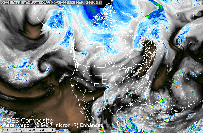
Satellite shows one cold front off east coast....next one over Midwest...which will work east with showers....reaching east Saturday and then offshore.
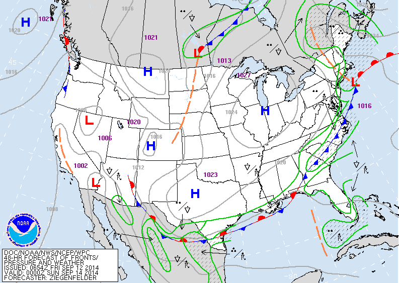
Map shows fronts for late Saturday. One exiting off the east...taking the clouds and showers with it. Showers for the southeast....thru the weekend.
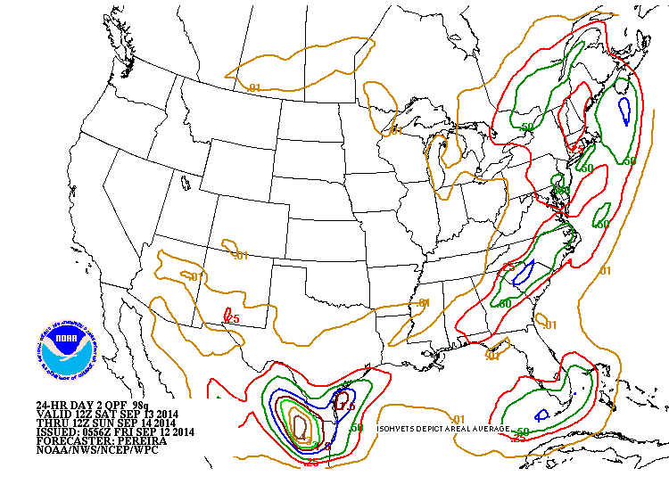
Above - amounts of rain for Saturday into Sat. nite. Think this is overdone in Northeast. Amounts should be less than .25" there...elsewhere...mainly dry.
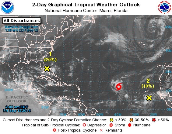
Tropical Storm Edouard was born last nite...should stay in Atlantic. Disturbance near Florida will wind up in Gulf...while system off Africa is many days away.
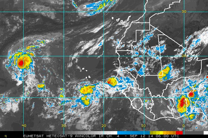
Left screen....Edouard......center - new disturbance.
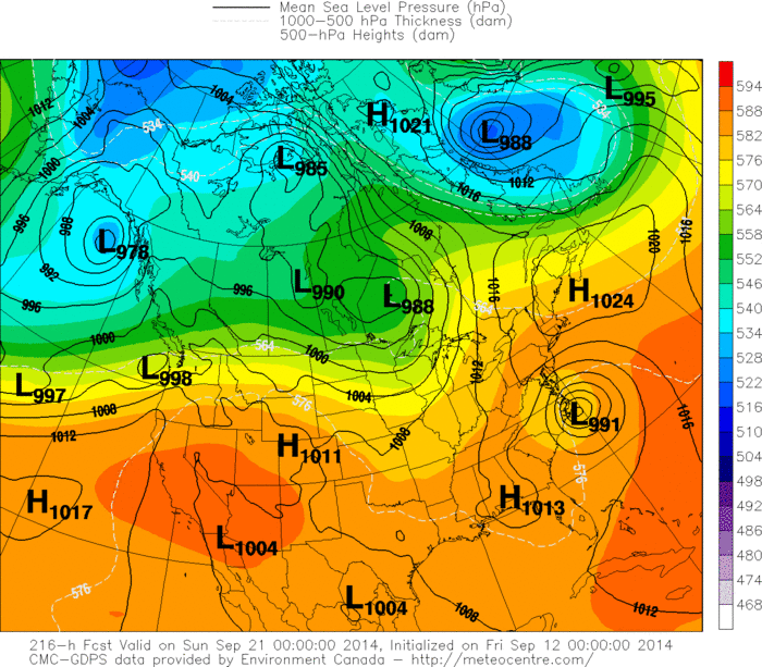
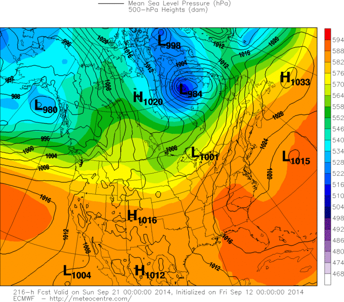
Canadian Model for next Saturday...showing a potent tropical system near Cape Hateras N.C. Below...Euro Model for the same time. Interesting ? Be safe.

 RSS Feed
