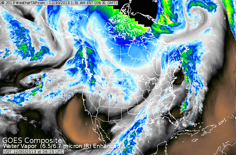
Veil of clouds from Buffalo - NY to Texas is a cold front moving east. Light blue is Dakotas...a clipper low..which will bring colder air
east by New Year's. In The Youkon...a disturbance that will head
southeast and bring mostly snow to NE Thursday...followed by bitter cold arctic air.
east by New Year's. In The Youkon...a disturbance that will head
southeast and bring mostly snow to NE Thursday...followed by bitter cold arctic air.
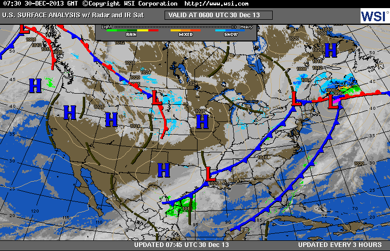
Latest surface map showing cold front headed for East Coast...and lows out west to follow. Below - map showing what we expect Thursday to look like with a winter storm affecting The Eastern Third of The Nation.
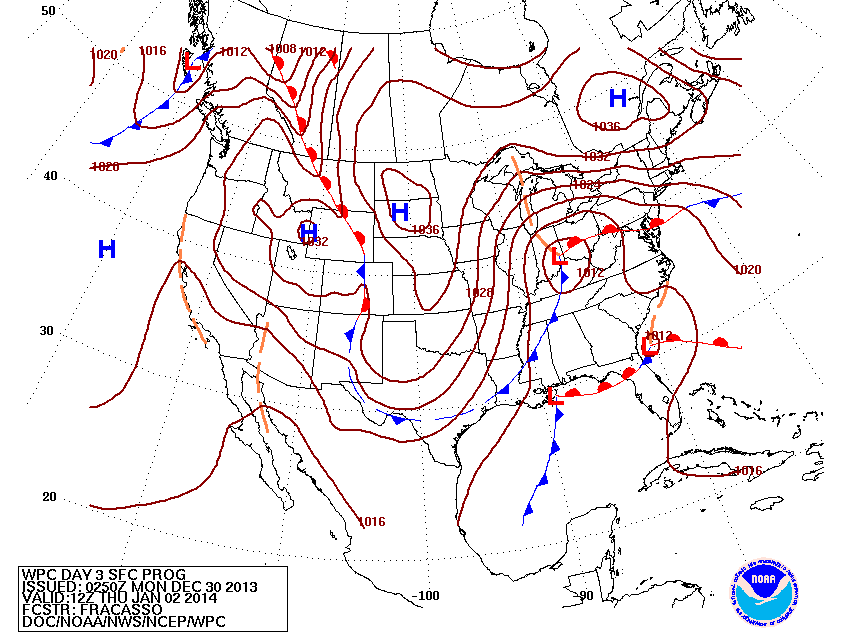
This map - valid for Thursday shows one low in Ohio Valley and another forming off Southeast coast. The 2 will combine to become a big storm off New England Friday...when powerful arctic winds will follow dropping temps into the single numbers as far as NYC & PHL...and below zero from NY State across New England.
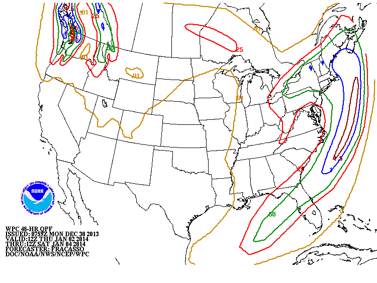
This map shows how much moisture could fall with the eastern storm.
Green line represents 4" or more from NYC north...while anywhere between the green and blue lines could get 10-12". More on this tomorrow. Later.
Green line represents 4" or more from NYC north...while anywhere between the green and blue lines could get 10-12". More on this tomorrow. Later.

 RSS Feed
