Metro Weather Inc. Services
Like us, follow us, link to us, contact us!
  • Home
    • Daily Weather Discussion
  • Weather Prepared for You
    • Film and TV Production
    • Radio & Television
    • Government and Industry
    • Forensic Services >
      • Weather Record Request Form
    • Metro Morning Monitor
  • About Metro Weather
    • Senior Staff
  • Your Weather Images
  • Contact Us

Colder for the East and snow for Appalachians.....

10/30/2014

0 Comments

 
Picture
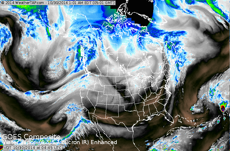
Satellite shows another front dropping out of Central Canada. This energy will produce a large storm in the Atlantic which will graze the coast with rain Fri.nite and Saturday. In mountains of Va., Wa, N.Carolina....there will be wet snow..which could easily amount to 4" or more.

Picture
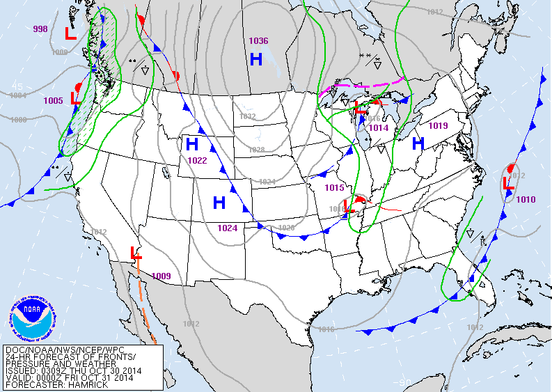
This map is valid for late today.  The 2 lows - Gt.Lakes and Mississippi Valley will bring the wet weather/ snow/ Saturday to the east.  Front along west coast will bring more wet weather to the Pacific NW. 
Picture
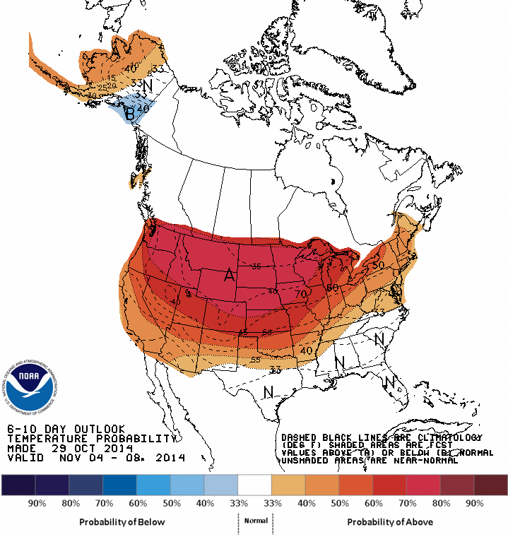
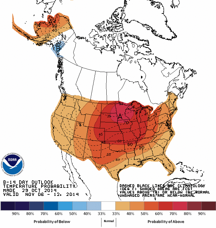
This map shows how temps will average between Nov. 4-8 -notice....all of the nation at or above normal.  Map below..is for Nov. 8- 12....and that trend continues.  For now...be safe...later.
Picture
0 Comments


Leave a Reply.

    Genesis of a Tornado
    We'll have daily weather discussions, talking about major systems on the horizon along with anything noteworthy that pops up on our radar.

    Pat Pagano,
    Mike Merin

    Follow us on Twitter and like us on Facebook to get updates whenever we post a new entry!

    RSS Feed

Powered by Create your own unique website with customizable templates.